
சிந்து சரஸ்வதி நதி நாகரிகம் ஆரம்பம் பொமு 7500, அதாவது இன்றைக்கு 8500 வருடம் முன்பு என பிர்ரானா என ஹரியானாவின் குருக்ஷேத்திரம் அருகில் உள்ள இடத்தில் கிடைத்த தொல்பொருட்கள் விஞ்ஞான ஆய்வுகள் நிருபித்து உள்ளது.
கோரக்பூர் ஐஐடி நில அமைப்பியல், புவி இயற்பியல் துறை தலைவர் அனிந்தியா சர்க்கார் தலைமையிலான குழு மற்றும் இந்திய தொல்லியல் துறை அதிகாரிகளும் இணைந்து புதிய ஆய்வை மேற்கொண்டனர். இது தொடர்பான கட்டுரை நேச்சர் என்ற பத்திரிகையில் வெளிவந்துள்ளது. அதில் கூறப்பட்டுள்ளதாவது:
அகழ்வாராய்ச்சியின்பேது, மண்பாண்டங்களின் பாகங் கள் கிடைத்தன. இவற்றின் வயதை கண்டறிய நவீன தொழில் நுட்பத்தை பயன்படுத்தினோம். இதில் இவை 6000 ஆண்டு களுக்கு முந்தயை ஹரப்பா நாகரீகத்தை விட தொன்மை யானது என்பது தெரியவந்தது. எனவே சிந்து சமவெளி நாகரீகம் 8,000 ஆண்டுகளுக்கு முந்தையது என்ற முடிவுக்கு வந்துள்ளோம்.
இந்த நாகரீகம் கிறிஸ்து பிறப்பதற்கு முன்பான 7,000-3000 ஆண்டுகளுக்கு முந்தை எகிப்து நாகரீகம், 6,500-3,100 ஆண்டுகளுக்கு முந்திய மெசபட்டோமியா நாகரீகத்துக்கும் முந்தையது. சிந்து சமவெளி நாகரீகம் இதற்கு முன்பே வேரூன்ற தொடங்கி விட்டது. இந்த நாகரீகம் அரியானாவில் பிர்ரானா, ராஹிகார்ஹி போன்ற இடங்களுக்கும் பரவியது. இந்த இடங்களில் அகழ்வாய்வை மேற்கொண்டோம். இங்கு அதிக எண்ணிக்கையிலான பசு,
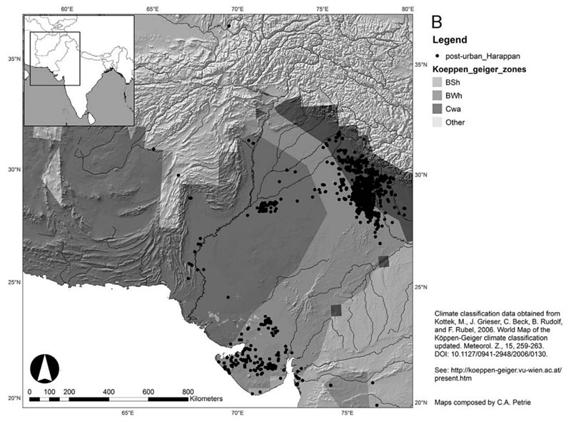
ஆடு, மான், கலைமான் போன்ற விலங்குகளின் எலும்புகள், பற்கள், கொம்புகள் கிடைத்தன. இவற்றை, கார்பன் 14 டேட்டிங் பகுப்பாய்வு முறையில் சோதனை செய்தோம். இதன் மூலன் இவற்றின் வயது, அப்போதிருந்த பருவ நிலையை தெரிந்து கொள்ள உதவியது. சிந்து சமவெளி நாகரீகம் இந்தியா முழுவதும் பரவியிருந்தது. குறிப்பாக இப்போது மறைந்துவிட்ட சரஸ்வதி நதி அல்லது காஹர்-ஹக்ரா நதியின் கரையோர பகுதிகளில் இது நிறைந்து காணப்பட்டது.
ஆனால் இவை குறித்து நமக்கு தெரியாமலேயே போய்விட்டது. நாம் ஆங் கிலேயர்களின் தொல்லியல் முடிவு களைதான் பின்பற்றி வந்தோம். எங்களது அகழ்வாய்வின் போது, சிந்து சமவெளி நாகரீகத்துக்கு முந்தைய (அதாவது 9000-8000 ஆண்டு களுக்கு முன்பு) முதல் ஹரப்பா நாகரீகம் தொடங்கிய காலம் வரை (8000-7000 ஆண்டுகள்) நன்கு வளர்ந்த ஹரப்பா நாகரீகம் காலம் வரையிலான பாது காக்கப்பட்ட அனைத்து கலாசார நிலைகளையும் கண்டோம்.
ஹரப்பா காலத்தில் திட்டமிடப்பட்ட நகரங்கள், கை வினைப் பொருள்கள் போன்றவை இடம் பெற்றிருந்தன. அரேபியா, மெசபட்டோமியா நகரங்களுடன் வர்த்தகம் செய்து வந்துள்ளனர்.
மெஹெர்கர், இன்றைய பாகிஸ்தானிலுள்ள, பண்டைக்காலக் குடியேற்றப் பகுதி ஆகும். இப்பிரதே சத்தின் புதிய கற்காலக் குடியேற்றங்கள் பற்றிய தொல் லியல் ஆய்வுகளுக்கு மிக முக்கியமான களங்களில் இதுவும் ஒன்று. இக்குடியேற்றத்தின் எச்சங்கள் பாகிஸ் தானின் பலூச்சிஸ்தான் பகுதியில் காணப்படுகின்றன. இது போலன் கணவாய்க்கு அருகிலுள்ள கச்சிச் சமவெளிப் பகுதியில், சிந்துநதிப் பள்ளத்தாக்குக்கு மேற்கே, குவேட்டா (Quetta),, காலத் Kalat)), சிபி (Sibi) ஆகிய நகரங்களுக்கு இடையே அமைந்துள்ளது.
பிரான்சைச் சேர்ந்த தொல்லியலாளர்களால் கண்டுபிடிக்கப்பட்ட இக் களம், உலகின் பழமையான மனித குடியேற்றங்களில் ஒன்றாகக் கருதப்படுகின்றது. இதன் ஆதிக் குடியேற்ற வாசிகள், பலூச்சிக் குகை வாழ்நரும், மீனவர்களும் ஆவர். 1974 இல் நடத்தப் பட்ட தொல்லியல் ஆய்வுகளை (ஜர்ரிகேயும் (Jarrige) மற்றவர்களும்) அடிப்படையாகக் கொண்டு, இப் பகுதியே தென்னாசியாவின் அறியப்பட்ட வேளாண் மைக் குடியேற்றங்களில் முற்பட்டதாகக் கருதப்படு கின்றது. இங்குள்ள குடியேற்றத்துக்கான மிக முற்பட்ட தடயங்கள் கி.மு. 7000 அய்ச் சேர்ந்தவை. தென்னாசி யாவின் முற்பட்ட மட்பாண்டச் சான்றுகளும் இங்கேயே கிடைத்துள்ளன.
இந்த நகரங்கள், குடியேற்றங்களுடைய ஒரு தன்மைத்தான அமைப்பு இவையனைத்தும் ஒரு உயர் வளர்ச்சி நிலையில் சமூக ஒருங்கிணைப்பு வல்லமை கொண்ட ஒரே நிர்வாகத்திக் கீழ் அமைந்திருந்தமையைக் காட்டுகின்றது.
இன்றும் வாசித்தறிய முடியவில்லை.[2]
பொருளடக்கம்
சிந்துவெளிப் பகுதியில் பொ.மு 7500 ஆண்டளவிலேயே மக்கள் குடியேற்றங்களும், சிறிய நகரங்களும் இருந்தததாகக் கூறப்படுகின்றது. பலுச்சிஸ்தானிலுள்ள மெஹெர்கர் பகுதி, ஹரப்பாவின் அடியிலுள்ள படைகள் என்பன இக்கூற்றுக்கான சான்றுகளாகும். எனினும் இவை சிறிய நகரங்களாகவும், சுதந்திரமான நிர்வாகம் மற்றும் தன்நிறைவுப் பொருளாதாரம் ஆகியவற்றைக் கொண்ட நகர அரசுகளாகவே இருந்தன.
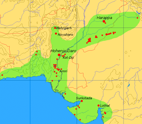
தற்போது ஹரப்பா நாகரிகம் என்று அறியப்படுகின்ற காலகட்டத்தில் சிந்துவெளி நாகரிகம், முன்னெப்பொழுதும் இல்லாத வகையில் அக்காலத்து வேறெந்த நாகரிகத்திலும் பார்க்க அளவிற் பெரிதாக சுமார் 13 இலட்சம் சதுர கிலோமீட்டர் (5 இலட்சம் சதுர மைல்கள்) பரப்பளவு கொண்டதாக வளர்ந்திருந்தது. இங்கே சிறிதும் பெரிதுமாக 200 க்கும் மேற்பட்ட ஊர்களும், 6 மிகப் பெரிய நகரங்களும் இருந்தன. இந்த நகரங்கள், குடியேற்றங்களுடைய ஒரு தன்மைத்தான அமைப்பு இவையனைத்தும் ஒரு உயர் வளர்ச்சி நிலையில் சமூக ஒருங்கிணைப்பு வல்லமை கொண்ட ஒரே நிர்வாகத்திக் கீழ் அமைந்திருந்தமையைக் காட்டுகின்றது.
சிந்துவெளிப் பண்பாட்டின் காலப் பகுப்பு[தொகு]
முறையான ஹரப்பா பண்பாடு கி.மு 2600 இலிருந்து 1900 வரை நிலவியது. இதன் முன் நிலவிய மற்றும் பின் நிலவிய பண்பாடுகளான முந்திய மற்றும் பிந்திய ஹரப்பாப் பண்பாடுகளையும் சேர்த்துப் பார்க்கும்போது, இது, கி.மு 33 – 14 ஆம் நூற்றாண்டுகளிலிருந்து ஆரம்பித்ததாகக் கருதலாம். சிந்துவெளிப் பண்பாட்டின் காலப் பகுப்பு தொடர்பில் இரண்டுவகையான பகுப்புக உள்ளன. ஒன்று சகாப்தங்கள்(Eras) மற்றது கட்டங்கள் (Phases).
| கால எல்லை | கட்டம் | சகாப்தம் |
| 7000 – 5500 | மெஹெர்கர் I | ஆரம்பகால உணவு உற்பத்தி |
|---|---|---|
| 5500-3300 | மெஹெர்கர் II-VI | மண்டலமயமாக்கல் (Regionalisation Era) |
| 3300-2600 | முந்திய ஹரப்பா | |
| 3300-2800 | ஹரப்பா 1 (ரவி கட்டம்) | |
| 2800-2600 | ஹரப்பா 2 (கொட் டிஜி கட்டம், நௌஷாரோ I, மெஹெர்கர் VII) | |
| 2600-1900 | முதிர் ஹரப்பா | ஒருங்கிணைப்பு சகாப்தம் (Integration Era) |
| 2600-2450 | ஹரப்பா 3A (நௌஷாரோ II) | |
| 2450-2200 | ஹரப்பா 3B | |
| 2200-1900 | ஹரப்பா 3C | |
| 1900-1300 | பிந்திய ஹரப்பா (கல்லறை எச் கலாச்சாரம்) | ஓரிடமாக்கல் (Localisation Era) |
| 1900-1700 | ஹரப்பா 4 | |
| 1700-1300 | ஹரப்பா 5 |


 Map of the Indus Valley Civilization
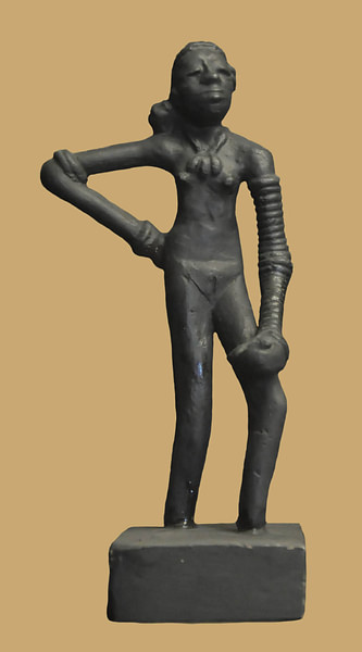 Dancing girl of Mohenjo Daro
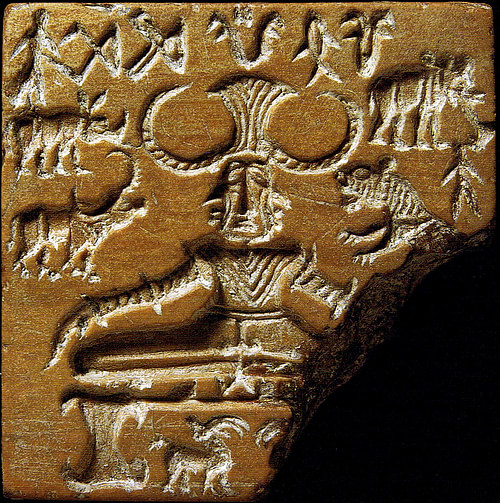 Shiva Pashupati
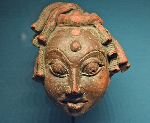 Shiva
Shiva Vishnu Riding Garuda
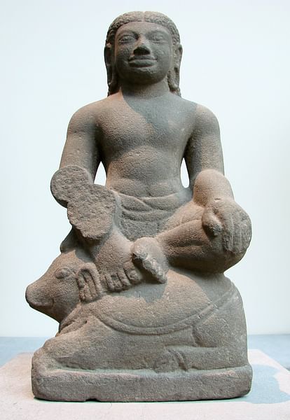 Agni
Agni Indus Valley
 Banner at the North Gate of Dholavira
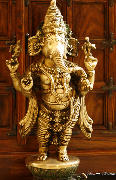 Ganesha
 Rajarani Temple, Bhubaneshwar
 A Bodhisattva, Gandhara
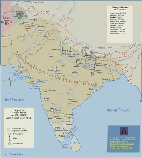 Maruyan Empire
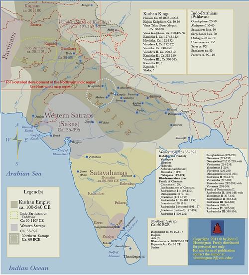 Kushan Empire & Neighboring States
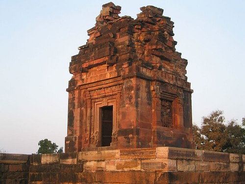 Dashavatara Temple, Deogarh
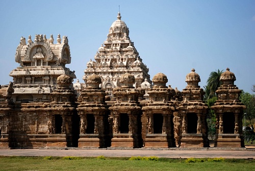 Kailasanatha Temple, Kanchipuram
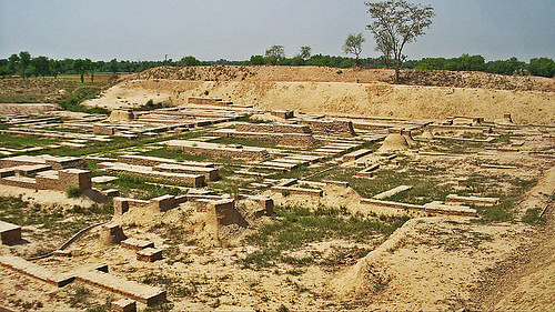 Harappa Ruins
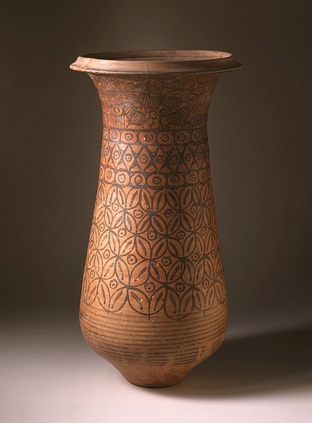 Harappan Ceremonial Vessel
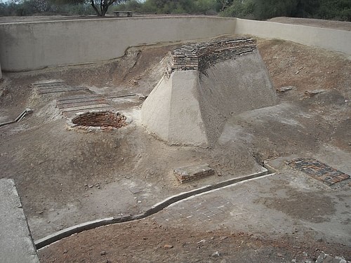 Well and Bathing Platform, Harappa
 World Map of Herodotus
 Map of Alexander the Great's Conquests
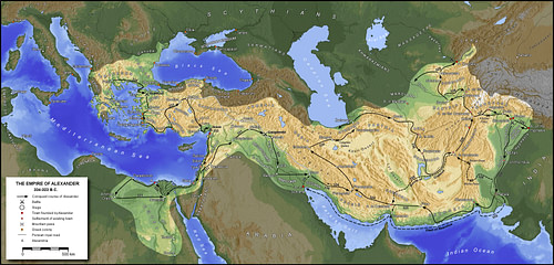 The Empire of Alexander the Great
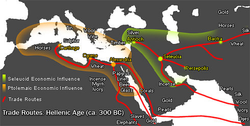 Hellenic Trade Routes, 300 BCE
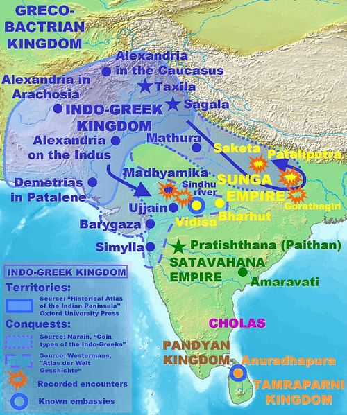 Indo-Greek Campaigns
 Gandhara Buddha
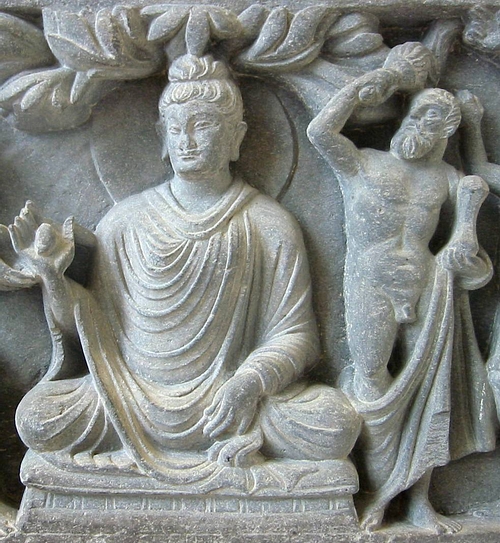 Buddha with Hercules Protector
 Yakshi


