New Indian-Chennai News + more

Members Login
Username 
 
Password 
    Remember Me  
Post Info TOPIC: சிந்து சரஸ்வதி நதி நாகரிகம்


Guru

Status: Offline
Posts: 24765
Date:
சிந்து சரஸ்வதி நதி நாகரிகம்
Permalink  


சிந்து சரஸ்வதி நதி நாகரிகம்

 
சிந்து சரஸ்வதி நதி நாகரிகம் சுமார் 13 இலட்சம் சதுர கிலோமீட்டர் (5 இலட்சம் சதுர மைல்கள்) பரப்பளவு கொண்டதாக வளர்ந்திருந்தது. இங்கே சிறிதும் பெரிதுமாக 200 க்கும் மேற்பட்ட ஊர்களும், 6 மிகப் பெரிய நகரங்களும் இருந்தன. மொஹஞதாரோ, ஹரப்பா இரண்டுமே சிந்து வெளியில் பாகிஸ்தானில் உள்ளது - எனவே சிந்து சரஸ்வதி நதி நாகரிகம் என அழைப்பதே சரியான பெயர் ஆகும்.
சிந்து சரஸ்வதி நதி நாகரிகம் ஆரம்பம் பொமு 7500, அதாவது இன்றைக்கு 8500 வருடம் முன்பு என பிர்ரானா என ஹரியானாவின் குருக்ஷேத்திரம் அருகில் உள்ள இடத்தில் கிடைத்த தொல்பொருட்கள் விஞ்ஞான ஆய்வுகள் நிருபித்து உள்ளது.

கோரக்பூர் ஐஐடி நில அமைப்பியல், புவி இயற்பியல் துறை தலைவர் அனிந்தியா சர்க்கார் தலைமையிலான குழு மற்றும் இந்திய தொல்லியல் துறை அதிகாரிகளும் இணைந்து புதிய ஆய்வை மேற்கொண்டனர். இது தொடர்பான கட்டுரை நேச்சர் என்ற பத்திரிகையில் வெளிவந்துள்ளது. அதில் கூறப்பட்டுள்ளதாவது:
அகழ்வாராய்ச்சியின்பேது, மண்பாண்டங்களின் பாகங் கள் கிடைத்தன. இவற்றின் வயதை கண்டறிய நவீன தொழில் நுட்பத்தை பயன்படுத்தினோம். இதில் இவை 6000 ஆண்டு களுக்கு முந்தயை ஹரப்பா நாகரீகத்தை விட தொன்மை யானது என்பது தெரியவந்தது. எனவே சிந்து சமவெளி நாகரீகம் 8,000 ஆண்டுகளுக்கு முந்தையது என்ற முடிவுக்கு வந்துள்ளோம்.
இந்த நாகரீகம் கிறிஸ்து பிறப்பதற்கு முன்பான 7,000-3000 ஆண்டுகளுக்கு முந்தை எகிப்து நாகரீகம்,  6,500-3,100 ஆண்டுகளுக்கு முந்திய மெசபட்டோமியா நாகரீகத்துக்கும் முந்தையது. சிந்து சமவெளி நாகரீகம் இதற்கு முன்பே வேரூன்ற தொடங்கி விட்டது. இந்த நாகரீகம் அரியானாவில் பிர்ரானா, ராஹிகார்ஹி போன்ற இடங்களுக்கும் பரவியது. இந்த இடங்களில் அகழ்வாய்வை மேற்கொண்டோம். இங்கு அதிக எண்ணிக்கையிலான பசு,
ஆடு, மான், கலைமான் போன்ற விலங்குகளின் எலும்புகள், பற்கள், கொம்புகள் கிடைத்தன. இவற்றை, கார்பன் 14 டேட்டிங் பகுப்பாய்வு முறையில் சோதனை செய்தோம். இதன் மூலன் இவற்றின் வயது, அப்போதிருந்த பருவ நிலையை தெரிந்து கொள்ள உதவியது.  சிந்து சமவெளி நாகரீகம் இந்தியா முழுவதும் பரவியிருந்தது. குறிப்பாக இப்போது மறைந்துவிட்ட சரஸ்வதி நதி அல்லது காஹர்-ஹக்ரா நதியின் கரையோர பகுதிகளில் இது நிறைந்து காணப்பட்டது.
ஆனால் இவை குறித்து நமக்கு தெரியாமலேயே போய்விட்டது. நாம் ஆங் கிலேயர்களின் தொல்லியல் முடிவு களைதான் பின்பற்றி வந்தோம். எங்களது அகழ்வாய்வின் போது, சிந்து சமவெளி நாகரீகத்துக்கு முந்தைய (அதாவது 9000-8000 ஆண்டு களுக்கு முன்பு) முதல் ஹரப்பா நாகரீகம் தொடங்கிய காலம் வரை (8000-7000 ஆண்டுகள்) நன்கு வளர்ந்த ஹரப்பா நாகரீகம் காலம் வரையிலான பாது காக்கப்பட்ட அனைத்து கலாசார நிலைகளையும் கண்டோம்.

ஹரப்பா காலத்தில் திட்டமிடப்பட்ட நகரங்கள், கை வினைப் பொருள்கள் போன்றவை இடம் பெற்றிருந்தன. அரேபியா, மெசபட்டோமியா நகரங்களுடன் வர்த்தகம் செய்து வந்துள்ளனர்.
மெஹெர்கர்,  இன்றைய பாகிஸ்தானிலுள்ள, பண்டைக்காலக் குடியேற்றப் பகுதி ஆகும். இப்பிரதே சத்தின் புதிய கற்காலக் குடியேற்றங்கள் பற்றிய தொல் லியல் ஆய்வுகளுக்கு மிக முக்கியமான களங்களில் இதுவும் ஒன்று. இக்குடியேற்றத்தின் எச்சங்கள் பாகிஸ் தானின் பலூச்சிஸ்தான் பகுதியில் காணப்படுகின்றன. இது போலன் கணவாய்க்கு அருகிலுள்ள கச்சிச் சமவெளிப் பகுதியில், சிந்துநதிப் பள்ளத்தாக்குக்கு மேற்கே, குவேட்டா (Quetta),, காலத் Kalat)), சிபி (Sibi) ஆகிய நகரங்களுக்கு இடையே அமைந்துள்ளது.

பிரான்சைச் சேர்ந்த தொல்லியலாளர்களால் கண்டுபிடிக்கப்பட்ட இக் களம், உலகின் பழமையான மனித குடியேற்றங்களில் ஒன்றாகக் கருதப்படுகின்றது. இதன் ஆதிக் குடியேற்ற வாசிகள், பலூச்சிக் குகை வாழ்நரும், மீனவர்களும் ஆவர். 1974 இல் நடத்தப் பட்ட தொல்லியல் ஆய்வுகளை (ஜர்ரிகேயும் (Jarrige) மற்றவர்களும்) அடிப்படையாகக் கொண்டு, இப் பகுதியே தென்னாசியாவின் அறியப்பட்ட வேளாண் மைக் குடியேற்றங்களில் முற்பட்டதாகக் கருதப்படு கின்றது. இங்குள்ள குடியேற்றத்துக்கான மிக முற்பட்ட தடயங்கள் கி.மு. 7000 அய்ச் சேர்ந்தவை. தென்னாசி யாவின் முற்பட்ட மட்பாண்டச் சான்றுகளும் இங்கேயே கிடைத்துள்ளன.

இந்த நகரங்கள், குடியேற்றங்களுடைய ஒரு தன்மைத்தான அமைப்பு இவையனைத்தும் ஒரு உயர் வளர்ச்சி நிலையில் சமூக ஒருங்கிணைப்பு வல்லமை கொண்ட ஒரே நிர்வாகத்திக் கீழ் அமைந்திருந்தமையைக் காட்டுகின்றது.
இன்றும் வாசித்தறிய முடியவில்லை.[2]
 
 
சிந்துவெளிப் பகுதியில் பொ.மு 7500 ஆண்டளவிலேயே மக்கள் குடியேற்றங்களும், சிறிய நகரங்களும் இருந்தததாகக் கூறப்படுகின்றது. பலுச்சிஸ்தானிலுள்ள மெஹெர்கர் பகுதி, ஹரப்பாவின் அடியிலுள்ள படைகள் என்பன இக்கூற்றுக்கான சான்றுகளாகும். எனினும் இவை சிறிய நகரங்களாகவும், சுதந்திரமான நிர்வாகம் மற்றும் தன்நிறைவுப் பொருளாதாரம் ஆகியவற்றைக் கொண்ட நகர அரசுகளாகவே இருந்தன.
தற்போது ஹரப்பா நாகரிகம் என்று அறியப்படுகின்ற காலகட்டத்தில் சிந்துவெளி நாகரிகம், முன்னெப்பொழுதும் இல்லாத வகையில் அக்காலத்து வேறெந்த நாகரிகத்திலும் பார்க்க அளவிற் பெரிதாக சுமார் 13 இலட்சம் சதுர கிலோமீட்டர் (5 இலட்சம் சதுர மைல்கள்) பரப்பளவு கொண்டதாக வளர்ந்திருந்தது. இங்கே சிறிதும் பெரிதுமாக 200 க்கும் மேற்பட்ட ஊர்களும், 6 மிகப் பெரிய நகரங்களும் இருந்தன. இந்த நகரங்கள், குடியேற்றங்களுடைய ஒரு தன்மைத்தான அமைப்பு இவையனைத்தும் ஒரு உயர் வளர்ச்சி நிலையில் சமூக ஒருங்கிணைப்பு வல்லமை கொண்ட ஒரே நிர்வாகத்திக் கீழ் அமைந்திருந்தமையைக் காட்டுகின்றது.

சிந்துவெளிப் பண்பாட்டின் காலப் பகுப்பு[தொகு]

முறையான ஹரப்பா பண்பாடு கி.மு 2600 இலிருந்து 1900 வரை நிலவியது. இதன் முன் நிலவிய மற்றும் பின் நிலவிய பண்பாடுகளான முந்திய மற்றும் பிந்திய ஹரப்பாப் பண்பாடுகளையும் சேர்த்துப் பார்க்கும்போது, இது, கி.மு 33 – 14 ஆம் நூற்றாண்டுகளிலிருந்து ஆரம்பித்ததாகக் கருதலாம். சிந்துவெளிப் பண்பாட்டின் காலப் பகுப்பு தொடர்பில் இரண்டுவகையான பகுப்புக உள்ளன. ஒன்று சகாப்தங்கள்(Eras) மற்றது கட்டங்கள் (Phases).

கால எல்லைகட்டம்சகாப்தம்
7000 – 5500மெஹெர்கர் Iஆரம்பகால உணவு உற்பத்தி
5500-3300மெஹெர்கர் II-VIமண்டலமயமாக்கல்
(Regionalisation Era)
3300-2600முந்திய ஹரப்பா
3300-2800ஹரப்பா 1 (ரவி கட்டம்)
2800-2600ஹரப்பா 2 (கொட் டிஜி கட்டம், நௌஷாரோ I, மெஹெர்கர் VII)
2600-1900முதிர் ஹரப்பாஒருங்கிணைப்பு
சகாப்தம்
(Integration Era)
2600-2450ஹரப்பா 3A (நௌஷாரோ II)
2450-2200ஹரப்பா 3B
2200-1900ஹரப்பா 3C
1900-1300பிந்திய ஹரப்பா   (கல்லறை எச் கலாச்சாரம்)ஓரிடமாக்கல்
(Localisation Era)
1900-1700ஹரப்பா 4
1700-1300ஹரப்பா 5


__________________


Guru

Status: Offline
Posts: 24765
Date:
Permalink  
 

மெஹெர்கர்

கட்டற்ற கலைக்களஞ்சியமான விக்கிப்பீடியாவில் இருந்து.
 
 
Jump to navigationJump to search
CiviltàValleIndoMappa.png
 
 
மெஹெர்கரின் பெண் சிற்பம்

மெஹெர்கர், இன்றைய பாகிஸ்தானிலுள்ள, பண்டைக்காலக் குடியேற்றப் பகுதி ஆகும். இப் பிரதேசத்தின் புதிய கற்காலக் குடியேற்றங்கள் பற்றிய தொல்லியல் ஆய்வுகளுக்கு மிக முக்கியமான களங்களில் இதுவும் ஒன்று. இக்குடியேற்றத்தின் எச்சங்கள் பாகிஸ்தானின் பலூச்சிஸ்தான் பகுதியில் காணப்படுகின்றன. இது போலான் கணவாய்க்கு அருகிலுள்ள கச்சிச் சமவெளிப் பகுதியில், சிந்துநதிப் பள்ளத்தாக்குக்கு மேற்கே, குவேட்டா (Quetta), காலத் (Kalat), சிபி (Sibi) ஆகிய நகரங்களுக்கு இடையே அமைந்துள்ளது.[1]

பிரான்சைச் சேர்ந்த தொல்லியலாளர்களால் கண்டுபிடிக்கப்பட்ட இக் களம், உலகின் பழமையான மனித குடியேற்றங்களில் ஒன்றாகக் கருதப்படுகின்றது. இதன் ஆதிக் குடியேற்ற வாசிகள், பலூச்சிக் குகைவாழ்நரும், மீனவர்களும் ஆவர். 1974 இல் நடத்தப்பட்ட தொல்லியல் ஆய்வுகளை (ஜர்ரிகேயும் (Jarrige) மற்றவர்களும்) அடிப்படையாகக் கொண்டு, இப்பகுதியே தென்னாசியாவின் அறியப்பட்ட வேளாண்மைக் குடியேற்றங்களில் முற்பட்டதாகக் கருதப்படுகின்றது. இங்குள்ள குடியேற்றத்துக்கான மிக முற்பட்ட தடயங்கள் கி.மு. 7000 ஐச் சேர்ந்தவை. தென்னாசியாவின் முற்பட்ட மட்பாண்டச்சான்றுகளும் இங்கேயே கிடைத்துள்ளன.[2]

மெஹெர்கரின் செப்புக்கால மக்கள், வடக்கு ஆப்கானிஸ்தான், வடகிழக்கு ஈரான் மற்றும் மத்திய ஆசியப் பகுதிகளுடனும் தொடர்புகளைப் பேணி வந்துள்ளதாகத் தெரிகிறது.


__________________


Guru

Status: Offline
Posts: 24765
Date:
Permalink  
 

மொகெஞ்சதாரோ

கட்டற்ற கலைக்களஞ்சியமான விக்கிப்பீடியாவில் இருந்து.
(மொஹெஞ்சதாரோ இலிருந்து வழிமாற்றப்பட்டது)
 
Jump to navigationJump to search
யுனெசுக்கோ உலகப் பாரம்பரியக் களம்
மெகெஞ்சதாரோவில் தொல்லியல் அழிபாடுகள்
உலக பாரம்பரிய பட்டியலில் உள்ள பெயர்
 
கராச்சி, தேசிய தொல்பொருட் காட்சி நிலையத்தில் கிமு 2500 ஆண்டு பழமையான சிலை.
வகைபண்பாடு
ஒப்பளவுii, iii
உசாத்துணை138
UNESCO regionஆசியா-பசிபிக்
பொறிப்பு வரலாறு
பொறிப்பு1980 (4வது தொடர்)
 
சிந்துவெளியில் மொஹெஞ்சதாரோ அமைவிடம்.

மொகெஞ்சதாரோ (Mohenjo-daroமொஹெஞ்சதாரோ) என்பது சிந்துவெளிப் பண்பாட்டுப் பகுதியில் அமைந்திருந்த முக்கிய நகரங்களுள் ஒன்று. ஏறத்தாழ கிமு 26 ஆம் நூற்றாண்டளவில் உருவாகியிருக்கக்கூடும் எனக் கருதப்படுகின்ற இது இன்றைய பாகிஸ்தானின் சிந்துப் பகுதியில் உள்ள சுக்கூர் என்ற ஊருக்கு தென்மேற்கே 80 கிலோமீட்டர் தொலைவில் உள்ளது. சிந்துவெளியில் அமைந்திருந்த நகரங்களில் மிகவும் பெரியது எனப்படும் இந்நகரம், அக்காலத்தில் தெற்காசியாவின் முக்கியமான நகரமாகவும் விளங்கியது.

இது சிந்துவெளியின் இன்னொரு முக்கிய நகரமான ஹரப்பாவை விட நன்கு பாதுகாக்கப்பட்டுள்ளது. இது ஹரப்பாவில் இருந்து 400 மைல் தொலைவில் உள்ள இந்நகரம் கி.மு. 1700-இல் சிந்துநதியின் தடம் மாறியதால் அழிந்திருக்கலாம் எனச் சிலர் நம்புகிறார்கள். மொஹெஞ்சதாரோவின் அழிபாடுகள் தொல்பொருள் ஆராய்ச்சியாளர்களால் முதன் முதலில் 1920களில் கண்டறியப்பட்டது.[1] எனினும் ஆழமான ஆய்வு முயற்சிகள் 1960 ஆம் ஆண்டுகளுக்குப் பின்னரே நடைபெற்றது.

 
மொகெஞ்சதாரோவில் அகழ்ந்து எடுக்கப்பட்ட கட்டிடப்பகுதி

இது யுனெஸ்கோவின் உலகப் பண்பாட்டுச் சின்னங்களில் ஒன்றாக அறிவிக்கப்பட்டுள்ளது. இப்பகுதியில் இடம்பெற்று வருகின்ற அண்மைக் காலத்திய விரிவான நடவடிக்கைகள், பாகிஸ்தானின்தொல்லியல் மற்றும் அருங்காட்சியகத் திணைக்களத்தினதும், பிற ஆலோசகர்களினதும் உதவியுடன் யுனெஸ்கோ மேற்கொண்டுவரும் காப்பாண்மை (conservation) நடவடிக்கைகளை மையப்படுத்தியுள்ளது.

இப்பகுதியில் ஏறத்தாழ 500 ஏக்கர் பரப்பளவில் மேற்கொள்ளப்பட்டிருந்த காப்பு வேலைகள், நிதிப் பற்றாக்குறையினால், 1997 ஆம் ஆண்டில் நிறுத்தப்பட்டது. எனினும் ஏப்ரல் 1997 ஆம் ஆண்டில், யுனெஸ்கோவின் ஆதரவில், மொஹெஞ்சதாரோ அழிபாடுகளை வெள்ளத்திலிருந்து பாதுகாப்பதற்கான திட்டம் ஒன்று தொடங்கப்பட்டது. இரண்டு பத்தாண்டுகளில் நிறைவேற்றப்பட இருக்கும் இந்தத் திட்டத்திற்காக யுனெஸ்கோ நிறுவனம் பத்து மில்லியன் அமெரிக்க டாலர்களை ஒதுக்கியுள்ளது.

வரலாறு[தொகு]

மொஹெஞ்சதாரோ கி.மு 2600 அளவில் உருவாகி கி.மு. 1700 அளவில் அழிந்துபோனதாகச் சொல்லப்படுகின்றது. சர் ஜான் மார்ஷல் என்பவர் தலைமையிலான தொல்லியலாளர்கள் இதனை 1920 இல் கண்டுபிடித்தனர். இவர் நினைவாக இவர் பயன்படுத்திய மோட்டார் வண்டி இன்றும் மொஹெஞ்சதாரோ அருங்காட்சியகத்தில் வைக்கப்பட்டுள்ளது. 1945 ஆம் ஆண்டில், அஹ்மத் ஹசன் தானி (Ahmad Hasan Dani) என்பவரும் மோர்ட்டிமர் வீலர் (Mortimer Wheeler) என்பவரும் மேலும் அகழ்வாவுகளை இப்பகுதியில் நடத்தினர்.


__________________


Guru

Status: Offline
Posts: 24765
Date:
Permalink  
 

 அரப்பா

கட்டற்ற கலைக்களஞ்சியமான விக்கிப்பீடியாவில் இருந்து.
 
 
Jump to navigationJump to search
 
சிந்து சமவெளியில் அரப்பாவின் அமைவிடம்.
அரப்பா
Harappa
View of Granary and Great Hall on Mound F.JPG
அரப்பாவிலுள்ள களஞ்சியம் மற்றும் மண்டபம் ஒரு தோற்றம்
இருப்பிடம்சாகிவால். பஞ்சாப், பாக்கித்தான்
வகைகுடியிருப்பு
பரப்பளவு150 ha (370 acres)
வரலாறு
காலம்அரப்பா 1 முதல் அரப்பா 5
கலாச்சாரம்சிந்து சமவெளி நாகரிகம்
பகுதிக் குறிப்புகள்
நிலைஇடிபாடுகள்
பொது அனுமதிஆம்
இணையத்தளம்www.harappa.com

அரப்பா (Harappa) என்பது இந்தியத் துணை கண்டத்தின் மிகப்பழமையான நாகரிகம் இருந்தததாகக் கருதப்படும் பண்டைய நகரங்களில் ஒன்று ஆகும். இத்தொல்லியல் தளம் இன்றைய பாக்கித்தானின் வடகிழக்குப் பகுதியில் பஞ்சாப் மாகாணத்தின் சகிவால் நகரத்திற்கு மேற்கில் 24 கிலோமீட்டர் தொலைவில் அமைந்திருந்தது[1]. அரப்பா என்ற இத்தளத்தின் பெயர் ராவி நதிக்கரைக்கு அருகில் அமைந்துள்ள நவீன கிராமத்தின் பெயரிலிருந்து வந்துள்ளதாகக் கருதப்படுகிறது. இந்நதி தற்போது இத்தளத்திர்கு வடக்கில் 8 கிலோ மீட்டர் தொலைவில் (5 மைல்) ஓடுகிறது. தற்போது அரப்பா என்றழைக்கப்படும் கிராமம் பண்டைய தொல்லியல் தளம் அமைந்துள்ள இடத்திலிருந்து ஒரு கிலோமீட்டர் தொலைவுக்குள் அமைந்துள்ளது. நவீன அரப்பா பிரித்தானியர் ஆட்சிக் காலத்தில் இருந்து இருக்கின்ற ஒரு மரபுரிமை ரயில் நிலையமாக இருந்தாலும், இன்றும் அந்நகரம் 15,000 பேரை மட்டுமே மக்கள் தொகையாக கொண்ட ஊராக உள்ளது.

இத்தொல்லியல் தளத்தில் வெண்கலக் காலத்தைச் சேர்ந்த பண்டைய கோட்டை நகரத்தின் இடிபாடுகள் காணப்படுகின்றன. இந்நகரமும் இடிபாடுகளும் சிந்து மற்றும் பஞ்சாப்பை மையமாகக் கொண்டிருந்த சிந்து சமவெளி நாகரிகத்தையும் மற்றும் அதைத் தொடர்ந்து இருந்த கல்லைறை எச் கலாச்சாரத்தையும் சேர்ந்ததாக இருக்கலாம் எனக் கருதப்படுகிறது. இந்நகரத்தில் 23500 குடும்பங்கள் 370 ஏக்கர் பரப்பளவில் களிமண்ணும் சுட்ட செங்கற்களும் சேர்த்து கட்டப்பட்ட வீடுகளில் வாழ்ந்திருக்கலாம் என நம்பப்படுகிறசுது. சுமார் கி.மு 2600 – 1900 ஆண்டுக் காலத்தில் வாழ்ந்த இந்நாகரிகத்தின் காலத்தை முதிர்ந்த அரப்பன் காலகட்டம் என்கிறார்கள். அந்தச் சமயத்தில் இது ஒரு மிகப்பெரிய நாகரிகமாகக் கருதப்படுகிறது [2]. முன்னர் அறியப்படாத நாகரிகங்களுக்கு பெயரிடும் தொல்பொருள் மாநாட்டில், முதல் அகழ்வாராய்ச்சியால் கண்டுபிடிக்கப்பட்ட சிந்து சமவெளி நாகரிகத்தை அரப்பா நாகரிகம் என்று பெயரிட்டு அழைத்தனர்.

பண்டைய அரப்பா நகரம் பிரித்தானியர்களின் ஆட்சிக்காலத்தில் மிகவும் சேதமடைந்தது, இடிபாடுகளில் இருந்து கிடைத்த செங்கற்களை லாகூர்-முல்தான் ரயில்வே கட்டுமானத்தில் இரயில்வே பாதைகள் அமைக்கப் பயன்படுத்தப்பட்டன. இத்தளத்தில் சர்ச்சைக்குரிய ஒரு கேளிக்கை பூங்கா அமைக்கும் திட்டம் 2005 ஆம் ஆண்டில் தொடங்கப்பட்டு பின்னர் கைவிடப்பட்டது, கட்டடத்தின் ஆரம்ப கட்டப் பணிகளின்போது அங்கிருந்து கலைப்பொருட்கள் பல தோண்டி எடுக்கப்பட்டன. பாக்கித்தானிய தொல்பொருள் ஆய்வாளரான அகமத் அசன் டானி கலாச்சார அமைச்சகத்திற்கு வைத்த ஒரு வேண்டுகோள் இந்த தளத்தின் மறுசீரமைப்புக்கு காரணமாக இருந்தது [3].

வரலாறு[தொகு]

சிந்து சமவெளி நாகரிகம் பண்டைக்காலக் குடியேற்றப் பகுதியாகக் கருதப்படும் மெகெர்கர் போல தோராயமாக கி.மு 6000 ஆண்டுகளுக்கு முற்பட்ட தொல்லியல் ஆய்வுகளுக்கு உரிய மிக முக்கியமான பண்டைய வேர்கள் இங்குள்ளன. மொகஞ்சதாரோ அரப்பா ஆகிய இரு பெரிய நகரங்கள் கி.மு. 2600 ஆம் ஆண்டுகளில் பஞ்சாப் மற்றும் சிந்துவில் சிந்து நதிக் கரையோரம் இருந்த பள்ளத்தாக்கில் தோன்றின [4]. லாகூரின் தெற்கே உள்ள மேற்கு பஞ்சாப் பகுதியில் அரப்பாவும் லர்கானாவுக்கு அருகிலுள்ள சிந்து பகுதியில் மொகஞ்சதாரோவும் அகழ்வாராய்ச்சியில் கண்டுபிடிக்கப்பட்ட பின்னர், ஒரு சாத்தியமான எழுதும் முறை, நகர்ப்புற மையங்கள் மற்றும் பல்வேறு சமூக மற்றும் பொருளாதார அமைப்புகள் ஆகியவற்றைக் கொண்ட இந்த நாகரிகம் மீண்டும் 1920 களில் மீண்டும் கண்டறியப்பட்டது. வடகிழக்கு இந்தியா, கிழக்கு பஞ்சாப்பு, தெற்கில் குசராத்து மேற்கில் பாக்கித்தானின் பலுசிசுதான் போன்ற இமயமலையின் அடிவாரத்தில் நீட்சியாக வளர்ந்திருக்கும் பல தொல்லியல் தளங்கள் கண்டுபிடிக்கப்பட்டு ஆய்வு செய்யப்பட்டுள்ளன. அரப்பாவில் உள்ள தொல்பொருள் ஆய்வு தளம் 1857 ஆம் ஆண்டில் சேதமடைந்தது [5]. சிந்து மற்றும் பஞ்சாப் இரயில்வேயைச் சேர்ந்த பொறியாளர்கள் லாகூர்-முல்தான் இரயில் பாதை கட்டுமானத்தின் போது இரயில்வே பாதைகள் அமைக்க இத்தளத்திலிருந்து செங்கற்களை எடுத்துப் பயன்படுத்தினர் [6].இங்கு கண்டுபிடிக்கப்பட்ட செங்கற்கள் சிவப்பு மணல், களிமண், கற்களால் மிக அதிக வெப்பநிலையில் சுடப்பட்டு தயாரிக்கப்பட்டவையாகும். மேற்கு பஞ்சாபில் 1826 ஆம் ஆண்டு அரப்பா கண்டுபிடிக்கப்பட்டவுடன் இந்தியாவில் இருந்த பிரித்தானிய அதிகாரிகளின் கவனத்தை ஈர்த்தது, அரப்பாவில் ஆரம்பகால அகழ்வாராய்ச்சிகளுக்கு வித்திட்டவர்கள் அவர்களேயாகும்.

பண்பாடும் பொருளாதாரமும்[தொகு]

சிந்துவெளிப் பண்பாடு பெரிதும் நகரமயப் பண்பாடாக இருந்திருக்கிறது. தம் தேவையைவிடக் கூடுதலான விவசாயப் பொருள்களையும் கைவினைப் பொருள்களையும் கொண்டு சுமேரியாவுடனும் தெற்கு மெசபடோமியாவுடனும் வணிகம் செய்து வளமாக இருந்திருக்கிறது. மொகஞ்சதாரோவும் அரப்பாவும் பொதுவாக, தட்டைக்கூரை கொண்ட செங்கல் வீடுகள் தனியாகவும், கோட்டைக்குள் பாதுகாக்கப்பட்ட அரண்மனை அல்லது வழிபாட்டுக் கட்டடங்கள் கொண்டதாகவும் பிரிக்கப்பட்ட வாழ்விடங்களைக் கொண்டதாக இருந்திருக்கின்றன. [7]இப்படிப்பட்ட நகரமைப்பு இரண்டுக்கும் பொதுவான சீரமைக்கப்பட்ட திட்டமிட்ட நகரமைப்பு இருந்திருக்க வேண்டும் என்ற கருத்துகளுக்கு இடம் கொடுத்திருந்தாலும் உண்மையில் இரண்டு நகரங்களின் அமைப்புகளை ஒப்பிட்டுப் பார்த்தால் இரண்டும் வெவ்வேறாகத்தான் கட்டப்பட்டிருக்கின்றன என்பதைப் பார்க்கலாம்.

அதே சமயம சிந்துவெளிப் பண்பாட்டின் எடைகளும் அளவைகளும் திட்டமிட்டுச் சீரமைக்கப் பட்டவை என்பது தெளிவு. தனித்தனி முத்திரைகள் ஒருவேளை சொத்துகளையும் விற்பனைச் சரக்குகளையும் அடையாளம் காண உருவாக்கப் பட்டிருக்கலாம். செம்பும் வெண்கலமும் பயன்பாட்டில் இருந்திருந்தாலும் இரும்பு சிந்துவெளிப் பண்பாட்டின் காலத்தில் பயனில் இல்லை. பஞ்சு நூற்கப்பட்டு நெய்யப்பட்டிருக்கிறது. துணிகளுக்குச் சாயம் இருந்திருக்கிறது. அரிசியும் கோதுமையும் பல காய்களும் கனிகளும் விளைந்திருக்கின்றன. திமில் கொண்ட காளை உட்பட்டப் பல வீட்டு விலங்குகள்[7] இருந்திருக்கின்றன. சண்டைக் கோழிகளும் இருந்திருக்கின்றன.[8]

சக்கரத்தால் செய்த மட்பாண்டங்கள், விலங்குகள், வடிவங்கள் வரைந்த பானைகள் எல்லாச் சிந்துவெளி அகழ்வாய்வுத் தளங்களிலும் ஏராளமாகக் கிடைக்கின்றன. ஒவ்வொரு நகரிலும் நகராட்சிக்கான நடுவமைப்பு ஒன்று இருந்திருக்கிறது. சிந்துவெளிப் பண்பாடு முழுவதும் ஒரே குடையின் கீழ் இருந்ததா என்று சொல்ல முடியாவிட்டாலும், நகரங்களில் ஆட்சி இருந்ததற்கான தடயங்கள் கிடைத்திருக்கின்றன. நகரங்களுக்குள் சீரான பண்பாடு இருந்திருக்கிறது. நகராட்சி வணிகர்களிடமிருந்ததா என்பது தெளிவாகத் தெரியவில்லை. அரப்பா மக்கள் சிந்து நதியின் வழியாக வணிகத்தடங்கள் அமைத்துப் பாரசீக வளைகுடா, மெசபடோமியா, எகிப்து வரைக்கும் வணிகம் செய்திருக்கிறார்கள்.[9]

ஆனால், சிந்துவெளிச் சமூகம் எல்லாமே பிணக்கில்லாமல் இருந்ததில்லை என்று அங்கு கிடைத்துள்ள மனித எலும்புக்கூட்டுகளின் எச்சங்களின் மூலம் தெரிகிறது. அவற்றில் காணப்படும் காயம் (15.5%) தெற்காசியாவின் முன்வரலாற்றிலேயே மிகவும் கூடுதலான ஒன்று.[10]

அதே போல் பண்டையநோய்க்குறியியல் பகுப்பாய்வின் மூலம் மக்களிடையே தொழுநோயும் காசநோயும் இருந்திருக்கிறது தெரிகிறது. அப்படி நோய்வாய்ப்பட்டவர்களை நகருக்கு வெளிப்புறமாக ஒதுக்கியிருக்கிறார்கள் என்பதும் தெரிகிறது.[11] மேலும் இந்தத் தொற்று நோய்கள் காலப்போக்கில் கூடியிருக்கின்றன என்றும் சிந்துவெளிப் பண்பாட்டின் வீழ்ச்சியின்போது இவை மிகுந்திருக்கின்றன என்றும் தெரிகிறது.[11]

அகழ்வாய்வு[தொகு]

 
A map of the excavations at Harappa
 
Miniature Votive Images or Toy Models from Harappa, ca. 2500. Hand-modeled terra-cotta figurines with polychromy.

அரப்பா களத்தை அகழ்ந்தவர்கள் அரப்பாவின் குடியேற்றக் காலங்களைப் பற்றிக் கீழ்க்காணும் கட்டங்களை முன்மொழிந்திருக்கிறார்கள்:[12]

  1. ராவி பகுதியின் ஹாக்ரா கட்டம், கி.மு. 3300 – 2800 
  2. கோட் டிஜியன் (முற்கால ஹரப்பாவின்) கட்டம், கி.மு. 2800 – 2600 
  3. அரப்பாவின் கட்டம், கி.மு. 2600 – 1900 
  4. மாறுகாலக் கட்டம், கி.மு. 1900 – 1800 
  5. பிற்கால அரப்பாவின் கட்டம், கி.மு. 1800 – 1300 

அரப்பா அகழ்வாய்வில் கிடைத்த பொருள்களிலேயே மிகவும் நேர்த்தியான ஆனால் புரிபடாத கைவினைப்பொருள்கள் மனித வடிவமோ அல்லது விலங்கு வடிவமோ பொறித்த சிறிய நாற்கட்ட முத்திரைகள்தாம். மொகஞ்ச-தாரோவிலும் அரப்பாவிலும் எண்ணற்ற முத்திரைகள் கிடைத்திருக்கின்றன. அவற்றில் பலவற்றில் படவடிவில் உள்ள பொறிப்புகள் ஒரு விதமான வரிவடிவம் அல்லது எழுத்து என்று ஆய்வாளர்கள் சிலரால் கருதப்படுகிறது. அவை எழுத்தே அல்ல என்று வேறு சில ஆய்வாளர்கள் கருதுகிறார்கள். உலகெங்கிலுமிருந்து பல மொழியறிவாளர்கள் முயன்ற போதிலும், தற்கால மறைப்பியல் பகுப்பாய்வை மேற்கொண்ட போதிலும் இந்த முத்திரைச் சின்னங்களின் மறைப்பு நீக்கம் எல்லோராலும் ஏற்றுக் கொள்ளப்படாத புரிபடாத சின்னங்களாகத்தான் இருக்கிறது. அவை வரிவடிவமாக இருந்தால் எந்த மொழியின் எழுத்துகள் என்பதிலும் சச்சரவு நீடிக்கிறது. அவை உண்மையிலேயே முந்தைய திராவிட மொழியின் எழுத்துகளா, வேதிய மொழியின் எழுத்துகளா அல்லது முண்டா அல்லது வேறு மொழியின் எழுத்துகளா என்பதிலும் தெளிவு இல்லை. சிந்து வெளிப் பண்பாட்டின் சிலைவடிவங்களையும் வரிவடிவங்களையும் வரலாற்றுக்கால தெற்காசியப் பண்பாடுகளோடு பொருத்திப் பார்ப்பதில் பல சிக்கல்கள் இருக்கின்றன. தெற்காசியா ஆய்வாளர்களின் அரசியல், பண்பாட்டுப் பின்னணியும், அவர்கள் முன்மொழியும் கருத்துகளும் பின்னிப் பிணைந்திருப்பதும் இதற்குக் காரணம். பாக்கிஸ்தான் ஆய்வாளர்கள் கருத்துகளும், இந்தியாவின் ஆரிய, திராவிட மொழிக்குடும்பத்திலிருந்து வரும் ஆய்வாளர்களின் கருத்துகளும் ஒருவரோடொருவர் பெரிதும் முரண்படுவது தெளிவு.

பெப்ரவரி 2006 இல் தமிழ்நாட்டிலுள்ள செம்பியன் - கண்டியூர் என்ற சிற்றூரில் ஒரு பள்ளியாசிரியர் கண்டுபிடித்த கற்கோடரியில் 3500 ஆண்டுகள் பழைமையானது என்று கணிக்கப்பட்ட பொறிப்புச் சின்னங்கள் ஆய்வுலகில் பரபரப்பேற்படுத்தின.[13] [14] இந்தியக் கல்வெட்டாய்வாளரும் சிந்து சமவெளி எழுத்துகளின் ஆய்வாளருமான ஐராவதம் மகாதேவன் அந்த நான்கு பொறிப்புச் சின்னங்களைச் சிந்து சமவெளிச் சின்னங்களில் இருந்தவை என்று அடையாளப்படுத்தி அந்தக் கண்டுபிடிப்பு "கடந்த நூற்றாண்டின் மிகப்பெரிய தமிழ்நாட்டு அகழ்வாய்வுக் கண்டுபிடிப்பு" என்று கூறினார்.[13] அவர் ஏற்கனவே சிந்து சமவெளிச் சின்னங்கள் எழுத்துகள் என்றும் அவற்றைத் தொல்தமிழின் வழியாகத் தொல்திராவிட மொழியின் எழுத்துகள் என்றும் பதிப்பித்திருந்த ஆய்வை இந்தக் கண்டுபிடிப்பு உறுதி செய்கிறது என்று அவர் கருதுகிறார். ஆனால் தென்னிந்தியாவில் வெண்கலக் காலத்தின் எச்சங்கள் ஏதுமில்லாமல் இருப்பதும் அதற்கு முரணாகச் சிந்துவெளிப் பண்பாட்டில் வெண்கலம் செய்வதற்கான கருவிகளும் நுட்பங்களும் இருந்ததற்கான அடையாளங்கள் இருப்பதும் இந்த முன்மொழிவை ஐயத்துக்குள்ளாக்குகின்றன.


__________________


Guru

Status: Offline
Posts: 24765
Date:
Permalink  
 

 லோத்தல்

கட்டற்ற கலைக்களஞ்சியமான விக்கிப்பீடியாவில் இருந்து.
 
 
Jump to navigationJump to search
தோலத்தல்
Archeological Remains at the Lower Town of Lothal.jpg
ஹரப்பா தொல்லியல் களம், லோத்தல், குசராத்து
லோத்தல் is located in India
லோத்தல்
 
Shown within India
இருப்பிடம்லோத்தல், குசராத்து
ஆயத்தொலைகள்22°31′17″N 72°14′58″Eஆள்கூற்று22°31′17″N 72°14′58″E
வகைSettlement
வரலாறு
கட்டப்பட்டதுசுமார் கி மு 3700
கலாச்சாரம்சிந்துவெளி நாகரிகம்
பகுதிக் குறிப்புகள்
அகழாய்வு தேதிகள்1954–1963
நிலைசிதைந்த நகரம்
உரிமையாளர்பொது
மேலாண்மைஇந்தியத் தொல்லியல் ஆய்வகம்
பொது அனுமதிஆம்

லோத்தல் சிந்துவெளி நாகரிகக் கால நகரங்களில் ஒன்றாகும். ஹரப்பா பண்பாட்டின் தொடர்ச்சியான லோத்தல் நகரத்தின் அழிபாடுகள் தற்கால இந்தியாவின் குஜராத் மாநிலத்தில் உள்ளது. இதன் தோற்றத்தின் காலம் கி.மு 3700 எனக் கணிக்கப்பட்டுள்ளது. இக்காலத்தைச் சேர்ந்த, இந்தியாவிலுள்ள முக்கியமான தொல்லியல் களமாக இது கருதப்படுகின்றது.[1] 1954 ஆம் ஆண்டில் கண்டுபிடிக்கப்பட்ட இவ்விடத்தில், 1954ம் ஆண்டு முதல் 1963ம் ஆண்டு முடிய அகழ்வாய்வுகள்இந்தியத் தொல்லியல் ஆய்வகத்தினால் நடத்தப்பட்டது.[2][3]

அமைவிடம்[தொகு]

அகமதாபாத் மாவட்டத்தின் தோல்கா தாலுகாவில் உள்ள சரக்வாலா கிராமத்தின் அருகில் அமைந்துள்ளது. அகமதாபாத் நகரத்திலிருந்து 80 கிலோ மீட்டர் தொலைவில் லோத்தல் அமைந்துள்ளது.

அருங்காட்சியகம்[தொகு]

இந்தியத் தொல்லியல் ஆய்வகம், லோத்தல் அகழாய்வில் கிடைத்த தொல்பொருட்களைக் கொண்டு அகமதாபாத் நகரத்தில் லோத்தல் தொல்பொருள் அருங்காட்சியகம் அமைத்துள்ளது [3][4]இந்தியத் தொல்லியல் ஆய்வகம்


__________________


Guru

Status: Offline
Posts: 24765
Date:
Permalink  
 

 தோலாவிரா

கட்டற்ற கலைக்களஞ்சியமான விக்கிப்பீடியாவில் இருந்து.
 
 
Jump to navigationJump to search
தோலாவிரா
அமைவிடம்
தோலாவிரா is located in இந்தியா
தோலாவிரா
ஆள்கூறுகள்23°53′10″N 70°13′30″Eஆள்கூற்று23°53′10″N 70°13′30″E
பண்பாடுசிந்துவெளி நாகரிகம்
நாடு இந்தியா
பகுதிகட்ச் மாவட்டம்குசராத்
பரப்பளவு1 km2 (0.39 சது மை)
 
தோலாவிரா தொல்லியல் களம், கட்ச் மாவட்டம்குஜராத்

தோலாவிரா (Dholaviraகுஜராத்திધોળાવીરા) என்பது, இந்தியாவின் மேற்கில் குசராத் மாநிலத்தில், கச் மாவட்டத்தில் உள்ள பாச்சோ தாலுக்காவில் அமைந்துள்ள ஒரு தொல்லியல் களம். இது புஜ் நகரத்திலிருந்து 200 கிமீ தொலைவில் உள்ளத்லு. இத் தொல்லியல் களத்தில் இருந்து 1 கிமீ தொலைவில் தெற்குப் புறமாக அமைந்துள்ள தற்கால ஊரின் பெயரால் இக்களத்துக்குப் பெயர் ஏற்பட்டது. உள்ளூரில் இதற்கு கொட்டாடா டிம்பா என்ற பெயரும் உண்டு.

தோலா விரா கிராமம் பாலைவனத்தில் அமைந்திருந்தாலும், வளம் மிக்க மற்றும் கலாசார பன்முகத்தன்மை மிகுந்த நகரமாக இருந்துள்ளது. சிந்து சமவெளி நாகரிக மக்கள் பாலைவனத்துக்குள் ஒரு நவீன நகரத்தையே உருவாக்கியுள்ளனர்.

தோலாவிரா நகரத்திற்கு அருகில் இரு பக்கங்களிலிலும் மழைக்காலங்களில் மட்டும் நீர் ஓடும் மான்சர் மற்றும் மான்கர் என இரண்டு ஆறுகள் பாய்ந்துள்ளது. இவ்வாறுகளின் குறுக்கே தடுப்பணைகள் கட்டி, ஆற்று நீரை தோலாவிரா நகரத்திற்கு திருப்பி, கால்வாய், நிலத்தடி நீர்த் தொட்டிகள் கட்டமைத்து தங்களது நீர்த் தேவைகளை சமாளித்துள்ளனர். சுனாமி ஆழிப்பேரலை, தோலா விரா நகரம் அழியக் காரணமாக இருந்திருக்கலாம் என்று அங்கு ஆய்வு செய்தவர்கள் கருதுகின்றனர்.[1]

இத் தொல்லியல் களம், சிந்துவெளி நாகரிகத்துக்கு உரிய அரப்பா பண்பாட்டின் அழிபாடுகளைக் கொண்டுள்ளது. மிகப்பெரிய ஐந்து ஹரப்பா தொல்லியல் களங்களுள் ஒன்றான[2] இதுவே இந்நாகரிகத்துக்கு உரியதாக இந்தியாவில் அமைந்த மிக முக்கியத்துவம் வாய்ந்த தொல்லியல் களம்.

இதன் காலத்தில் இருந்த மிகப்பெரிய நகரங்களுள் ஒன்றாகவும் இது விளங்கியது.[3] கட்ச் பாலைவனக் கட்ச் பாலைவனக் காட்டுயிர்க் காப்பகத்துள் அடங்கிய, காதிர் பெட் தீவில் இருக்கும் இக் களத்தின் மொத்தப் பரப்பளவு 100 எக்டேர் (250 ஏக்கர்).[4] கிமு 2650ல் இருந்தே குடியேற்றத்தைக் கொண்டிருந்த இவ்விடம் கிமு 2100 அளவில் நலிவடையத் தொடங்கிற்று. குறுகிய காலம் கைவிடப்பட்டிருந்த இந்நகரம் மீண்டும் கிமு 1450 வரை இயங்கியது.[5]

1967-8 காலத்தில் ஜே. பி. ஜோசி என்பவர், எட்டு முக்கியமான அரப்பன் தொல்லியல் களங்களுள் ஐந்தாவது பெரிய இக்களத்தைக் கண்டறிந்து வெளிப்படுத்தினார். 1990 ஆம் ஆண்டிலிருந்து இந்தியத் தொல்லியல் ஆய்வகம் அகழ்வாய்வுகளை நடத்தி வருகிறது. இந்த ஆய்வகத்தின் கருத்துப்படி "தோலாவிரா சிந்துவெளி நாகரிகத்தின் ஆளுமைக்குப் புதிய பரிமாணத்தை வழங்கியுள்ளது".[6]

தோலாவிராவின் கால வரன்முறை[தொகு]

 
தோலாவிரா அமைவுப்படம்

தோலவிரா அகழ்வாய்வின் பணிப்பாளரான ஆர். எசு. பிசுட் இக்களத்தை ஏழு காலப் பகுதிகளாக வரையறை செய்துள்ளார்.[7]:

கால கட்டங்கள்காலம் 
கட்டம் Iகிமு 2650–2550தொடக்க அரப்பன் – முதிர் அரப்பன் மாறுநிலை A
கட்டம் IIகிமு 2550–2500தொடக்க அரப்பன் – முதிர் அரப்பன் மாறுநிலை B
கட்டம் IIIகிமு 2500–2200முதிர் அரப்பன் A
கட்டம் IVகிமு 2200–2000முதிர் அரப்பன் B
கட்டம் Vகிமு 2000–1900முதிர் அரப்பன் C
 கிமு 1900–1850கைவிடப்பட்ட காலம்
கட்டம் VIகிமு 1850–1750பின்நகர அரப்பன் A
 கிமு 1750–1650கைவிடப்பட்ட காலம்
கட்டம் VIIகிமு 1650–1450பின்நகர அரப்பன் B

அகழ்வாய்வுகள்[தொகு]

 
தோலாவிரா தொல்லியல் களத்தில் கிடைத்த சிந்து வெளி எழுத்துக்கள்

1989 ஆம் ஆண்டில் இந்தியத் தொல்லியல் ஆய்வகத்தின் சார்பில், ஆர். எசு. பிசுட் என்பவர் தலைமையில் அகழ்வாய்வுகள் தொடங்கப்பட்டன. 190க்கும் 2005 ஆம் ஆண்டுக்கும் இடைப்பட்ட காலத்தில் 13 ஆய்வுகள் இடம்பெற்றன. இவ்வகழ்வாய்வுகள் மூலம் இப்பகுதியின் நகர அமைப்பு, கட்டிடக்கலை தொடர்பிலான பல தகவல்களை வெளிக் கொணரப்பட்டதுடன், முத்திரைகள், மணிகள், விலங்கு எலும்புகள்பொன்வெள்ளிபோன்ற உலோகங்களிலும் களிமண்ணிலும் செய்யப்பட்ட அணிகள், மட்பாண்டங்கள்வெண்கலக்கலங்கள் போன்ற பல வகை அரும்பொருட்களும் பெருமளவில் கிடைத்தன. குசராத், சிந்துபஞ்சாப்மேற்கு ஆசியா ஆகிய பகுதிகளில் காணப்பட்ட குடியேற்றப் பகுதிகளுக்கு இடையேயான வணிகத்தில். தோலாவிரா ஒரு முக்கிய மையமாக விளங்கியிருக்கலாம் எனக் கருதப்படுகிறது.[8][9]

நகர அமைப்பும் கட்டிடங்களும்[தொகு]

 
தோலாவிராவில் நீர் சேகரிப்புக்காக அமைக்கப்பட்ட ஒரு நீர்த் தேக்கம்.

இந்த நகரம் சிந்துவெளி நாகரிகத்துக்கு உரிய துறைமுக நகரமான லோத்தலை விடப் பெரியது எனக் கணிக்கப்பட்டுள்ளது. இது 771.1மீ (2,503 அடி) நீளமும், 616.85 (2,023.8 அடி) அகலமும் கொண்டது. அரப்பாமொகெஞ்சதாரோ ஆகிய நகரங்களைப் போலவே இந்நகரமும் வடிவவியல் தள அமைப்பு உடைய அரண் நகர், நடு நகர், கீழ் நகர் என்னும் மூன்று பகுதிகளால் ஆனது.[10] அரண் நகரும், நடு நகரும், அவற்றுக்கே உரித்தான அரண் அமைப்புக்கள், வாயில்கள், கட்டிடப் பகுதிகள், சாலைகள்கிணறுகள், பெரிய திறந்த வெளிகள் போன்றவற்றுடன் அமைந்திருந்தன. மிகக் கவனமாக அரண் செய்யப்பட்டிருந்த அரண் நகர், நகரத்தின் தென்மேற்குப் பகுதியின் பெரும்பகுதியைக் கொண்டிருந்தது. உயரமான கோட்டை மிகவும் பாதுகாப்பாக இரட்டை மதில்களுடன் அமைந்திருந்தது.[11] இதற்கு அருகே முக்கிய அலுவலர்கள் வாழ்ந்த ஒரு பாதுகாப்பான இடம் இருந்தது.[12] பொதுவாக அரண் செய்யப்பட்டு இருந்த நகரப்பகுதியின் பரப்பளவு 48 எக்டேர் (120 ஏக்கர்). இதற்கு வெளியே இருந்த பகுதிகளும் அரண் செய்யப்பட்ட நகருடன் ஒருங்கிணைந்தவையாகவே இருந்தன. மதிலுக்கு வெளியிலும் ஒரு குடியிருப்புப் பகுதி கண்டுபிடிக்கப்பட்டுள்ளது.[6] இந் நகரின் குறிப்பிடத்தக்க ஒரு அம்சம் அதன் கட்டிடங்கள் ஆகும். அரப்பா, மொகெஞ்சதாரோ என்பன உள்ளிட்ட சிந்துவெளி நகரங்களில் உள்ள கட்டிடங்கள் ஏறத்தாழ முற்றிலுமாகவே செங்கற்களால் ஆனவையாக இருக்க, தோலாவிராவில் உள்ள கட்டிடங்கள் கல்லால் கட்டப்பட்டுள்ளன.[13] தோலாவிராவின் இரு பக்கங்களிலும் மழைநீர்க் கால்வாய்கள் அமைந்துள்ளன. வடக்கில் உள்ளது "மன்சார்" தெற்கில் உள்ளது "மன்கார்".

முத்திரை உற்பத்தி[தொகு]

தோலாவிராவில் கண்டெடுக்கப்பட்ட மூன்றாம் கட்டத்தைச் சேர்ந்த முத்திரைகளுட் சில எழுத்துக்கள் எதுவும் இன்றி விலங்கு உருவங்களை மண்டுமே கொண்டிருக்கிறது. இவை முத்திரை உற்பத்தியின் தொடக்க நிலையைக் காட்டுவதாகக் கருதப்படுகிறது.[5]

குறிப்புகள்[தொகு]

  1. Jump up 5,000 ஆண்டுகளுக்கு முன்பு பாலை நிலத்தில் பசுமை புகுத்திய சிந்து சமவெளி நகரம்
  2. Jump up Subramanian, T S (5–18 June 2010. Vol 27 Issue 12). "The rise and fall of a Harappan City"Frontline. பார்த்த நாள்: 4 July 2012.
  3. Jump up Kenoyer & Heuston, Jonathan Mark & Kimberley (2005). The Ancient South Asian World. New York: Oxford University Press. பக். 55. ISBN 9780195222432.
  4. Jump up http://whc.unesco.org/en/tentativelists/1090/
  5. ↑ Jump up to:5.0 5.1 Possehl, Gregory L. (2002). The indus civilization : a contemporary perspective (2. print. ). Walnut Creek, CA: AltaMira Press. பக். 67–70. ISBN 9780759101722.
  6. ↑ Jump up to:6.0 6.1 "Excavations-Dholavira". Archeological Survey of India. பார்த்த நாள் 30 June 2012.


__________________


Guru

Status: Offline
Posts: 24765
Date:
Permalink  
 

 காளிபங்கான்

கட்டற்ற கலைக்களஞ்சியமான விக்கிப்பீடியாவில் இருந்து.
 
 
Jump to navigationJump to search
காளி பங்கான்
काली बंगा
Westernmound.jpg
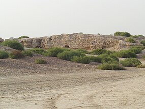
காளி பங்கானின் மேற்கில் கோட்டை மேடு
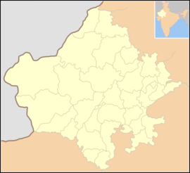
காளிபங்கான் is located in India
காளிபங்கான்
 
Shown within India#Rajasthan
காளிபங்கான் is located in Rajasthan
காளிபங்கான்
 
Shown within India#Rajasthan
இருப்பிடம்தற்கால பிலிபங்கான், அனுமான்காட் மாவட்டம் ராஜஸ்தான்இந்தியா
பகுதிதார் பாலைவனம்
ஆயத்தொலைகள்29°28′27″N 74°7′49″Eஆள்கூற்று29°28′27″N 74°7′49″E
வகைSettlement
வரலாறு
பயனற்றுப்போனதுகிமு 2000 - 1900
காலம்அரப்பா 1 - அரப்பா 3சி- இடைப்பட்ட காலம்
கலாச்சாரம்சிந்து வெளி நாகரீகம்
 
இடுகாட்டிற்கு செல்லும் பாதை

காளிபங்கான் (Kalibangān), தற்கால தார் பாலைவனத்தில் பாயும் காகர் நதியின் தென்கரையில் அமைந்த சிந்துவெளி பண்பாட்டுக் கள நகரம் ஆகும். 29.47°N 74.13°E [1][2] காளிபங்கான் நகரம்ஹரப்பா 1 - 3சி இடைப்பட்டகாலத்தில் செழித்து இருந்தது.[3]

ராஜஸ்தான் மாநிலத்தின் தார் பாலைவனத்தில் உள்ள அனுமான்காட் மாவட்டத்தில் உள்ள பிலிபங்கான் வருவாய் வட்டத்தில் அமைந்துள்ளது. பிகானேர் நகரத்திலிருந்து 205 கிமீ தொலைவில் காளி பங்கான் அமைந்துள்ளது.

பண்டைய திருஷ்டாவதி ஆறு மற்றும் சரசுவதி ஆறுகள் கூடுமிடத்தில் காளிபங்கானின் அமைவிடமாக கருதுகிறார்கள்.[4] சிந்து வெளி பண்பாட்டு காலத்திய காளி பங்கான் தொல்லியல் களத்தின் 34 ஆண்டு கால அகழாய்விற்குப் பின், முழு அறிக்கை இந்தியத் தொல்லியல் ஆய்வகம்2003ல் வெளியிட்டது.

லியுஜி பியோ தெஸ்சிதோரி எனும் இத்தாலிய இந்தியவியல் அறிஞரான லியுஜி பியோ தெஸ்சிதோரி (Luigi Pio Tessitori) என்பரால் கிபி 1887 - 1919களில் காளி பங்கான் அகழ்வாரய்ச்சி செய்யப்பட்டது.[5]

சிந்து வெளி பண்பாட்டுக் காலத்தின் போது, காளி பங்கான் நகரம், ஒரு மாகாணத்தின் தலைநகரமாக இருந்திருக்கும் என்றும் தொல்லியலாளர்கள் கருதுகிறார்கள். மேலும் காளி பங்கான் அதன் தனித்தன்மையான பலிபீடங்களாலும், உலகின் முதன்மையான சான்றளிக்கப்பட்ட உழவு நிலங்களாலும் தனித்துவமாக திகழ்கிறது.[6]

காளிபங்கான் 1 என்ற பகுதி முந்தைய ஹரப்பா பண்பாட்டு காலத்தியது என கண்டுபிடிக்கப்பட்டுள்ளது.[7] காளிபங்கானில் சுடுமண் எருது சிற்பம் கிடைத்துள்ளது.[8]காளிபங்கான் அகழாய்வில் சுடுமண் வளையல்கள் அதிக அளவில் கிடைத்துள்ளது. இங்கு கிடைத்த உருளை வடிவ முத்திரைகளில் கைகளில் ஈட்டிகள் ஏந்திய ஒரு பெண் மற்றும் இரண்டு ஆண்கள் உருவங்கள் உள்ளது

தற்கால காளிபங்கான்[தொகு]

காளிபங்கான் எனும் சொல்லிற்கு கறுப்பு வளையல்கள் எனப்பொருள்படும். காளிபங்கான் தொல்லியல் களத்திற்கு அருகில் உள்ள பிலிபங்கான் என்ற நகரியமும் தொடருந்து நிலையமும் உள்ளது. பிலிபங்கான் என்பதற்கு மஞ்சள் வளையல்கள் எனப் பொருள்.

காளிபங்கான் தொல்லியல் அகழாய்வில் கிடைத்த பொருட்களைக் கொண்டு, 1983ல், இந்தியத் தொல்லியல் ஆய்வகம் ஒரு அருங்காட்சியகத்தை நிறுவியுள்ளது.

இதனையும் காண்க[தொகு]

அடிக்குறிப்புகள்[தொகு]

  1. Jump up Calkins, PB. "India". Encyclopædia Britannica. பார்த்த நாள் 2008-12-31.
  2. Jump up Lal, BB (2002). "The Homeland of Indo-European Languages and Culture: Some Thoughts". PurātattvaIndian Archaeological Society. பக். 1–5.
  3. Jump up Harappa
  4. Jump up McIntosh, Jane (2008) The Ancient Indus Calley : New Perspectives. ABC-CLIO. Page 77
  5. Jump up cf. Finding Forgotten Cities.
  6. Jump up Lal, BB (2003). Excavations at Kalibangan, the Early Harappans, 1960-1969Archaeological Survey of India. பக். 17, 98.
  7. Jump up this is the wording of the official website of ASI : http://asi.nic.in/asi_exca_imp_rajasthan.asp
  8. Jump up Elements of Indian Archaeology, p.117.


__________________


Guru

Status: Offline
Posts: 24765
Date:
Permalink  
 

 கல்லறை எச் கலாச்சாரம்

கட்டற்ற கலைக்களஞ்சியமான விக்கிப்பீடியாவில் இருந்து.
 
 
Jump to navigationJump to search
 
ரிக் வேத கால ஆறுகளும்; பெயர்களும்; சுவத் கலாசாரம் மற்றும் கல்லறை எச் கலாச்சாரப் பகுதிகளின் பரப்புகள் பழுப்பு நிறத்தில் குறிக்கப்பட்டுள்ளது
 
கல்லறை எச் கலாச்சாரக் காலத்திய மட்பாண்டங்கள்

கல்லறை எச் கலாச்சாரம் (Cemetery H culture) தற்கால இந்தியா மற்றும் பாகிஸ்தான்நாடுகளின் பஞ்சாப் மற்றும் வடமேற்கு எல்லைப்புற மாகாணப் பகுதிகளில் கி மு 1900 முதல் கி மு 1300 வரை செழித்திருந்த வெண்கல காலத்தை சேர்ந்த கலாச்சாரம் ஆகும். [1] கல்லறை எச் கலாச்சாரம், சிந்துவெளிஹரப்பா மற்றும் ஆரியக் குடியேற்றங்களுக்கு பிந்தியதாகும்.

பெயர்க் காரணம்[தொகு]

அரப்பாவில் எச் என்று குறித்த பகுதியில் கி மு 1900 – 1300க்கு இடைப்பட்ட காலத்திய கல்லறைகளை அகழ்வாராய்ச்சி செய்த போது அறியப்பட்டதால் இதற்கு கல்லறை எச் கலாச்சாரம் பெயராயிற்று.

கல்லறை எச் கலாச்சாரத்தின் சிறப்பம்சங்கள்[தொகு]

எச் கல்லறைகளை அகழ்வாராய்ச்சி செய்த போது கிடைத்த மட்பாண்டங்களில் சூரியன், நட்சத்திரங்கள் மற்றும் கலைமான், மயில் போன்ற விலங்குகள் செந்நிற வர்ணத்தால் தீட்டப்பட்டிருந்தது. மேலும் கல்லறைகளில் கிடைத்த அணிகலன்கள், தானியங்களை ஆய்வு செய்த போது, அப்பகுதியில் வாழ்ந்த மக்களின் கலாச்சாரம் மற்றும் நாகரீகம் அறியப்பட்டது. எச் கல்லறை கலாச்சாரப் பகுதிகளில் நெல் முக்கிய பயிராகும். களிமண்னால் ஆன செங்கல்கள் பயன்படுத்தப்பட்டது. இறந்தவர்களின் சடலங்கள் மரப்பெட்டிகளில் அடக்கம் செய்யப்பட்டிருந்தது. [2]

இதனையும் காண்க[தொகு]

மேற்கோள்கள்[தொகு]

  1. Jump up M Rafiq Mughal Lahore Museum Bulletin, off Print, vol.III, No.2, Jul-Dec. 1990 [1]
  2. Jump up http://pubweb.cc.u-tokai.ac.jp/indus/english/3_1_02.html

வெளி இணைப்புகள்[தொகு]

ஆதாரங்கள்[தொகு]

  • Kenneth A. R. Kennedy (2000), God-Apes and Fossil Men: Palaeoanthropology of South Asia, Ann Arbor: University of Michigan Press
  • Jonathan Mark Kenoyer (1991a), "The Indus Valley tradition of Pakistan and Western India", Journal of World Prehistory 5 (4): 1–64, doi:10.1007/BF00978474
  • Jonathan Mark Kenoyer (1991b), "Urban Process in the Indus Tradition: A preliminary model from Harappa", in Meadow, R. H., Harappa Excavations 1986-1990: A multidiscipinary approach to Third Millennium urbanism, Madison, WI: Prehistory Press, pp. 29–60
  • Kochhar, Rajesh (2000), The Vedic People: Their History and Geography, Sangam Books
  • Mallory, J. P.; Adams, D. Q. (1997), Encyclopedia of Indo-European Culture, London and Chicago: Fitzroy-Dearborn, ISBN 1-884964-98-2
  • Asko Parpola (1998), "Aryan Languages, Archaeological Cultures, and Sinkiang: Where Did Proto-Iranian Come into Being and How Did It Spread?", in Mair, Victor H., The Bronze Age and Early Iron Age Peoples of Eastern and Central Asia, Washington, D.C.: Institute for the Study of Man, ISBN 0-941694-63-1
  • Sarkar, Sasanka Sekhar (1964), Ancient Races of Baluchistan, Panjab, and Sind
  • Jim G. Shaffer (1992), "The Indus Valley, Baluchistan and Helmand Traditions: Neolithic Through Bronze Age", in Ehrich, R. W., Chronologies in Old World Archaeology (Second ), Chicago: University of Chicago Press, pp. I:441–464, II:425–446


__________________


Guru

Status: Offline
Posts: 24765
Date:
Permalink  
 

 76. Is there any relation between Vedic and Indus Civilization as many Indus and Saraswati sites have been found in the region which is called Saptasindhu in Vedas?

Asked by Monu

Mayank Vahia
This question is a landmine and whatever I say will be challenged by someone. Let me list some issues. There was clearly a dried up riverbed between Indus and the Central India which is now a small seasonal river called Ghaggar in India and Hakra in Pakistan. Many IVC sites are along this river bed.

Rig Veda (the oldest of Vedas) mentions a river which coincides with the region in general and they call it Saraswati. However, we have no clue as to what the IVC people called it.

The problem between associating IVC and Vedic Civilisation boils down to 2 problems. Vedas swear by the horse (with 27 ribs and all) while Harappans only know of wild asses (26 ribs) and no more. There are no horse bones, drawings or even toys of horse borne carts – there are bullock carts though.

The second question is that Vedic literature discusses an entirely nomadic life and there are no fixed places of stay or worship. Harappans were highly urbanised for almost a thousand years. If IVC practiced any religion, then there is very little evidence. So the connection is not obvious.

Having said this, there are some well-made, well preserved seals in IVC which appear to represent one of the great gods of Hinduism – Shiva. Shiva is a very interesting god – he is the lord of animals (Pashupati), is an intellectual and short on temper. In many ways he is different in temperament than other gods of Vedic period. The others (Vishnu, Indra and Bramha) also have some connectivity with the Avetha of Iran from where the Vedic people presumably came. Hence it can be argued, with some merit, that Shiva was a IVC god assimilated in the Hindu Pantheon when the Vedic people came to India towards the podt urban declining phase of IVC when the cities had been abandoned. That is the closest you have, to a synthesis of data but the subtleties can be argued ad infinitum. However, every statement in this response can be questioned.

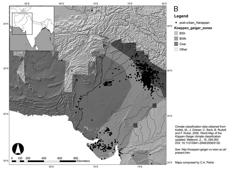
Above: Distribution of urban-phase Indus settlements (B) and their relationship to Global Köeppen-Geiger Climate Classification Zones., courtesy Adaptation to Variable Environments, Resilience to Climate Change


__________________


Guru

Status: Offline
Posts: 24765
Date:
Permalink  
 

Religious Developments in Ancient India

Article


a0b6a98476c3811a12b30560cd2c652a?d=ident
by Sanujit 
published on 01 May 2011

For well over 1,000 years, sacred stories and heroic epics have made up the mythology of Hinduism. Nothing in these complex yet colourful legends is fixed and firm. Pulsing with creation, destruction, love, and war, it shifts and changes. Most myths occur in several different versions, and many characters have multiple roles, identities, and histories. This seeming confusion reflects the richness of a mythology that has expanded and taken on new meanings over the centuries.

Hinduism stood for a wide variety of related religious traditions native to India. Historically, it involved the evolution since the pre-Christian epoch. In turn, it looked back to age-old belief of the Indus Valley Civilization followed by the Vedic religion.

INDUS VALLEY CIVILIZATION

The Indus Valley Civilization ensued during the Bronze Age (3300–1300 BCE; mature period 2600–1900 BCE). It mostly spread along the Indus and the Punjab region, extending into the Ghaggar-Hakra river valley and the Ganga-Yamuna Doab, surrounding most of what is now Pakistan, the western states of modern-day India, as well as extending into south-eastern Afghanistan, and the easternmost part of Baluchistan, Iran.


Map of the Indus Valley CivilizationMap of the Indus Valley Civilization


The geography of the Indus Valley put the civilizations that arose there in a similar situation to those in Egypt and Peru, with rich agricultural lands being surrounded by highlands, desert, and ocean. Of late, Indus sites had been discovered in Pakistan's north-western Frontier Province as well. Other smaller isolated colonies were found as far away as Turkmenistan. Coastal settlements extended from Sutkagan Dor in Western Baluchistan to Lothal in Gujarat. An Indus Valley site was located on the Oxus River at Shortughai in northern Afghanistan,

By 2600 BCE, early communities turned into large urban centres. Such inner-city centres included Harappa, Ganeriwala, Mohenjo-Daro in Pakistan, and Dholavira, Kalibangan, Rakhigarhi, Rupar, and Lothal in India. In total, over 1,052 cities and settlements have been found, mainly in the region of the Indus and the tributaries.
Steatite seals had images of animals, people (perhaps gods), and other types of inscriptions, including the yet un-deciphered writing system of the Indus Valley Civilization. A number of gold, terra-cotta and stone figurines of girls in dancing poses showed the presence of some dance form. Also, these terra-cotta figurines included cows, bears, monkeys, and dogs. Sir John Marshall reacted with surprise when he saw the famous Indus bronze statuette of a slender-limbed dancing girl in Mohenjo-Daro:

When I first saw I found it difficult to believe that they were prehistoric; they seemed to completely upset all established ideas about early art, and culture. Modelling such as this was unknown in the ancient world up to the Hellenistic age of Greece, and I thought, therefore, that some mistake must surely have been made; that these figures had found their way into levels some 3000 years older than those to which they properly belonged.

Now, in these statuettes, it was just this anatomical truth which was so startling; that made us wonder whether, in this all-important matter, Greek artistry could possibly have been anticipated by the sculptors of a far-off age on the banks of the Indus.


Dancing girl of Mohenjo DaroDancing girl of Mohenjo Daro


It was widely suggested that the Harappan people worshipped a Mother goddess symbolizing fertility. A few Indus valley seals displayed  swastika sign which were there in many religions, especially in Indian religions such as Hinduism, Buddhism and Jainism. The earliest evidence for elements of Hinduism is before and during the early Harappan period. Phallic symbols close to the Hindu Shiva lingam was located in the Harappan ruins.

SHIVA

One famous seal displayed a figure seated in a posture reminiscent of the lotus position, surrounded by animals. It came to be labelled after Pashupati (lord of beasts), an epithet of Shiva. The discoverer of the Shiva seal (M420), Sir John Marshall and others have claimed that this figure is a prototype of Shiva, and have described it as having three faces, seated on a throne in a version of the cross-legged lotus posture of Hatha Yoga. Yogi's penis is erect, with both testicles prominently visible. The precise placement of both heels under the scrotum is an advanced Tantric Yoga technique known as Bandha, meaning knot or lock. It is normally used to sublimate and redirect sexual energy and can endow the practitioner with spiritual powers.

A large tiger rears upwards by the yogi's right side, facing him. This is the largest animal on the seal, shown as if warmly connected to the yogi; the stripes on the tiger's body, also in groups of five, highlight the connection. Three other smaller animals are depicted on the Shiva seal. It is most likely that all the animals on this seal are totemic or heraldic symbols, indicating tribes, people or geographic areas. On the Shiva seal, the tiger, being the largest, represents the yogi's people, and most likely symbolizes the Himalayan region. The elephant probably represents central and eastern India, the bull or buffalo south India and the rhinoceros the regions west of the Indus river. Heinrich Zimmer agrees that the Pashupati figure shows a figure in a yoga posture.

PASHUPATI

The people of the Indus Valley also appear to have worshipped a male god. The most important depiction of an imagined Hinduism god is seal number 420. Many other seals have been found depicting the same figure, but not in the same detail as number 420. The deity is wearing a headdress that has horns, the shape being reminiscent of the crescent moon that modern image of Siva shows on his forehead.

What are thought to be linga stones have been dug up. Linga stones in modern Hinduism are used to represent the erect male phallus or the male reproductive power of the god Siva. But again, these stones could be something entirely different from objects of religious worship. Even today, Siva is worshipped in both human form and that of the phallus. The deity sitting in a yoga-like position suggests that yoga may have been a legacy of the very first great culture that occupied India.


Shiva PashupatiShiva Pashupati


RELIGIOUS SIGN OF SWASTIKA

The earliest sure use of swastika motifs in the archaeological record goes to the Neolithicepoch. The symbol appears in the "Vinca script" of Neolithic Europe (Balkans, 6th to 5th millennium BCE. Another early attestation is on a pottery bowl found at Samarra, dated to as early as 4000 BCE. Joseph Campbell  in an essay on The Neolithic-Palaeolithic Contrastcites an ornament on a Late Palaeolithic (10,000 BCE) mammoth ivory bird figurine found near Kiev as the only known occurrence of such a symbol predating the Neolithic. The swastika appears only very rarely in the archaeology of ancient Mesopotamia.

In Hinduism, the Swastika in two drawings symbolizes two forms of the creator god Brahma. Facing right it signifies the evolution of the universe; facing left it typifies the involution of the universe. The swastika is one of the 108 symbols of the Hindu deity Vishnu and represents the Sun's rays, upon which life depends. It is also seen as pointing in all four directions (north, east, south and west) and thus implies stability. Its use as a Sun symbol can first be seen in its image of the god Surya. The swastika is used in all Hindu yantras and religious designs.

Buddhism originated in the fifth century BCE and spread throughout the Indian subcontinent in the third century BCE. The swastika symbol (right-hand) was believed to have been stamped on Gautama Buddha's chest by his initiates after his death. It is known as The Heart's Seal. With the spread of Buddhism, the Buddhist swastika reached Tibet and China. The symbol was also introduced to Balinese Hinduism by Hindu kings.

Well over 400 distinct Indus symbols, some say 600, have been found on seals, small tablets, or ceramic pots and over a dozen other materials, including a signboard that apparently once hung over the gate of an inner citadel. 


A large number of eminent scholars argue that the Indus system did not encode language, but was instead similar to a variety of non-linguistic sign systems used extensively in the Near East and other societies. Others have claimed on occasion that the symbols were exclusively used for economic transactions, but this claim leaves unexplained the appearance of Indus symbols on many ritual objects, many of which were mass-produced in moulds. No parallels to these mass-produced inscriptions are known in any other early ancient civilizations.

MOHENJO-DARO

Mohenjo-Daro or “heap of the dead” was the largest city excavated of the Indus Valley, or Harappa Civilization. Mohenjo-Daro was a Sindhi word in the locality meaning ‘mound of the dead’.

The scholars Parpola and Asfaq identified another seal (M 430) found at Mohenjo-Daro as the one relating to a unique ritual of equinox. It was an stellar ceremony marking the equinox at the star constellation of Krittika - Alcyon. The legend on the seal cited: the epoch (Kali Yuga – the present epoch we live in) set off at the beginning of the sign of the goat on Wednesday at sunrise at Lanka.

To cut short a fascinating tale of astral importance with religious nuance, it was the city of Lanka which had the place of honour as the prime meridian passed through it in 3102 BCE.

One more narration in this regard was in the travel record of Hwen Tsang in 630-635 CE. He saw a palisade (stupa) of Mauryan times. It was one hundred feet high. Cunningham said of this pillar:

The principality of Middle Sind, which is generally known as Vichalo or ‘Midland’ is described by Hwen Tsang as only 2,500 li or 417 miles in circuit. The chief city, named ‘O-fan-cha’ was at 700 li or 117 miles from the capital of the upper Sind, and 50 miles from Pitasala, the capital of lower Sind. As the former was Alor, and the latter was almost certainly the Pattale of the Greeks or Haiderabad, the recorded distances fix the position of O-fan-cha in the immediate neighbourhood vicinity of the ruins of an ancient city called Bambhra-ka-Thul or simply Bambhar. This, according to tradition, was the site of the once famous city of Brahmanwas or Brahmanabad […].

The city can be located because the circumstances are narrated in detail. The king of the city had previously submitted, but the citizens withheld their allegiance, and shut their gates. By a stratagem, they were induced to come out, and a conflict ensued, in which Ptolemy was seriously wounded in the shoulder by a poisoned sword. The mention of Ptolemy’s wound enables us to identify this city with that of Hermetalia, which Diodorus describes as the ‘last town of the Brahmins on the river. 

Hermes in Greek is the muted term for Brahma. The Chinese syllable fan is the well-known phrasing of Brahma. Hence, both O-fan-cha and Hermetalia is a direct wording of Bambhra-ka-thul or Brahma-sthal. From all these discussions, it seemed certain that what Hwen Tsang visited was the city of Mohenjo-Daro and its real name was Brahma-sthal or Brahmanabad.  The meaning of the name Mohenjo-Daro is ‘Heap of the Dead’. Such a name seems peculiar for a prosperous city like this.

The Hindi word was mohan jodad.o. This word jodad.o had cognates in many mleccha, meluhha languages. The Sindhi word d.a_r.o meant ‘feast given to relatives in honour of the dead’. A number of scholars made out that meluhha was the Sumerian name for mleccha, meaning non-Vedic, barbarian. It was used by the Aryans much as the ancient Greeks used barbaros, indicating garbled speech of foreigners or native people of the country.

The city flourished between 2600 BCE and 1900 BCE, although the first signs of settlement in the area had been dated to the period of 3500 BCE. Excavation at this level was impossible due to the high water table that made even simple excavations of Mohenjo-Daro difficult. The city covered around 200 hectares of land and at its height might have had a population of 85, 000 people. The site was located in the modern Larkana district of Sind province in Pakistan. Mohenjo-Daro was the largest city in the southern portion of the Indus Valley Civilization and important for trade and governance of this area.

The Great Mound, or Citadel, stood out the west end of Mohenjo-Daro. The mound rose 40 feet about the plain at present time; it would have been higher at the time Mohenjo-Daro was inhabited. There was a gap between the mound and the lower city. Because of the large size and separation from the rest of the city, it was thought the mound might have been used for a religious or administrative purpose. This hypothesis was supported by the architecture found on the top of the mound. The mound at Mohenjo-Daro had two distinct features: the Great Bath and the Granary or Meeting hall. The Great Bath was a sunken tank on the top of the mound; the tank was 12 meters long, 7 meters wide and was sunk 2.4 meters below the depth of the mud bricks that enclosed it. The Great Bath was one of the first aspects of Indus Valley life that could be related to modern Hinduism. The Great Bath might also be linked to the concept of river worship, much like the worship of the River Ganga today.

EMERGENCE OF THE MITANNI KINGDOM

In northern Mesopotamia, a great power arose: the Mitanni kingdom. Whatever we could gather about it is from indirect sources. Those people were called Kharri. Some philologists believed that this term was the same as Arya. According to the Vedic Index of Names and Subjects, compiled by Macdonald and Keith, this was the normal designation in Vedic literature from the Rig-Veda onwards of an Aryan of the three upper classes. The Mitannian invasion of northern Mesopotamia and the Aryan influx into India represented two streams of wandering migrations from a common cultural axis.

In 1906-07 CE at Boghaz Keui (about eighty miles to the south east of Ankara, modern capital of Turkey) Hugo Winkler discovered the great state archive of the Chatti Empirecontaining more than 10,000 cuneiform tablets written in Akkadian cuneiform. One tablet recorded a peace treaty concluded in about 1400 BCE between the Hittite Monarch Suppiluliumas and Mattiuaza, King of the Mitanni. Four gods were called upon as witness to this treaty in the records: In-da-raUru-w-naMi-it-ra and Na-sa-at-ti-ia. These names were nearly identical with the Vedic gods IndraVarunaMitra and Nasatya. According to the eminent Indologist Paul Thieme, during the time of the Boghaz Keui treaty, these gods were brought into Iranian mythology. The Avestan scholars affirmed that many Vedic gods were revived, though they were below the supreme god Ahura Mazda. The Mitannians of the upper Euphrates River worshipped them around this epoch.

When Vedic texts were the oldest surviving evidence of early Indo-European-speaking peoples, it was assumed that these texts preserved aspects of Proto-Indo-European culture with careful accuracy. Many ethnologists hoped to unify Indo-Iranian, Celtic, Norse, Greek and Roman into a Proto-Indo-European religion. Max Muller believed that Indo-Iranian religion began as sun worship. G. Dumézil stressed the tripartite social system of Indo-European religion and society. Later scholarship had moved away from considering all these religions near-identical. Instead, since early in the 20th century CE, following Meillet, Thieme and Kuiper, the social function of the Indo-Iranian Asura/Āditya deities was stressed; they were an innovative group not found in Indo-European religion.

Several scholars held that Indo-Aryans reached Assyria in the west and the Punjab in the east before 1500 BCE. The Hurrite speaking Mitanni rulers, influenced by Indo-Aryan, turned up from 1500 BCE in northern Mesopotamia, and the Gandhara grave culture emerged from 1600 BCE. Shaffer & Lichtenstein (in Erdosy 1995:139) stated that:

This shift by Harappan and, perhaps, other Indus Valley cultural mosaic groups, is the only archaeologically documented west-to-east movement of human populations in South Asia before the first half of the first millennium BC.

This could have been caused by ecological factors, such as the drying-up of the Ghaggar-Hakra River and increased aridity in Rajasthan and other places. The Indus River also began to flow east and flooding occurred.

IRON AGE VEDIC RELIGION

The religion of the Vedic period (also known as Vedism or Vedic Brahmanism or, in a context of Indian antiquity, simply Brahmanism was a historical predecessor of Hinduism. Many scholars insisted that to call this period Vedic Hinduism was a contradiction in terms since Vedic religion was very different from what we generally called Hindu religion - at least as much as Old Hebrew religion was from medieval and modern Christian religion. However, Vedic religion was treatable as a predecessor of Hinduism.

According to traditional views, the hymns of the Rig-Veda and other Vedic hymns were divinely revealed to the rishis, who were considered to be seers or "hearers" (shruti meant "what was heard") of the Veda, rather than "authors". In addition, the Vedas were said to be "apaurashaya", a Sanskrit word meaning uncreated by man and which further revealed their eternal non-changing status.

Elements of Vedic religion reached back to a Proto-Indo-Iranian religion and an earlier Proto-Indo-European religion. The Vedic period was held to have ended around 500 BCE, Vedic religion with time evolving into the various schools of Hinduism. Vedic religion also influenced Buddhism and Jainism.

Proto-Indo-Iranian religion meant the religion of the Indo-Iranian peoples prior to the earliest Vedic (Indo-Aryan) and Zoroastrian (Iranic) scriptures. These shared a common inheritance of concepts including the universal force *rta (Vedic rta, Avestan asha), the sacred plant and drink *sauma (Vedic Soma, Avestan Haoma) and gods of social order such as *mitra (Vedic Mitra, Avestan and Old Persian Mithra, Miϑra), *bhaga (Vedic Bhaga, Avestan and Old Persian Baga). Proto-Indo-Iranian religion was an archaic offshoot of Indo-European religion.

The documented history of Indian religions began with historical Vedic religion, the religious practices of the early Indo-Aryans, which were collected and later redacted into the Samhitas, four canonical collections of hymns or mantras composed in archaic Sanskrit. These texts were the central shruti (revealed) texts of Hinduism. The period of the composition, redaction and commentary of these texts was known as the Vedic period, which lasted from roughly 1500 to 500 BCE.

The late Vedic period (9th to 6th centuries BCE) marked the beginning of the Upanisadic or Vedantic period. This period heralded the beginning of much of what became classical Hinduism, with the composition of the Upanishads, later the Sanskrit epics, still later followed by the Puranas.

The Sanskrit word véda "knowledge, wisdom" was derived from the root vid- "to know". This was reconstructed as being derived from the Proto-Indo-European root *u̯eid-, meaning "see" or "know".

The Rig-Veda was counted among the four canonical sacred texts (śruti) of Hinduism known as the Vedas. Some of its verses are still recited as Hindu prayers, at religious functions and other occasions, putting these among the world's oldest religious texts in continued use. The Rig-Veda was full of several mythological and poetical accounts of the origin of the world, hymns praising the gods, and ancient prayers for life, prosperity, etc.

It is one of the oldest extant texts in any Indo-European language. Philological and linguistic evidence implies that the Rig-Veda was composed in the north-western region of India, roughly between 1700–1100 BCE (the early Vedic period). There were strong linguistic and cultural similarities with the early Iranian Avesta, deriving from the Proto-Indo-Iranian times.

The text is organized in 10 books, known as Mandalas, of varying age and length. The "family books": mandalas 2-7, were the oldest part of the Rig-Veda and the shortest books; they were arranged by length. Tradition linked a rishi (the composer) with each hymn of the Rig-Veda. In all, 10 families of rishis accounted for more than 95% of the hymns. The compilation by each family went on over a long period of time. Thus, the Rig-Veda was not one book compiled and put together by the sages: each mandala stood out on its own.

The Rig-Vedic hymns were dedicated to various deities, chief of whom being Indra, a heroic god praised for having slain his enemy Vrtra; Agni, the sacrificial fire; and Soma, the sacred potion or the plant it was made from. Equally prominent gods were the Adityas or Asura gods Mitra–Varuna and Ushas (the dawn). Also invoked were Savitr, Vishnu, Rudra, Pushan, Brihaspati or Brahmanaspati, as well as deified natural phenomena such as Dyaus Pita (the shining sky, Father Heaven ), Prithivi (the earth, Mother Earth), Surya (the sun god), Vayu or Vata (the wind), Apas (the waters), Parjanya (the thunder and rain), Vac (the word), many rivers (notably the Sapta Sindhu – the seven rivers starting with the Indus, and the SarasvatiRiver). The Adityas, Vasus, Rudras, Sadhyas, Ashvins, Maruts, Rbhus, and the Vishvadevas ("all-gods") as well as the "thirty-three gods" were the groups of deities mentioned.

The priests performed the solemn rituals for the noblemen (Kshsatriya) and some wealthy merchants (Vaishyas). They prayed for abundance of children, rain, cattle (wealth), long life and an afterlife in the heavenly world of the ancestors. This mode of worship had been preserved even now in Hinduism, which needed recitations from the Vedas by a purohita(priest).

The religious practices rested on a priest administering rites that often involved sacrifices. Homa (also known as homam or havan) was a Sanskrit word which referred to any ritual in which making offerings into a consecrated fire was the primary action. At present, the words homa/homam and havan were interchangeable with the word Yagna. Although a consecrated fire was the central element of every homa ritual, the procedure and items offered to the fire varied by what was the occasion of the ceremony, or by the benefit expected from the ritual. Procedures invariably involved

  • the kindling and consecration of the sacrificial fire;
  • the invocation of one or more divinities; and,
  • making of offerings (whether real or visualized) to them with the fire as via media, amid the recitation of prescribed prayers(mantras).

The sacred fire formed the focus of devotion; it was often held on certain types of dung, wood, dried coconut and so on. The fire-altar (vedi or homa/havan kunda) was generally made of brick or stone or a copper vessel, and was almost always built especially for the occasion, being taken apart immediately afterwards. This fire-altar was always built in square shape. While very large vedis were seldom built for major public homas, the usual altar would be as small as 1 x 1 foot square and rarely exceeded 3 x 3 feet square.

In all events, the arrangement was in the middle of a space, which could be either outdoors or indoors. The principal people performing the ceremony and the priests who instructed them through the rituals seated themselves around the altar, while family, friends and other devotees formed a larger ring around that centre.

THE VEDAS

  1. Rig-Veda
  2. Sama-Veda
  3. Yajur-Veda
  4. Atharva-Veda

Of these, the first three were the principal original division, also called "trayī vidyā", implying "the triple sacred science" of reciting hymns (RV), chanting (SV) and performing sacrifices (YV).

The Sama-Veda Samhita (from sāman, the term for a melody applied to metrical hymn or song of praise) consisted of 1549 stanzas, taken almost entirely (except for 78 stanzas) from the Rig-Veda.

The Yajur-Veda Samhita had archaic prose mantras and also in part of verses borrowed and adapted from the Rig-Veda. Its purpose was practical, in that each mantra must accompany an action in sacrifice but, unlike the Sama-Veda, it was compiled to apply to all sacrificial rites,

In the Vedic literature, the Veda was one – the Rig-Veda. It was not the Vedas as the foreign scholars cited quite often. From the narration about the composition of the Sama-Veda, it was the chanting of the hymns, taken almost entirely from the Rig-Veda. The Yajur-Vedacontained the details of the platform to be made, dedicated to the deity in whose homage the homa was going to be recited. For every deity there were separate chanting and separate platform for the ritual of yagna. The prose hymns here were again taken from the Rig-Veda.

The Atharva-Veda embodied an independent parallel tradition to that of the Rig-Veda and Yajur-Veda. It added in much of early traditions of healing and magic that had parallel in other Indo-European literature.

The Atharva-Veda was less common than other Vedas as it was little used in solemn ritual. Its first part composed chiefly of spells and incantations, concerned with protection against demons and disaster, spells for the healing of diseases, for long life and for various desires or aims in life. The largely silent Brahman priest looked at the procedures of the ritual and mended it with two mantras and pouring of ghee when a mistake occurred. An early text, its status had been ambiguous due to its magical character.

EDITORIAL REVIEWThis Article has been reviewed for accuracy, reliability and adherence to academic standards prior to publication.

https://www.ancient.eu/article/230/religious-developments-in-ancient-india/


__________________


Guru

Status: Offline
Posts: 24765
Date:
Permalink  
 

 Initiation of religions in India

Article


a0b6a98476c3811a12b30560cd2c652a?d=ident
by Sanujit 
published on 23 July 2011

The religious practices of the early Indo-Aryans, known as the Vedic religion (1500 BCE to 500 BCE) were written down and later redacted into the Samhitas, four canonical collections of hymns or mantras, called the Veda, in archaic Sanskrit.

The Late Vedic age (9th to 6th centuries BCE) marked the beginning of the Upanisadic or Vedantic phase. This epoch heralded the start of what became classical Hinduism, with the composition of the Upanishads, later the Sanskrit epics, still later followed by the Puranas. The Sanskrit term Upanishad arose from upa- (nearby), ni- (at the proper place, down) and şad (to sit) thus: "sitting down near"), implying sitting near a teacher to get instruction.

The Upanishads are the philosophical account deemed to be the earliest source of Hindureligion. Out of more than 200 Upanishads the first dozen or so were the oldest and most important. The Brihadaranyaka, Jaiminiya and Chandogya Upanishads were composed during the pre-Buddhist era while the Taittiriya, Aitareya and Kausitaki, which showed Buddhist influence, must have been composed after the 5th century BC. All Upanishads had been passed down in oral tradition.


ShivaShiva


The Puranas (meaning "of ancient times") were a genre of important Hindu, Jain and Buddhist religious texts, with stories of the history of the universe from creation to destruction, genealogies of kings, heroes, sages, and demigods, and descriptions of Hindu cosmology, philosophy, and geography. Early references to the Puranas are found in the Chandogya Upanishad (7.1.2) (500BCE).

Vedic religion had a strict code of rituals where the kings, the aristocrats and the rich merchants would contribute as the cost of organising such worship was very high and time-consuming. The mode of worship was prayer to the elements like fire and rivers, worship of heroic gods like Indra, chanting of hymns and carrying out sacrifices. Sacrifice was the offering of food, objects or the lives of animals to the gods as an act of propitiation or worship. In Vedic times, Yagya commonly included the sacrifice of milk, ghee, curd, grains, and the soma plant—animal offerings were less common.

PREPARATION OF A VEDIC RITUAL

Priests were trained for the ritual and they had to get proficient in its practice. The specialization of roles focused on the elaboration and development of the ritual corpus over time. Over time a full complement of sixteen priests became the custom for major ceremonies. The sixteen consisted of four chief priests and their assistants, with each of the four chief priests playing a unique role:

The hotri was the reciter of invocations and litanies. These could consist of single verses, or entire hymns (sukta), drawn from the Rig-Veda. As each phase of the ritual required an invocation, the hotri had a leading or presiding role. 

The adhvaryu was in charge of the physical details of the sacrifice. According to Monier-Williams, the adhvaryu "had to measure the ground, to build the altar, to prepare the sacrificial vessels, to fetch wood and water, to light the fire, to bring the animal and immolate it," among other duties. Each action was accompanied by supplicative or benedictive formulas (yajus), drawn from the Yajur-Veda.

The udgātri was a chanter of hymns set to melodies (sāman) drawn from the Sāma-Veda. This was a specialized role in the major soma sacrifices: a characteristic function of the udgātri was to sing hymns in praise of the energizing properties of the freshly pressed juice of the soma plant.
The brahman was superintendent of the entire performance, and responsible for correcting mistakes by means of supplementary invocations, usually from the Atharva-Veda.

THOSE WHO HAD PAID FOR & PARTICIPATED IN SUCH RITUALS PRAYED FOR ABUNDANCE OF CHILDREN, RAIN, CATTLE (WEALTH), LONG LIFE & AN AFTERLIFE IN THE HEAVENLY WORLD OF THE ANCESTORS. 

Those who had paid for and participated in such rituals prayed for abundance of children, rain, cattle (wealth), long life and an afterlife in the heavenly world of the ancestors. This mode of worship has been preserved even today in Hinduism, which involves recitations from the Vedas by a purohita (priest), for prosperity, wealth and general well-being.

Sacrifice was done in several ways: First, there was simply the gift-offering. There was also a sense in which the sacrifice gave power or a way of spiritually carrying out something through the sacrifice, such as the severing of the heads of enemies through the gods. Sacrifice was seen as a way of pleasing the gods and gaining their favour in contrast to those who did not sacrifice (e.g. Rig 1.110.7 “those who pour no offering forth”). In the soma offering it was the priests offering the gods the juice that gave them pleasure and strength to win wealth and help from the gods for those who offered the Soma.

NARRATION IN THE EPIC ON VEDIC RITUAL

There was an ornate description of the Vedic rites performed at the royal bidding in Kosala. At the prologue of the Ramayana, King Dasaratha was getting ready to perform a grand yagna to have a son.

After some time, when the sweet vernal season appeared, King Dasaratha thought of carrying out the ritual […] to get sons to keep up his lineage.

King Dasaratha, addressing his prime minister, said, O Sumantra, summon priests versed in the Vedas and the Vedangas. When they arrived, Dasaratha, after showing due respect to them, said, having no son I have no happiness in life. Hence, I intend to perform an Asvamedha Yagna. By the blessings of holy Sage Rishyasringa, I am sure, I shall attain my intent. They fully agreed to his words.

The priests erected the sacrificial fireplace with bricks. The fireplace consisting on three sides of eighteen bricks looked like a golden-winged Garuda, the celestial carrier of Vishnu. For the purpose of sacrifice, horses, beasts and birds, reptiles and aquatic animals were collected. To those Yupas (posts) were tied hundreds of animals as well as the horse of the king.


Vishnu Riding GarudaVishnu Riding Garuda


Animal sacrifice was very apparent in the Vedas as a part of the rituals. The Rig-Veda had several clear references to animal sacrifices. In a reference to the sacrifice of a goat it held (1.162.2) “The dappled goat went straight to heaven, bleating to the place dear to Indra and to Pusan.” In one of the hymns to the horse (1.162.9-11) it said, “What part of the steed’s flesh the fly did not eat or was left sticking to the post or hatchet, or to the slayer’s hands and nails adhered, among the Gods, too may all this be with thee. Food undigested steaming from his belly and any odour of raw flesh that remained let the immolators set in order and dress the sacrifice with perfect cooking. What from thy body which with fire was roasted when thou art set upon the spit distilled let not that lay on earth or grass neglected, but to the longing Gods let all be offered.” As well, the non-vegetarian aspect was clear that when this horse was sacrificed, it was distributed to those who were eagerly waiting.

The meat was tested with a trial fork and then distributed (Rig 1.162.12ff). The Yajur-Veda was full of many more references to animal sacrifices, clear and often repeated references to animal sacrifices, mainly in association with the full moon rite, the Soma sacrifice and its supplement. There was an entire section of the Yajur-Veda devoted to optional animal sacrifices (ii.1): “To the Asvins he sacrifices a dusky, to Sarasvati a ram, to Indra a bull” (Yajur 1.8.21.e).

ASVAMEDHA YAGNA

The Ashvamedha, horse sacrifice, was one of the most important royal rituals of Vedic religion, described in detail in the Yajur-Veda. The Ashvamedha could only be conducted by a king. Its object was the acquisition of power and glory, the sovereignty over neighbouring provinces, and general prosperity of the kingdom. The ceremony narrated in the Ramayana was a departure from the Vedic text as the king wished to perform the ritual for being blessed with sons.

The horse to be sacrificed had to be a stallion, more than 24, but less than 100 years old. The horse was sprinkled with water, and the chief priest whispered mantras into its ear. Anyone who detained the horse was ritually cursed, and a dog was killed, symbolic of the punishment for the sinners. The horse was yoked to a gilded chariot, together with three other horses, and RV 1.6.1, 2 (Y.V. 23.5, 6) was recited. The horse was then driven into water and bathed. After this, the chief queen and two other royal consorts anointed it with ghee (clarified butter). They also adorned the horse's head, neck, and tail with golden ornaments.

After this, the horse, a hornless he-goat and a wild ox were tied to sacrificial stakes near the fire, and seventeen other animals were fastened to the horse. A great number of animals both tame and wild were tied to other stakes, according to a commentator, 609 animals in total.

The chief queen ritually called on the king's fellow wives for pity. The queens walked around the dead horse reciting mantras. The chief queen then had to mimic coitus with the dead horse, while the other queens ritually uttered obscenities.

On the next morning, the priests lifted up the queen from the place where she had spent the night with the horse. The three queens with a hundred golden, silver and copperneedles pointed to the lines on the horse's body along which it would be dissected. The horse was dissected, and its flesh roasted. Various parts were offered to a host of deities.

Now, to get back to the narration in the epic: a scholarly analysis put forward as under: ‘According to the text available to us, it seemed that the queen did not spend the entire night with the horse. Typically, she lay down with the horse and was covered with an upper cloth; at this time she was symbolically said to unite with the horse. Some words suggestive of copulation and fertility were spoken over her and the dead horse.

THERE WERE MANY AMBIGUITIES AND DISCORDS BETWEEN THE DIFFERENT SECTIONS OF THE VEDA, OFTEN CAUSING CLASHES BETWEEN MEMBERS OF THE PRIESTLY CLASS. 

Wilson, the eminent Vedic scholar, held: […] As was detailed in the Yajur-Veda 22.26, and more particularly in the Sutras of Katyayani (Asvamedha 1-210), the object was the same as that of the Ramayana, or posterity, as one step towards which the principal queen, Kausalya, in the poem, was directed to lie all night in closest contact with the dead steed; in the morning, when the queen was released from the disgusting, and in fact, impossible, contiguity, a dialogue, as given in the Yajus, and in the Asvamedha section of the Satapatha Brahmana, and as explained in the Sutra, took place between the queen and the females accompanying or attending upon her, and the principal priest, which though brief, was in the highest degree both silly and obscene[…] We came across no vestige, however, of these revolting impurities in the Rig-Veda[…] no reasonable doubt could be entertained that the early ritual of the Hindus did authorize the sacrifice of a horse, the details and objects of which were very soon grossly amplified and distorted; at the same time it was to be remarked that these two hymns were the only ones in the Rich that related especially to the subject; from which it might be inferred that they belonged to a different period[…] As the solemnity appeared in the Rich, it allowed a less poetical, a more barbaric character, and it might have been a relic of an ante-Vedic period, imported from some foreign region, possibly from Scythia, where animal victims, and especially horses, were commonly sacrificed (Herod IV 71).

There were many ambiguities and discords between the different sections of the Veda, often causing clashes between members of the priestly class. Further, they spoke of the rewards of carrying out costly rites and rituals. Often, the different sections of the Veda contradicted each other, confusing the common man as to what to believe.

To sum up, the attitude of the Vedic Aryan to unseen forces was simple yet primitive. The gods were thirty-three to begin with. They had no icons. Fire was their emissary. The Aryan man killed an ox, a sheep, a goat, at times, a horse and offered its meat and fat together with milk and butter, barley bread and the intoxicating drink soma by the fire to his gods. The gods were gratified with these offerings of food and drink and in return, they gave the worshipper what he wished for, viz. wealth, sons, long life and victory over enemies. This was the Vedic Aryan ritual of homa or fire-worship.

BASIC CONCEPTS OF RELIGION IN THE VEDA

The gods in the Rig-Veda were mostly personified concepts, who fell into two categories: the devas – who were gods of nature – such as the weather deity Indra (who was also the king of the gods), Agni (fire), Usha (dawn), Surya (sun) and Apas (waters) on the one hand, and on the other hand the asuras – gods of moral concepts – such as Mitra (contract), Aryaman (guardian of guest, friendship and marriage), Bhaga (share) or Varuna, the supreme Asura (or Aditya). While Rig-Vedic deva was variously applied to most gods, including many of the Asuras, the Devas were characterized as Younger Gods while Asuras were the Older Gods (pūrve devāh). In later Vedic texts, the Asuras became demons.


AgniAgni


The Rig-Veda had 10 Mandalas (books). There was essential variation in the language and style between the older family books (RV books 2–7), book 8, the Soma Mandala (RV 9), and the more recent books 1 and 10. The older books shared many aspects of common Indo-Iranian religion and were an important source for the reconstruction of earlier common Indo-European traditions. Especially RV 8 had striking similarity to the Avesta, containing allusions to Afghan Flora and Fauna, e.g. to camels uštra- = Avestan uštra). Many of the key religious terms in Vedic Sanskrit had cognates in the religious vocabulary of other Indo-European languages (deva: Latin deus; hotar: Germanic god; asura: Germanic ansuz; yajna: Greek hagios; brahman: Norse Bragi or perhaps Latin flamen etc.). Above all notable is the fact that in the Avesta Asura (Ahura) was known as good and Deva (Daeva) as evil entity, quite the opposite of the Rig-Veda.

Leaving aside the question of the primary religion of the Hindus at a later section of this essay, let it be made clear that the Veda did not deal with religion alone throughout the volumes one went over. It had been a favourite notion of many scholars that at the time of composition of the hymns of the Veda there were a nomadic and pastoral people. Such an opinion rested solely upon frequent solicitations for food, and for horses and cattle, found right in the hymns. That those people were not nomads became evident from the repeated allusions to fixed dwellings, villages and towns. Also there were references to overthrow of enemies and destruction of their cities after long-drawn-out battles. Not only the hymns were familiar with the ocean, there were merchants sailing to distant places for the sake of grain. There was a naval expedition against a continent, frustrated by a shipwreck. Most curious was the prayer in the Rig-Veda (I.11.7.14), from the peculiar expression used on more than one occasion, in soliciting long life, when the worshipper asked for a hundred winters (himas), a boon not likely to have been desired by the natives of hot climate like north-western part of India, Iran and so on. People coming over at that distant epoch towards India appeared to have been fair-complexioned as one hymn (I.15.7.18) declared that Indra, the supreme God, divided the conquered fields to his white-complexioned people, after destroying the native barbarian races, the term being Dasyu.

SYNTHESIS OF HARAPPA, VEDIC & HINDU RELIGIONS

Hinduism is a label for a wide variety of related religious traditions native to India. Historically, it includes the development of religion in India since the Iron Age traditions, which in turn harks back to prehistoric religions such as that of the Bronze Age Indus Valley Civilization followed by the Iron Age Vedic religion.

The Indus Valley Civilization (IVC) was a Bronze Age civilization (3300–1300 BCE; mature period 2600–1900 BCE) that was located in the north-western region of the Indian subcontinent. The mature phase was known as the Harappan Civilization, as the first excavated city was the one at Harappa in modern Pakistan, in the 1920s CE. Around 1800 BCE, signs of a gradual decline began to emerge, and by around 1700 BCE, most of the cities were abandoned. In 1953 CE, Sir Mortimer Wheeler proposed that the decline of the Indus Civilization was caused by the invasion of an Indo-European tribe from Central Asia called the Aryans. Because of language similarities those Aryans were associated particularly with the Iranians and even further back with the origins of the Indo-European language group. The general consensus seemed to be that this culture must have begun somewhere in the Russian steppes and Central Asia about 2000 BCE. The branch of these speakers, who came to India under the name Aryans, meaning noble ones, was the Indo-Iranian group. In fact "Iran" drew from the Persian cognate of the word for Aryan.


Indus ValleyIndus Valley


However, the Indus Valley Civilization did not disappear suddenly, and many elements of the Indus Civilization could be found in later cultures. Harvard archaeologist Richard Meadow pointed to the late Harappan settlement of Pirak, which thrived continuously from 1800 BCE to the time of the invasion of Alexander the Great in 325 BCE. Pirak was located in Baluchistan, Pakistan. After the discovery of the IVC in the 1920s, it was immediately associated with the indigenous Dasyu, inimical to the Rig-Vedic tribes in numerous hymns of the Rig-Veda.

Religion of Indus valley civilization was a theme not found in any ancient accounts. Seals, images and other materials had been unearthed by various archaeologists. Scholars were unable to draw any inference about those people.

Well over 400 distinct Indus symbols (some say 600) had been found on seals, small tablets, or ceramic pots and over a dozen other materials, including a "signboard" that apparently once hung over the gate of the inner citadel of the Indus city of Dholavira. It was one of the largest and most prominent archaeological sites in India in the Kutch Desert Wildlife Sanctuary of Gujarat, India.


Banner at the North Gate of DholaviraBanner at the North Gate of Dholavira


Typical Indus inscriptions were no more than four or five characters in length, most of which (aside from the Dholavira "signboard") were exquisitely tiny; the longest on a single surface, which was less than 1 inch (2.54 cm) square, was 17 signs long; the longest on any object (found on three different faces of a mass-produced object) had a length of 26 symbols. Each script was written from right to left. However, the script had not been deciphered as yet. It was believed that they used ideograms i.e., a graphic symbol or character to convey the idea directly.

Indus Valley Civilization was often believed as a literate society on the evidence of such lettering. Even so, Farmer, Sproat, and Witzel (2004) argued that the Indus system did not encode language; it was instead similar to a variety of non-linguistic sign systems used widely in the Near East and other societies. Others had claimed on occasion that the symbols were used for economic transactions, but this claim left unexplained the appearance of symbols on many ritual objects, many of which were mass-produced in moulds. No parallels to these mass-produced inscriptions were known in any other early ancient civilizations.

Several pottery figurines called to mind that female deities had been worshipped. Probably it represented the Mother-Goddess worshipped in the near and Middle East in ancient times. Clay figures resembled the horns of a goat or bull that traced that animal worship was common. The seal amulets and talismans of stone and pottery did indicate the religious attitude of the Harappa people. A nude image of a deity with horns and three faces, seated on a stool with heals closely pressed together pointed to some ritualistic posture. Animals like deer, antelope, rhinoceros, elephant, tiger and buffalo encircled him. Arms were adorned with large number of bangles.

Another seal-amulet showed a horned goddess in the midst of a Peepul or sacred fig-tree before which one more horned deity was kneeling and doing obeisance. A row of female deities occupied the whole of the lower register of the seal-amulet, each figure wearing a spring on the head, a long pigtail behind. Stone objects made out that veneration was paid to phallic symbols.

Several steatite seals discovered at Indus Valley Civilization (3300–1700 BCE) sites portrayed figures in a yoga- or meditation-like posture, "a form of ritual discipline, suggesting a precursor of yoga", according to Indus archaeologist Gregory Possehl. He pointed out sixteen specific "yogi glyptics" in the corpus of mature Harappan artefacts that suggested Harappan devotion to "ritual discipline and concentration", and that the yoga pose "may have been used by deities and humans alike." Some type of connection between the Indus Valley seals and later yoga and meditation practices was supported by many other scholars.


Map of the Indus Valley CivilizationMap of the Indus Valley Civilization


Karel Werner held that "Archaeological discoveries allowed us therefore to speculate with some justification that a wide range of Yoga activities was already known to the people of pre-Aryan India." A seal recently (2008) uncovered in the Cholistan desert was described by Dr. Farzand Masih, Chairman, Archaeology Department, Punjab University, as depicting a "yogi". Thomas McEvilley noted that "The six mysterious Indus Valley seal images...all without exception showed figures in a position known in hatha yoga as mulabhandasana or possibly the closely related utkatasana or baddha konasana...."

REACTION TO AUSTERE RITUALISTIC RELIGION

From early times, there were those who denied faith in divine beings. Even the Vedic hymns referred sharply to scoffers and unbelievers. Those hymns, usually ascribed to Brihaspati, a son of Loka, put into words the first protests against just a study of the Veda and upheld that a man who tried to soak them up was far superior to the reciting priest. Although there was no special animal fable in Vedic literature, in the Rig-Veda there was all the variety of a story. It pointed to the fondness of the Vedic Aryan for tales of all sorts. There was one song in the Rig-Veda where Brahmins singing at a holy offering were compared to croaking frogs. Prof. Max Muller said that this famous hymn was a satire on Vedic priesthood, or better still, on the manner of hymn chanting. Aitereya Aranyaka put forth, why should we repeat the Vedas or offer this kind of oblation? To offset such negative analyses, the cynics adopted the doctrine of svabhava (nature) as the next stage. This doctrine held that all things were self-existent. They did not create themselves nor any cause created them. For instance, there was no cause for the delicate web of the lotus or the eye-like marks on the pea****’s tail. As the cause was not there, they indeed existed on their own. Such was the case with this changing universe. In the same way, feelings like pleasure, pain etc. had no cause, as they were fleeting.

With its claim of pratyaksa or perception as the only means of learning, and physical pleasure being the central object of life, this system was widespread in ancient India. Thus, its name was Lokayata, literally meaning a doctrine spread among the people (loka).

The Vratyas, who were the Aryans from later migrations, came slowly into this belief. Like the Lokayatikas, they too defied everything, including the caste system, sacrifices and the Veda. Drawing upon such generous support, the Lokayatikas exhorted people to strain every nerve for instant earthly welfare rather than striving for a heaven one could not prove existed. Kama or the fulfilment of desire was the central theme of human life. The result of such activity was an urge for freedom—freedom for the individual as well as for society, for the woman as well as for the man, for the poor as well as for the rich. One unique outcome of this struggle for freedom was the rise of the Buddhist culture. Buddha’s views against Vedic sacrifices, memorising verses and the fruitless repetition of Vedic mantras, gory ritual of animal sacrifice, the caste system, the authority of the Veda and the worship of the deities and the magic rites, all had counterparts in the views of the Lokayatikas.

MESSAGE OF THE UPANISHADS

Vedanta was in earlier times a word used in Hindu philosophy as a synonym for that part of the Veda texts known also as the Upanishads. The name was a form of Veda-anta = Veda-end = the appendix to the Vedic hymns. It was inferred that Vedanta stood for the purpose or goal [end] of the Veda. Vedanta was not restricted or confined to one book and there was no sole source for Vedantic philosophy. 

Vedic religion gradually evolved into Vedanta, which was viewed by some as the primary institution of Hinduism. Vedanta deemed itself the 'essence' of the Veda.

All forms of Vedanta were drawn primarily from the Upanishads, a set of philosophical and instructive Vedic scriptures. The Upanishads were commentaries on the Veda. They were considered the fundamental essence of all the Veda. Some segment of Vedantic thought was also derived from the earlier aranyakas.

The Aranyakas were called the forest texts, because ascetics retreated into the forest to study the spiritual doctrines with their students, leading to less emphasis on the sacrificial rites that were still performed in the towns. These writings were transitional between the Brahmanas and the Upanishads in that they still discussed rites and had magical content, dull lists of formulas and some hymns from the Veda. The sages who took in students in their forest hermitages were not as wealthy as the priests in the towns who served royalty and other wealthy patrons.

The primary philosophy weighed up in the Upanishads that of one absolute reality termed as Brahman was the main tenet of Vedanta. The sage Vyasa was one of the major proponents of this philosophy and author of the Brahma Sūtras based on the Upanishads. The concept of Brahman – the eternal, self-existent, immanent and transcendent Supreme and Ultimate Reality which was the divine view of all being - was central to most schools of Vedānta. The notion of God or Ishvara was also there. Vedantic sub-schools differed mainly in how they would identify God with Brahman.

The Upanishads were works of various authors living in different ages. They were the words of spiritual-minded people, who got glimpses of the highest truth by observation and were not necessarily part of a consistent system of philosophy. Their ways were intuitive rather than logical and they dealt with topics like God, man, destiny, soul etc. There were so many hints, suggestions and implications in the Upanishads and so varied that subsequent founders of almost all religions and religious sects in India had been able to quote one or more of these as authority.

In spite of the brilliance of such ideas, they were not adequate for the religious needs of the people. Their appeal lay with the intelligentsia, not with the ordinary man to whom attainment of such profound knowledge appeared a distant dream. Upanishadic philosophers soared to dizzy heights and laid the basis on which Indian thoughts were to be refined in later years.


GaneshaGanesha


India stirred up with freethinking views and the Buddha was the result of this freedom. No man ever lived such a godlike life, without ever talking of a god. The Vishnu Purana had a record of this stage of the school. It alluded to a set of people of very ancient origin who were free to live wherever they liked, unworried by conventions, pure at heart and blameless in action. Virtue or vice they had none; they lived in an ambience of perfect freedom in which men could move without fear of disobeying traditional dogmas of religious and social usage. Still, the ordinary devoted followers were not satisfied merely with social and religious freedom. As the Lokayatikas captured the hearts of the cultured as well as the common people, all were set on working out their immediate earthly welfare.

Before proceeding further on the topic it is necessary to recall certain basic tenets touched upon so far with a view to link with development of a few major religions in India during the coming centuries.

The Upanishads were like a breath of fresh air blowing through the stuffy corridors of power of the Vedic Brahmanism. They were noticed by the priestly authorities because the yogis did not owe allegiance to any established religion or mode of thought. They were very largely saying what may well have been current among other sramanic groups at that time. Such an atheistic doctrine was evidently very acceptable to the authors of Upanishads, who made use of many of its concepts.

The end of the Vedantic period was around the 2nd century CE. In the latter period, several texts were composed as summaries/attachments to the Upanishads. These texts collectively called as Puranas allowed for a divine and mythical interpretation of the world, not unlike the ancient Hellenic or Roman religions. Legends and epics with a multitude of gods and goddesses with human-like characteristics were composed. Two of Hinduism's most revered epics, the Mahabharata and the Ramayana were compositions of this period. Devotion to particular deities was reflected from the composition of texts composed to their worship. For example, the Ganapati Purana was written for devotion to Ganapati (or Ganesha). Popular deities of this era were Shiva, Vishnu, Durga, Surya, Skanda, and Ganesh (including the forms/incarnations of these deities.)

Unlike the early Vedic religion neither the Brahmanic rituals nor the spiritualism of the Upanishads could somehow become popular. A religion, in order that it might become popular, needed a simple and uniform creed, a good deal of mythology, certain easy practices of worship. The failure of the Vedic Brahmanas and the Upanishads in this respect resulted in an indirect support to the non-Vedic religious thought. Non-Vedic religious systems such as Buddhism and Jainism quickly spread. They adopted the mythology, worship of the deities and intelligent speculation of a variety of Upanishads. At the same time they steered clear of the weak points in them.

SHRAMANA TRADITION

Vedic religion of Iron Age India co-existed and closely interacted with the parallel non-Vedic shramana traditions. These were not direct outgrowths of Vedism, but separate movements that influenced it and were influenced by it. The shramanas were wandering ascetics. Buddhism and Jainism were a continuation of the shramana custom, and the early Upanishadic movement was influenced by it.

AS A RULE, A SHRAMANA WAS ONE WHO RENOUNCED THE WORLD & LED AN ASCETIC LIFE FOR THE PURPOSE OF SPIRITUAL DEVELOPMENT & LIBERATION. 

As a rule, a shramana was one who renounced the world and led an ascetic life for the purpose of spiritual development and liberation. They asserted that human beings were responsible for their own deeds and reaped the fruits of those deeds, for good or ill. Liberation from such anxiety could be achieved by anybody irrespective of caste, creed, colour or culture. Yoga was probably the most important shramana practice to date. Elaborate processes were outlined in Yoga to achieve individual liberation through breathing techniques (Pranayama), physical postures (Asanas) and meditation (Dhyana).

The movement later received a boost during the times of Mahavira and Buddha when Vedic ritualism had become the dominant belief in certain parts of India. Shramanas adopted a path alternate to the Vedic rituals to achieve liberation, while renouncing household life. They typically engaged in three types of activities: austerities, meditation, and associated theories (or views). At times, a shramana was at variance with traditional authority, and he often recruited members from priestly communities as well. Mahāvīra, the 24th Jina, and Gautama Buddha were leaders of their shramana orders. According to Jain literature and the Buddhist Pali Canon, there were also some other shramana leaders at that time.

Indian philosophy was a confluence of shramanic (self-reliant) traditions, Bhakti traditions with idol worship and Vedic ritualistic nature worship. These co-existed and influenced each other. Śramanas held a view of samsara as full of suffering (or dukkha). They practiced Ahimsa and rigorous ascetism. They believed in Karma and Moksa and viewed re-birth as undesirable.

Vedics, on the contrary, believed in the efficacy of rituals and sacrifices, performed by a privileged group of people, who could improve their life by pleasing certain gods. The Sramanic ideal of mendicancy and renunciation, that the worldly life was full of suffering and that emancipation required abandoning desires and withdrawal into a solitary contemplative life, was in stark contrast with the Brahminical ideal of an active and ritually punctuated life. Traditional Vedic belief held that a man was born with an obligation to study the Vedas, to procreate and bring up male offspring and to perform sacrifices. Only in later life would he meditate on the mysteries of life. The idea of devoting one's whole life to mendicancy seemed to disparage the whole process of Vedic social life and obligations. Because the shramanas rejected the Vedas, the Vedics labelled their philosophy as "nastika darsana" (heterodox philosophy).

Astika and nastika were sometimes used to categorise Indian religions. Those religions that believed that God was the central actor in this world were termed as astika. Those religions that did not believe that God was the prime mover were classified as nastika. From this point of view the Vedic religion (and Hinduism) was an astika religion, whereas Buddhism and Jainism were nastika religions.

Note: This article contains text passages from various Wikipedia articles on the subject, copied under the Creative Commons Share Alike license.

EDITORIAL REVIEWThis Article has been reviewed for accuracy, reliability and adherence to academic standards prior to publication.


__________________


Guru

Status: Offline
Posts: 24765
Date:
Permalink  
 

The History of Ancient India

Article


497b3cf79a6633b9e5640ea6ff5a3fda?d=ident
by Library of Congress 
published on 15 December 2011

The earliest imprints of human activities in India go back to the Paleolithic Age, roughly between 400,000 and 200,000 B.C. Stone implements and cave paintings from this period have been discovered in many parts of the South Asia. Evidence of domestication of animals, the adoption of agriculture, permanent village settlements, and wheel-turned pottery dating from the middle of the sixth millennium B.C. has been found in the foothills of Sindh and Baluchistan (or Balochistan in current Pakistani usage), both in present-day Pakistan. One of the first great civilizations--with a writing system, urban centers, and a diversified social and economic system--appeared around 3,000 B.C. along the Indus River valley in Punjab and Sindh. It covered more than 800,000 square kilometers, from the borders of Baluchistan to the deserts of Rajasthan, from the Himalayan foothills to the southern tip of Gujarat. The remnants of two major cities--Mohenjo-daro and Harappa--reveal remarkable engineering feats of uniform urban planning and carefully executed layout, water supply, and drainage. Excavations at these sites and later archaeological digs at about seventy other locations in India and Pakistan provide a composite picture of what is now generally known as Harappan culture (2500-1600 B.C.).


Rajarani Temple, BhubaneshwarRajarani Temple, Bhubaneshwar


The major cities contained a few large buildings including a citadel, a large bath--perhaps for personal and communal ablution--differentiated living quarters, flat-roofed brick houses, and fortified administrative or religious centers enclosing meeting halls and granaries. Essentially a city culture, Harappan life was supported by extensive agricultural production and by commerce, which included trade with Sumer in southern Mesopotamia(modern Iraq). The people made tools and weapons from copper and bronze but not iron. Cotton was woven and dyed for clothing; wheat, rice, and a variety of vegetables and fruits were cultivated; and a number of animals, including the humped bull, were domesticated. Harappan culture was conservative and remained relatively unchanged for centuries; whenever cities were rebuilt after periodic flooding, the new level of construction closely followed the previous pattern. Although stability, regularity, and conservatism seem to have been the hallmarks of this people, it is unclear who wielded authority, whether an aristocratic, priestly, or commercial minority.

By far the most exquisite but most obscure Harappan artifacts unearthed to date are steatite seals found in abundance at Mohenjo-daro. These small, flat, and mostly square objects with human or animal motifs provide the most accurate picture there is of Harappan life. They also have inscriptions generally thought to be in the Harappan script, which has eluded scholarly attempts at deciphering it. Debate abounds as to whether the script represents numbers or an alphabet, and, if an alphabet, whether it is proto-Dravidian or proto-Sanskrit.

The possible reasons for the decline of Harappan civilization have long troubled scholars. Invaders from central and western Asia are considered by some historians to have been the "destroyers" of Harappan cities, but this view is open to reinterpretation. More plausible explanations are recurrent floods caused by tectonic earth movement, soil salinity, and desertification.

VEDIC ARYANS

A series of migrations by Indo-European-speaking seminomads took place during the second millennium B.C. Known as Aryans, these preliterate pastoralists spoke an early form of Sanskrit, which has close philological similarities to other Indo-European languages, such as Avestan in Iran and ancient Greek and Latin. The term Aryan meant pure and implied the invaders' conscious attempts at retaining their tribal identity and roots while maintaining a social distance from earlier inhabitants.

Although archaeology has not yielded proof of the identity of the Aryans, the evolution and spread of their culture across the Indo-Gangetic Plain is generally undisputed. Modern knowledge of the early stages of this process rests on a body of sacred texts: the four Vedas(collections of hymns, prayers, and liturgy), the Brahmanas and the Upanishads(commentaries on Vedic rituals and philosophical treatises), and the Puranas (traditional mythic-historical works). The sanctity accorded to these texts and the manner of their preservation over several millennia--by an unbroken oral tradition--make them part of the living Hindu tradition.

These sacred texts offer guidance in piecing together Aryan beliefs and activities. The Aryans were a pantheistic people, following their tribal chieftain or raja, engaging in wars with each other or with other alien ethnic groups, and slowly becoming settled agriculturalists with consolidated territories and differentiated occupations. Their skills in using horse-drawn chariots and their knowledge of astronomy and mathematics gave them a military and technological advantage that led others to accept their social customs and religious beliefs. By around 1,000 B.C., Aryan culture had spread over most of India north of the Vindhya Range and in the process assimilated much from other cultures that preceded it.


Indus ValleyIndus Valley


The Aryans brought with them a new language, a new pantheon of anthropomorphic gods, a patrilineal and patriarchal family system, and a new social order, built on the religious and philosophical rationales of varnashramadharma . Although precise translation into English is difficult, the concept varnashramadharma , the bedrock of Indian traditional social organization, is built on three fundamental notions: varna (originally, "color," but later taken to mean social class--see Glossary), ashrama (stages of life such as youth, family life, detachment from the material world, and renunciation), and dharma (duty, righteousness, or sacred cosmic law). The underlying belief is that present happiness and future salvation are contingent upon one's ethical or moral conduct; therefore, both society and individuals are expected to pursue a diverse but righteous path deemed appropriate for everyone based on one's birth, age, and station in life. The original three-tiered society--Brahman (priest), Kshatriya (warrior), and Vaishya (commoner)--eventually expanded into four in order to absorb the subjugated people--Shudra (servant)--or even five, when the outcaste peoples are considered.

The basic unit of Aryan society was the extended and patriarchal family. A cluster of related families constituted a village, while several villages formed a tribal unit. Child marriage, as practiced in later eras, was uncommon, but the partners' involvement in the selection of a mate and dowry and bride-price were customary. The birth of a son was welcome because he could later tend the herds, bring honor in battle, offer sacrifices to the gods, and inherit property and pass on the family name. Monogamy was widely accepted although polygamy was not unknown, and even polyandry is mentioned in later writings. Ritual suicide of widows was expected at a husband's death, and this might have been the beginning of the practice known as sati in later centuries, when the widow actually burnt herself on her husband's funeral pyre.

Permanent settlements and agriculture led to trade and other occupational differentiation. As lands along the Ganga (or Ganges) were cleared, the river became a trade route, the numerous settlements on its banks acting as markets. Trade was restricted initially to local areas, and barter was an essential component of trade, cattle being the unit of value in large-scale transactions, which further limited the geographical reach of the trader. Custom was law, and kings and chief priests were the arbiters, perhaps advised by certain elders of the community. An Aryan raja, or king, was primarily a military leader, who took a share from the booty after successful cattle raids or battles. Although the rajas had managed to assert their authority, they scrupulously avoided conflicts with priests as a group, whose knowledge and austere religious life surpassed others in the community, and the rajas compromised their own interests with those of the priests.

KINGDOMS & EMPIRES

From their original settlements in the Punjab region, the Aryans gradually began to penetrate eastward, clearing dense forests and establishing "tribal" settlements along the Ganga and Yamuna (Jamuna) plains between 1500 and ca. 800 B.C. By around 500 B.C., most of northern India was inhabited and had been brought under cultivation, facilitating the increasing knowledge of the use of iron implements, including ox-drawn plows, and spurred by the growing population that provided voluntary and forced labor. As riverine and inland trade flourished, many towns along the Ganga became centers of trade, culture, and luxurious living. Increasing population and surplus production provided the bases for the emergence of independent states with fluid territorial boundaries over which disputes frequently arose.

The rudimentary administrative system headed by tribal chieftains was transformed by a number of regional republics or hereditary monarchies that devised ways to appropriate revenue and to conscript labor for expanding the areas of settlement and agriculture farther east and south, beyond the Narmada River. These emergent states collected revenue through officials, maintained armies, and built new cities and highways. By 600 B.C., sixteen such territorial powers--including the Magadha, Kosala, Kuru, and Gandhara--stretched across the North India plains from modern-day Afghanistan to Bangladesh. The right of a king to his throne, no matter how it was gained, was usually legitimized through elaborate sacrifice rituals and genealogies concocted by priests who ascribed to the king divine or superhuman origins.


A Bodhisattva, GandharaA Bodhisattva, Gandhara


The victory of good over evil is epitomized in the epic Ramayana (The Travels of Rama, or Ram in the preferred modern form), while another epic, Mahabharata (Great Battle of the Descendants of Bharata), spells out the concept of dharma and duty. More than 2,500 years later, Mohandas Karamchand (Mahatma) Gandhi, the father of modern India, used these concepts in the fight for independence. The Mahabharata records the feud between Aryan cousins that culminated in an epic battle in which both gods and mortals from many lands allegedly fought to the death, and the Ramayana recounts the kidnapping of Sita, Rama's wife, by Ravana, a demonic king of Lanka (Sri Lanka), her rescue by her husband (aided by his animal allies), and Rama's coronation, leading to a period of prosperity and justice. In the late twentieth century, these epics remain dear to the hearts of Hindus and are commonly read and enacted in many settings. In the 1980s and 1990s, Ram's story has been exploited by Hindu militants and politicians to gain power, and the much disputed Ramjanmabhumi, the birth site of Ram, has become an extremely sensitive communal issue, potentially pitting Hindu majority against Muslim minority

THE MAURYAN EMPIRE

By the end of the sixth century B.C., India's northwest was integrated into the Persian Achaemenid Empire and became one of its satrapies. This integration marked the beginning of administrative contacts between Central Asia and India.

Although Indian accounts to a large extent ignored Alexander the Great's Indus campaign in 326 B.C., Greek writers recorded their impressions of the general conditions prevailing in South Asia during this period. Thus, the year 326 B.C. provides the first clear and historically verifiable date in Indian history. A two-way cultural fusion between several Indo-Greek elements--especially in art, architecture, and coinage--occurred in the next several hundred years. North India's political landscape was transformed by the emergence of Magadha in the eastern Indo-Gangetic Plain. In 322 B.C., Magadha, under the rule of Chandragupta Maurya, began to assert its hegemony over neighboring areas. Chandragupta, who ruled from 324 to 301 B.C., was the architect of the first Indian imperial power--the Mauryan Empire (326-184 B.C.)--whose capital was Pataliputra, near modern-day Patna, in Bihar.


Maruyan EmpireMaruyan Empire


Situated on rich alluvial soil and near mineral deposits, especially iron, Magadha was at the center of bustling commerce and trade. The capital was a city of magnificent palaces, temples, a university, a library, gardens, and parks, as reported by Megasthenes, the third-century B.C. Greek historian and ambassador to the Mauryan court. Legend states that Chandragupta's success was due in large measure to his adviser Kautilya, the Brahman author of the Arthashastra (Science of Material Gain), a textbook that outlined governmental administration and political strategy. There was a highly centralized and hierarchical government with a large staff, which regulated tax collection, trade and commerce, industrial arts, mining, vital statistics, welfare of foreigners, maintenance of public places including markets and temples, and prostitutes. A large standing army and a well-developed espionage system were maintained. The empire was divided into provinces, districts, and villages governed by a host of centrally appointed local officials, who replicated the functions of the central administration.

Ashoka, grandson of Chandragupta, ruled from 269 to 232 B.C. and was one of India's most illustrious rulers. Ashoka's inscriptions chiseled on rocks and stone pillars located at strategic locations throughout his empire--such as Lampaka (Laghman in modern Afghanistan), Mahastan (in modern Bangladesh), and Brahmagiri (in Karnataka)--constitute the second set of datable historical records. According to some of the inscriptions, in the aftermath of the carnage resulting from his campaign against the powerful kingdom of Kalinga (modern Orissa), Ashoka renounced bloodshed and pursued a policy of nonviolence or ahimsa, espousing a theory of rule by righteousness. His toleration for different religious beliefs and languages reflected the realities of India's regional pluralism although he personally seems to have followed Buddhism. Early Buddhist stories assert that he convened a Buddhist council at his capital, regularly undertook tours within his realm, and sent Buddhist missionary ambassadors to Sri Lanka.

Contacts established with the Hellenistic world during the reign of Ashoka's predecessors served him well. He sent diplomatic-cum-religious missions to the rulers of Syria, Macedonia, and Epirus, who learned about India's religious traditions, especially Buddhism. India's northwest retained many Persian cultural elements, which might explain Ashoka's rock inscriptions--such inscriptions were commonly associated with Persian rulers. Ashoka's Greek and Aramaic inscriptions found in Kandahar in Afghanistan may also reveal his desire to maintain ties with people outside of India.

After the disintegration of the Mauryan Empire in the second century B.C., South Asia became a collage of regional powers with overlapping boundaries. India's unguarded northwestern border again attracted a series of invaders between 200 B.C. and A.D. 300. As the Aryans had done, the invaders became "Indianized" in the process of their conquest and settlement. Also, this period witnessed remarkable intellectual and artistic achievements inspired by cultural diffusion and syncretism. The Indo-Greeks, or the Bactrians, of the northwest contributed to the development of numismatics; they were followed by another group, the Shakas (or Scythians), from the steppes of Central Asia, who settled in western India. Still other nomadic people, the Yuezhi, who were forced out of the Inner Asian steppes of Mongolia, drove the Shakas out of northwestern India and established the Kushana Kingdom (first century B.C.-third century A.D.). The Kushana Kingdom controlled parts of Afghanistan and Iran, and in India the realm stretched from Purushapura (modern Peshawar, Pakistan) in the northwest, to Varanasi (Uttar Pradesh) in the east, and to Sanchi (Madhya Pradesh) in the south. For a short period, the kingdom reached still farther east, to Pataliputra.


Kushan Empire & Neighboring StatesKushan Empire & Neighboring States


The Kushana Kingdom was the crucible of trade among the Indian, Persian, Chinese, and Roman empires and controlled a critical part of the legendary Silk Road. Kanishka, who reigned for two decades starting around A.D. 78, was the most noteworthy Kushana ruler. He converted to Buddhism and convened a great Buddhist council in Kashmir. The Kushanas were patrons of Gandharan art, a synthesis between Greek and Indian styles, and Sanskrit literature. They initiated a new era called Shaka in A.D. 78, and their calendar, which was formally recognized by India for civil purposes starting on March 22, 1957, is still in use.

THE DECCAN & THE SOUTH

During the Kushana Dynasty, an indigenous power, the Satavahana Kingdom (first century B.C.-third century A.D.), rose in the Deccan in southern India. The Satavahana, or Andhra, Kingdom was considerably influenced by the Mauryan political model, although power was decentralized in the hands of local chieftains, who used the symbols of Vedic religion and upheld the varnashramadharma . The rulers, however, were eclectic and patronized Buddhist monuments, such as those in Ellora (Maharashtra) and Amaravati (Andhra Pradesh). Thus, the Deccan served as a bridge through which politics, trade, and religious ideas could spread from the north to the south.

Farther south were three ancient Tamil kingdoms--Chera (on the west), Chola (on the east), and Pandya (in the south)--frequently involved in internecine warfare to gain regional supremacy. They are mentioned in Greek and Ashokan sources as lying at the fringes of the Mauryan Empire. A corpus of ancient Tamil literature, known as Sangam (academy) works, including Tolkappiam , a manual of Tamil grammar by Tolkappiyar, provides much useful information about their social life from 300 B.C. to A.D. 200. There is clear evidence of encroachment by Aryan traditions from the north into a predominantly indigenous Dravidian culture in transition.

Dravidian social order was based on different ecoregions rather than on the Aryan varna paradigm, although the Brahmans had a high status at a very early stage. Segments of society were characterized by matriarchy and matrilineal succession--which survived well into the nineteenth century--cross-cousin marriage, and strong regional identity. Tribal chieftains emerged as "kings" just as people moved from pastoralism toward agriculture, sustained by irrigation based on rivers, small-scale tanks (as man-made ponds are called in India) and wells, and brisk maritime trade with Rome and Southeast Asia.

Discoveries of Roman gold coins in various sites attest to extensive South Indian links with the outside world. As with Pataliputra in the northeast and Taxila in the northwest (in modern Pakistan), the city of Madurai, the Pandyan capital (in modern Tamil Nadu), was the center of intellectual and literary activities. Poets and bards assembled there under royal patronage at successive concourses and composed anthologies of poems, most of which have been lost. By the end of the first century B.C., South Asia was crisscrossed by overland trade routes, which facilitated the movements of Buddhist and Jain missionaries and other travelers and opened the area to a synthesis of many cultures.

GUPTA & HARSHA

The Classical Age refers to the period when most of North India was reunited under the Gupta Empire (ca. A.D. 320-550). Because of the relative peace, law and order, and extensive cultural achievements during this period, it has been described as a "golden age" that crystallized the elements of what is generally known as Hindu culture with all its variety, contradiction, and synthesis. The golden age was confined to the north, and the classical patterns began to spread south only after the Gupta Empire had vanished from the historical scene.

The military exploits of the first three rulers--Chandragupta I (ca. 319-335), Samudragupta (ca. 335-376), and Chandragupta II (ca. 376-415)--brought all of North India under their leadership. From Pataliputra, their capital, they sought to retain political preeminence as much by pragmatism and judicious marriage alliances as by military strength. Despite their self-conferred titles, their overlordship was threatened and by 500 ultimately ruined by the Hunas (a branch of the White Huns emanating from Central Asia), who were yet another group in the long succession of ethnically and culturally different outsiders drawn into India and then woven into the hybrid Indian fabric.


Dashavatara Temple, DeogarhDashavatara Temple, Deogarh


Under Harsha Vardhana (or Harsha, r. 606-47), North India was reunited briefly, but neither the Guptas nor Harsha controlled a centralized state, and their administrative styles rested on the collaboration of regional and local officials for administering their rule rather than on centrally appointed personnel. The Gupta period marked a watershed of Indian culture: the Guptas performed Vedic sacrifices to legitimize their rule, but they also patronized Buddhism, which continued to provide an alternative to Brahmanical orthodoxy.

The most significant achievements of this period, however, were in religion, education, mathematics, art, and Sanskrit literature and drama. The religion that later developed into modern Hinduism witnessed a crystallization of its components: major sectarian deities, image worship, devotionalism, and the importance of the temple. Education included grammar, composition, logic, metaphysics, mathematics, medicine, and astronomy. These subjects became highly specialized and reached an advanced level.

The Indian numeral system--sometimes erroneously attributed to the Arabs, who took it from India to Europe where it replaced the Roman system--and the decimal system are Indian inventions of this period. Aryabhatta's expositions on astronomy in 499, moreover, gave calculations of the solar year and the shape and movement of astral bodies with remarkable accuracy. In medicine, Charaka and Sushruta wrote about a fully evolved system, resembling those of Hippocrates and Galen in Greece. Although progress in physiology and biology was hindered by religious injunctions against contact with dead bodies, which discouraged dissection and anatomy, Indian physicians excelled in pharmacopoeia, caesarean section, bone setting, and skin grafting.

THE SOUTHERN RIVALS

When Gupta disintegration was complete, the classical patterns of civilization continued to thrive not only in the middle Ganga Valley and the kingdoms that emerged on the heels of Gupta demise but also in the Deccan and in South India, which acquired a more prominent place in history. In fact, from the mid-seventh to the mid-thirteenth centuries, regionalism was the dominant theme of political or dynastic history of South Asia. Three features, as political scientist Radha Champakalakshmi has noted, commonly characterize the sociopolitical realities of this period. First, the spread of Brahmanical religions was a two-way process of Sanskritization of local cults and localization of Brahmanical social order. Second was the ascendancy of the Brahman priestly and landowning groups that later dominated regional institutions and political developments. Third, because of the seesawing of numerous dynasties that had a remarkable ability to survive perennial military attacks, regional kingdoms faced frequent defeats but seldom total annihilation.

Peninsular India was involved in an eighth-century tripartite power struggle among the Chalukyas (556-757) of Vatapi, the Pallavas (300-888) of Kanchipuram, and the Pandyas (seventh through the tenth centuries) of Madurai. The Chalukya rulers were overthrown by their subordinates, the Rashtrakutas, who ruled from 753 to 973. Although both the Pallava and Pandya kingdoms were enemies, the real struggle for political domination was between the Pallava and Chalukya realms.


Kailasanatha Temple, KanchipuramKailasanatha Temple, Kanchipuram


Despite interregional conflicts, local autonomy was preserved to a far greater degree in the south where it had prevailed for centuries. The absence of a highly centralized government was associated with a corresponding local autonomy in the administration of villages and districts. Extensive and well-documented overland and maritime trade flourished with the Arabs on the west coast and with Southeast Asia. Trade facilitated cultural diffusion in Southeast Asia, where local elites selectively but willingly adopted Indian art, architecture, literature, and social customs.

The interdynastic rivalry and seasonal raids into each other's territory notwithstanding, the rulers in the Deccan and South India patronized all three religions--Buddhism, Hinduism, and Jainism. The religions vied with each other for royal favor, expressed in land grants but more importantly in the creation of monumental temples, which remain architectural wonders. The cave temples of Elephanta Island (near Bombay, or Mumbai in Marathi), Ajanta, and Ellora (in Maharashtra), and structural temples of Kanchipuram (in Tamil Nadu) are enduring legacies of otherwise warring regional rulers. By the mid-seventh century, Buddhism and Jainism began to decline as sectarian Hindu devotional cults of Shiva and Vishnu vigorously competed for popular support.

Although Sanskrit was the language of learning and theology in South India, as it was in the north, the growth of the bhakti (devotional) movements enhanced the crystallization of vernacular literature in all four major Dravidian languages: Tamil, Telugu, Malayalam, and Kannada; they often borrowed themes and vocabulary from Sanskrit but preserved much local cultural lore. Examples of Tamil literature include two major poems, Cilappatikaram (The Jewelled Anklet) and Manimekalai (The Jewelled Belt); the body of devotional literature of Shaivism and Vaishnavism--Hindu devotional movements; and the reworking of the Ramayana by Kamban in the twelfth century. A nationwide cultural synthesis had taken place with a minimum of common characteristics in the various regions of South Asia, but the process of cultural infusion and assimilation would continue to shape and influence India's history through the centuries.

EDITORIAL REVIEWThis Article has been reviewed for accuracy, reliability and adherence to academic standards prior to publication


__________________


Guru

Status: Offline
Posts: 24765
Date:
Permalink  
 

 Harappa: An Overview of Harappan Architecture and Town Planning

Article


50-mbnaveed15.jpg
by Muhammad Bin Naveed 
published on 13 December 2014

INTRODUCTION 

Harappa is a large village presently in the province of Punjab in Pakistan.  The modern town is a part of, and lies next to, the ancient city. The site of Harappa is important in that it has provided  proof of not just the Indus Valley Civilization as it was in its prime, but also of preceding and succeeding cultures as well and is the only site included in this category. The old path of the Ravi River runs to the north of the site, which has since shifted six miles further north. 


Harappa RuinsHarappa Ruins


It is speculated that its oldest mention is in the Rigveda, as the scene of the defeat of the Vrcivants by Abhyavartin Cayamana. The name is recorded as Hari-Yupuya. The previous inhabitants were presumably non-Aryans who were vanquished. Thus it might be said that this site is one of the famed sites where the so-called Aryans overcame the local population and established their dominance. However, until further proof is uncovered to support the theory, this is mostly conjecture. 

The first visit to Harappa was made in 1826 CE by James Lewis, who was a British army deserter and roamed the Punjab and North West areas in search of antiquarian remains. On his journey to Multan he approached Harappa and had the following words in description for it, as recorded by Nazir Ahmad Chaudhry in his book:

East of the village was an abundance of luxuriant grass, where along with many others, I went to allow my nag to graze. When I joined the camp I found it in front of the village and ruinous brick castle. Behind us was a large circular mound, or eminence, and to the west was an irregular rocky height crowned with remains of buildings, in fragments of walls, with niches, after the eastern manner. The latter elevation was undoubtedly a natural object; the former being of earth only, was obviously an artificial one …The walls and towers of the castle are remarkably high, though, from having been long deserted, they exhibit in some parts the ravages of time and decay. Between our camp and it, (there) extended a deep trench, now overgrown with grass and plants. Tradition affirms the existence here of a city, so considerable that it extended to Chicha Watni, and that it was destroyed by a particular visitation of Providence, brought down by the lust and crimes of the sovereigns.

Lewis related the city to Sangala from the age of Alexander (1300 years previous) by which he was mistaken in his assumption.  Later in 1831 CE, an emissary from King William IV, namely Alexander Burnes, recorded the extensive remains at Harappa while travelling from Multan to Lahore to deliver gifts of horses from the King of England to Ranjit Singh. He has also described Harappa while on the same route:

About fifty miles eastward of Toolumba, I passed inland for four miles to examine the ruins of an ancient city, called Harappa. The remains are extensive, and the place, which has been built of brick, is about three miles in circumference. There is a ruined citadel on the river side of the town; but otherwise Harappa is a perfect chaos, and has not an entire building: the bricks have been removed to build a small place of the old name heard by tradition fixes the fall of Harappa at the same period as Shortkot (1300 years ago), and the people ascribe its ruin to the vengeance of God on Harappa; its governor, who claimed certain priveleges on the marriage of every couple in his city, and in the course of his sensualities, was guilty of incest…I have found coins in these ruins, both Persian and Hindu, but I cannot fix its era from any of them.

However, their records were noticed by Alexander Cunningham, who visited the site in 1853 CE and 1856 CE, resulting in a small excavation in 1872 CE, which then identifies the site with that of Malii, which Alexander had ordered to be blockaded when he invaded the subcontinent. That city was near extensive marshes and to the east or south-east of Kot Kamalia, and Harappa lies exactly in such a place on the banks of the old course of the Indus and 16 miles east-south-east of Kot Kamalia.

The site even at this time was used as a brick quarry by brick robbers working on the Multan Railway, in the same way that Mohenjo-Daro and Kalibangan became quarries for the Sind and Bikaner Railways respectively. During his excavations Cunningham found pottery, chert blades, and a seal. Cunningham termed the seal foreign to India at that time. Also according to locals, the citadel hill was the site of a major Hindu temple that was destroyed and was at the time the site of a tomb of Nur Shah. Some artifacts were found with this tomb. The bricks taken from the site were more than enough to furnish 100 miles of the Lahore Multan Railway, testifying to the scale of the buildings that existed there. Despite several excavations, Cunningham found very little to preserve as the majority of the settlement had been stripped of bricks. Subsequent excavations at Kalibangan, Suktagendor and Mohenjo-Daro revealed the extent of this civilization, but it wasn’t until 1922 that extensive investigations were carried out at Mohenjo-Daro and Harappa and the corresponding sites were labeled as the Indus Valley Civilization.

John Marshal then sent a deputy, Harry Hargreaves, on an inspection of Harappa in 1914 CE to determine if it should be further excavated, and it was his work that allowed the acquisition of the Harappan mounds for further study. Further seals were found and similar seals were found in Mesopotamia which pushed the age of these sites beyond even what had been previously considered into the 3rd-4th millennium BCE and this was attested by Dr Ernst Mckay as well who was working at Kish in Sumeria. John Marshal abandoned his Taxila digs to work on the sites in Harappa and Mohenjo-Daro in 1923-24 CE and this is considered the point where the Indus Civilization is finally considered to have been identified. Other archaeologists who worked on the IVC at this time were Rai Bahadur Daya Ram Sahni, Madho Sarup Vats, Rakhal Das Banerjee, Ahmad Hasan Dani, Aurel Stein and E. J. H. MacKay. Mortimer Wheeler then took over the excavations in 1944 CE and continued this into the post partition era when he was archaeological adviser to the government of Pakistan. The later work of Dales, Meadow and Kenoyer specifically in Mound E has pushed the historical dates back to the early 4th millenium BCE.

TOWN PLANNING AT HARAPPA

Harappa is located near the Ravi River, which is a tributary of the upper Indus region. The patterns of settlements were based on the behavior of rivers which is based around the flood plain ecology, regional trade over rivers, favorable climate for daily life, access to trade routes and natural resources etc. Easy access to water table near rivers and arable land due to alluvial soil encourages human habitation. Cities like Harappa, which lie on the periphery of the known Indus Valley Civilization, served as gateway cities into the main region where that civilization held sway and were hence more robust or powerful than smaller cities. It is spread over 450,000 sqm of space. 

CITIES LIKE HARAPPA, WHICH LIE ON THE PERIPHERY OF THE KNOWN INDUS VALLEY CIVILIZATION, SERVED AS GATEWAY CITIES.

Ransacked by local housebuilders and mostly demolished during the 19th century CE construction of the Lahore Multan railway during the British Raj, the ruins at Harappa now stand in a fragile state but nonetheless still have a host of information to provide us. Most obviously what we see is the same general layout as at Mohenjo Daro in Larkana, Sind. The circuit of both cities spreads to about 3 miles, and both have the same differentiations of areas in terms of town planning as well. These areas can simply be divided into the lower (public) and upper (acropolis) areas. Both had the same shape where the acropolis is concerned namely a parallelogram that was 400-500 yards north-south and 200-300 yards east-west. The height is 40 feet from the flood-plain and both the cities are similarly oriented, with the major axis north-south. The grid plan is indicative of an evolved civil engineering principle that had developed at the time, which is not seen in the older towns of Mesopotamia such as Ur which have a meandering street layout that is more natural. Although the plan at Harappa isn’t fully excavated, the general similarities mean that it was probably the same as at Mohenjo Daro. 

Massive defensive walls on all sides have been partially exposed. Sections reveal post Harappan cultures linked with Rana Ghundai to be at the very base of the structure, after which some time of no occupation is followed by a fully mature Harappan culture. A tapered bankment to protect against floods was made along the outer defensive wall as well. This was formed by filling up the previous alluvial deposits that had been washed away by rains with more mud bricks and mud. 6 variants of the internal plan are seen made using baked bricks and spreading over a considerable period of time. Bastions are seen at regular intervals as well with the main entrance seen at the north end. There is also an entrance to the west end next to a bastion. This leads to ramps and terraces outside the gates and supervised from guardrooms. Ramps are in evidence in many places and the existence of stairs is also known from the accounts of Alexander Cunningham but those stairs have been removed since that time by brick-robbers. The fortifications themselves have been built and rebuilt even in antiquity, first utilizing simple brick bats and once those had worn down they were replaced nearly from the ground up by baked bricks of refined Harappan style.

The cities of the Indus Valley all have a number of common factors that distinguish them from the civilizations of the Bronze Age. The defining feature of overall town planning of the cities is the cardinal orientation, with the longer grid aligned north-south to take advantage of prevailing winds. The layout and compartmentalization of the cities look to have a visual and conceptual connection to the geometric designs on seals from the Early Chalcolithic and even the houses of Mehergarh and perhaps if not directly connected, there is probably indication of a cultural template for the organization of space that continued to form a basis for cultural styles and patterns in the Harappan era. This organization of space into grids is seen not just in town planning in this area but also in house plans, designs on pottery, diagrams on seals and even the designs of the individual script characters.


Harappan Ceremonial VesselHarappan Ceremonial Vessel


This pattern existed well before mature Harappan era and is found even in the 2nd Period of Harappa that dates from 2800-2600 BCE where there are large north-south streets, a pattern repeated in the Indus and Saraswati towns and cities such as Kalibangan, Rehman-Dehri, Nausharo and Kot Diji. Mohenjo-Daro has a high water table and hence its deepest levels have not yet been excavated properly but it is reasonable to assume based on available evidence that the earlier stages were typical of the Harappan period. 

Although the general Upper and Lower town divisions of Harappan cities is understood to be the norm, this has proven to not be the case as large public areas, markets, big and small private houses and craft workshops have all been found throughout the various “districts”. The western mound at Harappa stands only slightly higher than those at Mohenjo-Daro, which has a much higher Western or “main” mound. 

The Citadel area has a huge mud brick platform which is 6m high and underlies all the construction. Wheeler and M.S. Vats both have identified the structure, although whether it is one giant platform or made in parts cannot be said as of yet. 

In terms of the orientation, the cities were probably oriented based on the rising sun and moon, certain stars in the sky whose movements were known (not the North Star as it was not in the same position as it currently is) or other methods involving tracing the sun path on the ground with a stick and string. The slightly lopsided angled plan of the town may indicate that many hundreds of centuries worth of planning and re-planning based on older sighting techniques resulted in a skewed direction of the plan due to the changing position of stars in the sky that led to slightly different cardinal points being determined by the ancients. The star Aldebaran and the constellation of Pleiades were used as measuring benchmarks for determining the cardinal points. 

The town planning was achieved through the development of compass, plum bob and scale, tools which are still found to be in use today. 

Walled areas were spread around a central depression that might have been a reservoir and each major mound was surrounded by a mud brick wall, with brick gateways and bastions located at intervals on every face like modern forts. 

Mound E is the oldest section of area which also has a pre-Harappan settlement underneath. It has a mud brick perimeter wall faced in places with baked bricks. The south wall has a major gateway in the center of a large curve that extends out into the plain seemingly encompassing a public space on the outside. The wall here is 9-11 meters wide if the existence of bastions is considered. The gate is made of baked brick of 1 meter thickness bonded to the mud brick city walls. The possible existence of stairs is in evidence here and the opening is only 2.8 meters wide, just enough for one ox cart to pass through which shows the defensive nature of the gate. It probably stood between 3-4 meters high and had rooms and lookout posts on the top.

A large open area inside the gateway was probably a staging area for checking or taxing of goods or a public market for out of town traders. A large street to the east of the gateway leads north to the center of the city where evidence of workshops of agate, shell and copperworks are found.

Thirty meters due south of the main mound gateway is a small mound of the Harappan period with houses, drains, bathing areas and a possible well, which probably served as an externally placed traveler’s stop for incoming caravans. Even the modern road exists adjacent to this location showing that it possibly lies on the same ancient route as the Harappans used 4500 years ago, and a caravanserai of modern times is also found next to this road and opposite to the Harappan one. The ancient well and bathing platforms were still used in recent historical times as well.

Between Mound E and ET is the second gateway of Mound E. Although the gate here is only 2.6 meters wide, the bastions to either side are a massive 25 meters across and 15 meters deep showing heavy defensive nature of the construction. This controlled access to the main workshop areas of Mound E and also faced the smaller Mound ET that was again another caravanserai for traders engaging in trade with this area. 

Only the walls around mound AB have been properly excavated and these were 14 meter wide at the base and larger and higher than the ones of Mound E. These were faced with baked bricks and tapered 11 meters high above the plain level. Gates from 3 different periods are in evidence in the West wall originally excavated by Mortimer wheeler and a gate in the North wall has a ramp that leads to the smaller Mound F, which itself is strewn with what appear to be house structures and a large building with multiple rooms that might be a granary, great hall or palace. The Citadel  has an exact size of 460 yards north-south and 215 yards east to west. It is higher on north side with the summit at 45-50 ft above the plain. The buildings inside are raised on a mud and mud brick platform 25ft. or so above former ground level. 

Working platforms and craft debris is also found.  This mound is also enclosed in the same manner as Mound ET. 

These Mounds, although belonging to varying periods, still formed part of the same overall culture and were related to each other in that the same people occupied them, the same type of artifacts are found in them and they were directly connected to each other although why they were made as separate mounds and not as a part of a continuous city cannot be said as of now.

Although there are some indications as to the defensive nature of the walls, this cannot be taken as a certainty due to some missing elements that were known to exist in other defensive walls of the era such as those at Dholavira which had moats and two to three walls instead of just one. These walls were hence probably more to control the trade within the city and make sure it occurred exactly as the administrators of the city wanted. This is further evidence of the control the authority had and how architectural techniques were used by the city to safeguard its interests.

STREETS & EXTERNAL DRAINAGE

The most prominent feature of Harappan era architecture is the drainage system. It shows how important cleanliness was for them, and it was achieved through having a series of drains running along the streets that connected to larger sewers in the main streets. Smaller drains from household latrines and bathing areas connected to these larger drains, which had corbelled roofs so they could be buried underneath the main streets when required without caving in. Some sections had removable brick paving or dressed stones on top to allow cleaning when required. Drains exiting the city even had wooden doors that were probably closed at night to prevent vagrants or negative elements from entering the city through that access. Sump pits were found at intervals along the drains which allowed heavier solid waste to collect at the bottom. These were regularly cleaned to avoid blockages. There is evidence in some places of drains being blocked for a long period of time, possible 100 to 150 years, after which new drains were made by a new incoming authority. Coupled with this new construction the entire street level ended up rising to the extent that after consecutive re-constructions, entire stories of buildings had to be covered over and the ground level raised in order to bring it on par with the new street so there wouldn’t be sewage backflow.

THE MODERN ROAD POSSIBLY LIES ON THE SAME ANCIENT ROUTE AS THE HARAPPANS USED 4500 YEARS AGO.

Mound AB contains a large gable roofed drain with a spill water jar. Another drain is made of a solid mass of bricks with a sharp gradient with polished bricks on the edge as well. 

HOUSES

Varying types of houses and buildings are found in both large and small settlements.  Rural areas tend to have exclusively mud brick buildings whereas urban areas have buildings partially or wholly made of baked bricks. Small and large houses and public buildings are the main categories.

Houses range from 1-2 stories in height, with a central courtyard around which the rooms are arranged. The interior is not visible from the street, shut off using corridors or walls in the inside. Openings are also restricted to side streets to maintain privacy on the inside of the houses. Stairs led to the upper stories through a side room or the courtyard and the size of foundations has shown that a third floor might also have existed at one point. Average thickness of walls was 70cm and average ceiling height about 3 meters. Doors were made of wood with wooden frames and the pivot was a brick socket set in the threshold. Door frames were possibly painted and simply ornamented and also had holes at the base and two at the top of the door to secure and hang curtains respectively. The windows had both shutters and grills, which were embedded into the building itself. Grills might have been of reed or matting but alabaster and marble latticework has also been found suggesting that although it was a common feature of houses, the more refined ones were obviously kept for the more affluent homes. This element continued to be used through historical era into modern times as well.

Larger houses had smaller dwellings connected to them and evidence of repeated rebuilding in the interior shows that the internal spaces were constantly reorganized. Whether the adjoining dwellings were for extended family or servants cannot be accurately ascertained at this time. 

Large public buildings are the third major category and include both public spaces such as markets, squares and courtyards and administrative buildings including granaries. The great hall or great bath structures are also a part of this serving possibly a religious as well as social function. 

Groups or clusters of houses are also in evidence, which probably housed several families together and had their own facilities such as latrines and bathing areas as opposed to using the communal facilities. 

Although well planned, they are not as impactful as the houses of other cities due to floods and brick robbery which has left the buildings in a sorry state. Mound F has two nearly complete houses with courtyard and rooms and an angled entrance for privacy along with a latrine as well and a central dividing lane. Fifteen units of workmen’s quarters have been found and this complex was surrounded by a wall. 


Well and Bathing Platform, HarappaWell and Bathing Platform, Harappa


WELLS & SANITATION

Drinking water or water in general was made available in abundance to the people of Harappa to the very close proximity of the city to the pre-Indus Gaggar/Hakra River which allowed fewer water wells to serve the people as the majority could attain their water from the river itself. There is also found in Harappa a central depression that might have been a public pool for drinking and washing which allowed wider access to the resource. As a result there are a few wells at Harappa totaling perhaps a total of only 30 wells as compared to 700 or more at Mohenjo-Daro. Only 8 have so far been found and the total number of wells has been projected by their layout.  There are more private than public wells, which points to the fact that the public wells probably got polluted or run out due to heavy use and affluent citizens then dug their own. Bathing rooms in these houses were situated next to the well which itself was raised above ground level. Bathing rooms had tightly fitted brick floors which made them more or less waterproof. Drains from these rooms led separately to the main drains on the outside from the latrine drains, and care was taken to separate the water and sewage drains. The drains were tapered out into the street. Almost every house in Harappa has been found to contain a latrine which was a large terracotta jar sunk into the ground and sometimes connected to the external drains. A small hole in the bottom of the jar allowed water to seep out to the ground. A special class of laborers probably periodically cleaned these rooms. 

DRAINS FROM BATHING ROOMS LED SEPARATELY TO THE MAIN DRAINS ON THE OUTSIDE, AND CARE WAS TAKEN TO SEPARATE THE WATER AND SEWAGE DRAINS. 

PUBLIC BUILDINGS

What is proposed to be a granary is located on Mound F, lying on a massive mud brick foundation with a rectangular plan of 50m x 40m, with the length corresponding to the North-South axis. The foundations point to a total of 12 rooms in two rows (6 rooms per row) divided by a central passageway that is 7m wide and partially paved with baked bricks. Each room measures approx. 15m x 6m and has three walls at the long ends with air between them pointing to hollow floors. The main structure would probably have been of wood build on these foundations with stairs leading up from the central path. There have also been found triangular openings in the floor which might have been air ducts to remove moisture from the inside. The evidence for this being a granary has not been found during excavations and is mostly based on comparisons with Roman building techniques and does not coincide with local traditions. Grain is kept in large jars raised from the ground in South Asia and not in rooms as proposed here, and the circular platforms near the buildings thought to be for husking of wheat are found in many other places and spread over a considerable amount of time showing that their function was probably not for agricultural use. Hence it can be said that this “granary” was probably a public or state building for rulers or administrators or for other purposes related to the everyday workings. Due to the lack of any single monumental structure in the cities, we can say that the cities themselves were monumental in an otherwise rural environment. 

BUILDING MATERIALS

The main materials used were sun-dried and burnt bricks, which were made in molds of 1:2:4 ratios. Easy availability of wood for burning meant baked bricks were used in abundance in Harappa and Mohenjo-Daro. Mud mortar and gypsum cement is also in evidence, and mud plaster and gypsum plaster are also found to have been used. Mud mortar is most evident at Harappa. Wooden frames were probably used for the doors and windows which have since rotted away. 

CONCLUDING WORDS

Although relatively little data has been found at Harappa as compared to other sites of the Indus Valley, it nonetheless holds the distinction of being considered the first identified site of the IVC and hence is still a major site in terms of excavations. The data still being discovered from there is helping us to piece together its history bit by bit, even in the absence of a complete structure such as those at other cities, but this makes the work at Harappa that much more intriguing, in that the archaeologist must connect the pieces like a puzzle to create a whole picture. No doubt much more work needs to be done to preserve the heritage from this most important of sites due to the heavy encroachment and wear and tear it is witnessing in this day and age.

EDITORIAL REVIEWThis Article has been reviewed for accuracy, reliability and adherence to academic standards prior to publication.


ABOUT THE AUTHOR

Muhammad Bin Naveed
I have completed my Masters in Archaeology and Bachelors in Architecture. After completing my Architectural degree I found that I could help in the field of archaeology in Pakistan to virtually preserve the threatened heritage of the country.


__________________


Guru

Status: Offline
Posts: 24765
Date:
Permalink  
 

 Etymology of the Name India

Article


a0b6a98476c3811a12b30560cd2c652a?d=ident
by Sanujit 
published on 13 January 2011

The name of India is a corruption of the word Sindhu. Neighbouring Arabs, Iranians uttered‘s’ as ‘h’ and called this land Hindu. Greeks pronounced this name as Indus.

Sindhu is the name of the Indus River, mentioned in the Rig-Veda, one of the oldest extant Indo-European texts, composed in the northwestern region of the Indian subcontinent roughly between 1700-1100 BC. There are strong linguistic and cultural similarities with the Iranian Avesta, often associated with the early culture of 2200-1600 BC.

The English term is from Greek Ἰνδία (Indía), via Latin IndiaIindía in Byzantineethnography denotes the region beyond the Indus (Ἰνδός) River, since Herodotus alluded to "Indian land". Ἰνδός, Indos, "an Indian", from Avestan Hinduš refers to Sindh and is listed as a conquered territory by Persian emperor Darius I (550-486 BC) in the Persepolis terrace inscription.

The name India was known in Old English (between at least the mid-5th century and the mid-12th century AD) and was used in King Alfred's translation of Orosius. The name was, under French influence, replaced by Ynde or Inde. It went into Early Modern English (the latter half of the 15th century to 1650 AD). Thus, Indie appeared the first edition of the King James Bible and the works of William Shakespeare - both belong to the late phase of Early Modern English. The name India then came back to English usage from the 17th century onwards, may be due to the influence of Latin, or Spanish or Portuguese.

Here is a timeline of the name beginning with the ancient Persian dynasty:

DateNameSourceDefinition
c. 486 BCHidushNaksh-i-Rustam"Says Darius the King: By the grace of  Ormazd these (are) the countries which I have acquired besides Persia. I have established my power over them. They have brought tribute to me. That which has been said to them by me they have done. They have obeyed my lawMedea... Arachotia (Harauvatish), Sattagydia (Thatagush), Gandaria (Gadára), India (Hidush)...."
c. 440 BC   IndiaHerodotus"Eastward of India lies a tract which is entirely sand. Indeed, of all the inhabitants of Asia, concerning whom anything is known, the Indians dwell nearest to the east, and the rising of the Sun."
c. 300 BCIndia/IndikēMegasthenes"India then being four-sided in plan, the side which looks to the Orient and that to the South, the Great Sea compasseth; that towards the Arctic is divided by the mountain chain of Hēmōdus from Scythia, inhabited by that tribe of Scythians who are called Sakai; and on the fourth side, turned towards the West, the Indus marks the boundary, the biggest or nearly so of all rivers after the Nile."
c. 140 ADIndoi, IndouArrian"The boundary of the land of India towards the north is Mount Taurus. It is not still called Taurus in this land; but Taurus begins from the sea over against Pamphylia and Lycia and Cilicia; and reaches as far as the Eastern Ocean, running right across Asia. But the mountain has different names in different places; in one, Parapamisus, in another Hemodus; elsewhere it is called Imaon, and perhaps has all sorts of other names; but the Macedonians who fought with Alexander called it Caucasus; another Caucasus, that is, not the Scythian; so that the story ran that Alexander came even to the far side of the Caucasus. The western part of India is bounded by the river Indus right down to the ocean, where the river runs out by two mouths, not joined together as are the five mouths of the Ister; but like those of the Nile, by which the Egyptian delta is formed; thus also the Indian delta is formed by the river Indus, not less than the Egyptian; and this in the Indian tongue is called Pattala. Towards the south this ocean bounds the land of India, and eastward the sea itself is the boundary. The southern part near Pattala and the mouths of the Indus were surveyed by Alexander and Macedonians, and many Greeks; as for the eastern part, Alexander did not traverse this beyond the river Hyphasis. A few historians have described the parts which are this side of the Ganges and where are the mouths of the Ganges and the city of Palimbothra, the greatest Indian city on the Ganges. (...) The Indian rivers are greater than any others in Asia; greatest are the Ganges and the Indus, whence the land gets its name; each of these is greater than the Nile of Egypt and the Scythian Ister, even were these put together; my own idea is that even the Acesines is greater than the Ister and the Nile, where the Acesines having taken in the Hydaspes, Hydraotes, and Hyphasis, runs into the Indus, so that its breadth there becomes thirty stades. Possibly also other greater rivers run through the land of India."
c. 590 ADHindIstakhri"As for the land of the Hind it is bounded on the East by the Persian Sea (i.e. the Indian Ocean), on the W. and S. by the countries of Islām, and on the N. by the Chinese Empire. . . . The length of the land of the Hind from the government of Mokrān, the country of Mansūra and Bodha and the rest of Sind, till thou comest to Kannūj and thence passest on to Tibet, is about 4 months, and its breadth from the Indian Ocean to the country of Kannūj about three months."
c. 650 ADFive IndiesXuanzang"The circumference of 五印 (Modern Chinese: Wǔ Yìn, the Five Indies) is about 90,000 li; on three sides it is bounded by a great sea; on the north it is backed by snowy mountains. It is wide at the north and narrow at the south; its figure is that of a half-moon."
c. 944 ADHind, SindMasudi"For the nonce let us confine ourselves to summary notices concerning the kings of Sind and Hind. The language of Sind is different from that of Hind. . . ."
c.1020 ADHindAl-Birūnī"Hind is surrounded on the East by Chín and Máchín, on the West by Sind and Kábul, and on the South by the Sea."-
1205 ADHindHasan Nizāmī"The whole country of Hind, from Peshawar in the north, to the Indian Ocean in the south; from Sehwan (on the west bank of the Indus) to the mountains on the east dividing from China."
1298 ADIndia the Greater
India the Minor
Middle India
Marco Polo"India the Greater is that which extends from Maabar to Kesmacoran (i.e. from Coromandel to Mekran), and it contains 13 great kingdoms. . . . India the Lesser extends from the Province of Champa to Mutfili (i.e. from Cochin-China to the Kistna Delta), and contains 8 great Kingdoms. . . . Abash (Abyssinia) is a very great province, and you must know that it constitutes the Middle India."
c. 1328 ADIndiaFriar Jordanus"What shall I say? The great- ness of this India is beyond description. But let this much suffice concerning India the Greater and the Less. Of India Tertia I will say this, that I have not indeed seen its many marvels, not having been there. . . ."
1404 ADIndia MinorClavijo"And this same Thursday that the said Ambassadors arrived at this great River (the Oxus) they crossed to the other side. And the same day . . . came in the evening to a great city which is called Tenmit (Termez), and this used to belong to India Minor, but now belongs to the empire of Samarkand, having been conquered by Tamurbec."


EDITORIAL REVIEWThis Article has been reviewed for accuracy, reliability and adherence to academic standards prior to publication


__________________


Guru

Status: Offline
Posts: 24765
Date:
Permalink  
 

Ancient Geography of India

Article


a0b6a98476c3811a12b30560cd2c652a?d=ident
by Sanujit 
published on 11 January 2011

The first text in Greek devoted entirely to India was written by Ctesias in the fourth century BCE. Only fragments of it survive. Yet he was probably the most widely quoted author on India, although Aristotle treated him with contempt. However, soon after Aristotle drew upon Ctesias’ writings, as did PlatoXenophon and Plutarch. From all these account India became a happy land, a kind of utopia. Pliny (24-79 CE) put forth the age-old notion that India covered one-third of the surface of the earth. Indian kings from Father Tiber to Alexander had reigned 6451 years and three months.

Anaximander of Miletus, born in 610 BCE, was the first Greek to draw a map of the earth. It was shown there that the earth was shaped like two half moons of land. The one on the north was Europe and the southern one consisted of Asia and Africa. Together these two half moons enclosed an inland sea – the Mediterranean, truly meaning the middle (medi) of the land (terra). Herodotus drew upon such an authority of the past and put forth his idea of the inhabited world – oikoumene. His notion of the earth was an oblong one, running from west to east. This was divided into three continents – Europe, Asia and Libya. He inform in one place in his writings that the boundaries of Europe were unknown and there was not a man who could say whether any sea girdled it round either to the north or to the east. He thought the farthest settled land in this world reached out to the Persian province of Punjab. Aristotle added that between the Pillars of Hercules (modern Gibraltar) and India there was nothing but ocean.

World Map of HerodotusWorld Map of HerodotusThis was the sum of knowledge when Alexander began his conquests from Macedon, the tiny kingdom in distant Greece. With all the details given by the advanced parties through marches before the great expedition began across Europe, Alexander believed India to be a peninsula of no great depth, which just jutted eastward to the sea, and which on its northern flank was bordered by the chain of mountains. North of this, at no great distance beyond the River Jaxartes was the ocean. To Alexander India meant the land of the Indus River. Whether that mighty river was the source of the Nile or whether it flowed into the ocean was beyond his interest. He must have questioned the local interpreters on arrival with his vast army on the other side of the Indus. Most of the local people did not even know the meaning of the term ocean.
     
Ptolemy (90–168 CE) was a Roman citizen of Egypt who wrote in Greek. He was a mathematician, astronomer, geographer, astrologer, and poet. His second book is the Geography, which is a thorough discussion of the geographic knowledge of the Greco-Roman world. In it he says that the true shape of India, the most striking feature of the land, is the acute angle formed by the meeting of the two coasts of the peninsula in a single coastline running almost straight from the mouth of the Indus to the mouth of the GangaRiver.
     
Xuanzang (Hsüan-tsang 602 – 664 CE) was a famous Chinese Buddhist monk, scholar, traveller, and translator who described the interaction between China and India in the early Tang period. The same division of five provinces – Five Indies – continue in his description of the land he travelled. He packs together the shape of India to a half moon with the diameter or broad side to the north and the narrow end to the south. This is not unlike the configuration of India in Ptolemy’s Geography; yet much more accurate. In fact the Chinese pilgrim author brings in a touch of humour when he says rather wryly that the people’s faces are the same shape as the country – narrow downward and broad on the top.


EDITORIAL REVIEWThis Article has been reviewed for accuracy, reliability and adherence to academic standards prior to publication.


__________________


Guru

Status: Offline
Posts: 24765
Date:
Permalink  
 

Depictions of India in Ancient Literature

Article


a0b6a98476c3811a12b30560cd2c652a?d=ident
by Sanujit 
published on 11 January 2011

Herodotus (484 BCE – c. 425 BCE) has been called the Father of History since he was the first historian known to collect his materials in detail, test their accuracy to a certain extent and arrange them in a well-constructed and vivid narrative. The Histories — his masterpiece and the only work he is known to have produced — is a record of his inquiry. Just as Homerdrew mostly on a tradition of oral poetry, sung by wandering minstrels, so Herodotus appears to have drawn on a tradition of story-telling, collecting and interpreting the oral histories he chanced upon in his travels. These oral histories often contained folk-tale motifs.

On the subject of India he recounts an account of ants who threw up mounds of gold dust. This afterwards became a permanent element in the classic conception of India. The facts on which the account was based seem now fairly clear. Gold-dust was actually brought as tribute by the tribes of Dardistaii in Kashmir and was called by the Indians pipilika, 'ant gold'. When Herodotus said that the ants were the size of dogs and fiercely attacked any one carrying off the gold, it had been perhaps suggested that the account was derived from people who had been chased by the formidable dogs kept by the native miners.

World Map of HerodotusWorld Map of HerodotusOf course, all this was incidental to his writings about the struggle between Greece and Persia. He travelled through Asia Minor to Egypt, and then went back to Greece. He was the first person to imagine India as a certain mystery. India was at the very edge of the oikoumene – the known world. All kinds of fantasies could be found in this land at the edge of earth. Fabulous beasts and spiritual athletes, great wealth – all woven into an amazing mosaic, such an image of India persisted until the time of Alexander’s invasion in 326 BCE.


ALEXANDER THE GREAT ENTERS INDIA

Alexander the Great invaded India in 327 BCE, and to this expedition we owe all our real knowledge of Indian history in ancient times. Before Alexander's invasion we have only the Vedas, dating from about 1400 BCE, the Code of Menu (900-300 BCE), the sacred legends of the Ramayana, (400-350 BCE), and the Mahabharata, (500-250 BCE) to depend upon. Neither by Homer, Pindar, nor Euripides, India or its people is mentioned by name. Aeschylus cites "the wandering Indians," and Sophocles "Indian gold" but although they knew its name they really knew nothing of the country. It was not until the Persian war that the Greeks became aware of the existence of the enormous peninsula lying east and southward of the Indus River. It is more than probable; however, that Homer confounded India with Africa under the general name of Ethiopia. Alexander believed that he would find the sources of the Nile in India. In the Bible the only mention of India by that name is in the Book of Esther [circa B.C. 450, ch. i. 1, and ch. viii. 9] wherein we are told that Ahasuerus reigned "from India even unto Ethiopia, over an hundred and seven and twenty provinces." This Ahasuerus was Xerxes, and the feast he held "in Shushan the palace," in the third year of his reign.

Map of Alexander the Great's ConquestsMap of Alexander the Great's ConquestsAll our real knowledge of India dates from Alexander's invasion of the Punjab, where he crossed the Indus at Attock in April in 327 BCE, the first authentic date in Indian history. A number of Alexander's officers wrote descriptions of different parts of his route, and thus the ancients became possessed of the separate narratives, most of which have since perished. It is to the information collected by the officers of Alexander, Seleucus, and the Ptolemies, condensed, extracted, and reduced to a consistent shape by Diodorus, Strabo, Pliny, and Arrian, during the first century before and the first century after Christ that we owe most of our knowledge of ancient India. Arrian, the author of the Periplus of the Erythrean Sea, almost a contemporary of Arrian the author of the Indica and the Anabasis Alexandri, gives us a minute account of the sea-borne trade of India and of the coasts of the Erythrean Sea generally. Alexander's expedition and the embassies of Seleucus carried our knowledge of India from the Punjab to the mouths of the Indus and the valley of the Ganges; the Periplus of the Erythrean Sea extended it to the whole Malabar coast, and the Coromandel, as far as Masulipatam. Eratosthenes, the Alexandrian geographer, 276-161 BCE, describes India fully.

Nonetheless, the history of Strabo is really the best general account we have of India. Strabo (63/64 BCE – 24 CE) was a Greek historian, geographer and philosopher. Travel throughout the Mediterranean and Near East, especially for scholarly purposes, was popular during this era, and was facilitated by the relative peace enjoyed throughout the reign of Augustus(27 BCE - 14 CE). It is not known precisely when Strabo's Geography was written. Some place its first drafts around 7 CE, others around 18 CE. The India of Strabo is the India of the Maurya dynasty of Magadha, 325-118 BCE, the most brilliant and best known of the early Indian dynasties, to which Saudrocottus (Chandragupta Maurya) belonged, whose grandson, Asoka, established Buddhism as the State religion of India, 250 BCE, at which date the most intimate relations existed between India, Syria and Egypt, and the arts and literature and science of India reached their highest perfection.          


CHINESE KNOWLEDGE OF INDIA

The Chinese first knew India during the reign of Emperor Wuti of later Han dynasty in the second century before Christ. They called this land Yuantu or Yin-tu, a variation of Hinduor Sindhu. In the official record of the Tang dynasty in the seventh century CE India was a country of five divisions. Quite often the royal dispatches called India as Magadha, after the name of the best known and the richest province. Some other times, it was known as the Kingdom of the Brahmins.

Of the five divisions or Five Indies, mentioned above in the timeline, the narration confines to northern stretch of India. It included Punjab alongside Kashmir and the adjoining hills with the whole of eastern Afghanistan today beyond the Indus River. The districts of Kabul, Peshawar, Gazni and Banu were all under the ruler of Kapisa whose capital was possibly at Charikar, known today as Alexandria in the Caucasus.

EDITORIAL REVIEWThis Article has been reviewed for accuracy, reliability and adherence to academic standards prior to publication.


__________________


Guru

Status: Offline
Posts: 24765
Date:
Permalink  
 

 Cultural links between India & the Greco-Roman world

Article


a0b6a98476c3811a12b30560cd2c652a?d=ident
by Sanujit 
published on 12 February 2011

Cyrus the Great (558-530 BCE) built the first universal empire, stretching from Greece to the Indus River. This was the famous Achaemenid Dynasty of Persia. An inscription at Naqsh-i-Rustam, the tomb of his able successor Darius I (521-486 BCE), near Persepolis, records Gadara (Gandhara) along with Hindush (Hindus, Sindh) in the long list of satrapies of the Persian Empire.

By about 380 BC the Persian hold on Indian regions slackened and many small local kingdoms arose. In 327 BCE Alexander the Great overran the Persian Empire and located small political entities within these territories. The next year, Alexander fought a difficult battle against the Indian monarch Porus near the modern Jhelum River. East of Porus' kingdom, near the Ganges River, was the powerful kingdom of Magadha, under the Nanda Dynasty.

Plutarch (46 – 120 CE) was a Greek historian, biographer and essayist, known primarily for his Parallel Lives and Moralia. He gives an interesting description of the situation:

As for the Macedonians, however, their struggle with Porus blunted their courage and stayed their further advance into India. For having had all they could do to repulse an enemy who mustered only twenty thousand infantry and two thousand horse, they violently opposed Alexander when he insisted on crossing the river Ganges also, the width of which, as they learned, was thirty-two furlongs, its depth a hundred fathoms, while its banks on the further side were covered with multitudes of men-at arms and horsemen and elephants.

Exhausted and frightened by the prospect of facing another giant Indian army at the Ganges River, his army mutinied at the Hyphasis (modern Beas River), refusing to march further East. Alexander left behind Greek forces which established themselves in the city of Taxila, now in Pakistan.

After the death of Alexander in 323 BCE, Seleucus was nominated as the satrap of Babylonin 320 BCE. Antigonus forced Seleucus to flee from Babylon, but, supported by Ptolemy, he was able to return in 312 BCE. Seleucus' later conquests include Persia and Media. He invaded what is now Punjab in northern India and Pakistan in 305 BCE.

EARLY ALLUSION TO THE GREEKS IN INDIA

Long before the arrival of Alexander the Great on India's north-western border, there are references in early Indian literature calling the Greeks Yavanas. Pāṇini, an ancient Sanskritgrammarian, was acquainted with the word yavana in his composition. Katyaanaa explains the term yavanānī as the script of the Yavanas. Nothing much is known about Pāṇini’s life, not even the century he lived in. The scholarly mainstream favours  4th century BCE. Pāṇini’s grammar, known as Ashtadhyayi , meaning eight chapters, defines classical Sanskrit, so that Pāṇini by definition lived at the end of the Vedic period: An important hint for the dating of Pāṇini is the occurrence of the word yavanānī  (in 4.1.49, either "Greek woman", or "Greek script"). It is unlikely there would have been first-hand knowledge of Greeks in Gandhara before the conquests of Alexander the Great in the 330s BCE, but it is likely that the name was known via the Old Persian word yauna, so that the occurrence of yavanānī taken in isolation allows for as early as 520 BC, i.e. the time of Darius the Great's conquests in India.

Katyayana (3rd century BCE) was Sanskrit grammarian, mathematician and Vedic priest who lived in ancient India. He explains the term yavanānī as the script of the Yavanas. He takes the same line as above that the Old Persian term yauna became Sanskrtised to name all Greeks. In fact, this word appears in the Mahabharata.

HELLENIZATION: THE CULTURAL LEGACY

The start of the so-called Hellenistic Period is usually taken as 323 BCE, the year of death of Alexander in Babylon. During the previous decade of invasion, he had conquered the whole Persian Empire, overthrowing King Darius. The conquered lands included Asia Minor, the LevantEgyptMesopotamia, Media, Persia and parts of modern Afghanistan, Pakistan and parts of the steppes of central Asia, almost the entire earth known to the Greeks at that time.


The Empire of Alexander the GreatThe Empire of Alexander the Great


As Alexander marched deeper into the East, distance alone presented him with a serious problem: how was he to remain in touch with the Greek world left behind? A physical link was vital as his army drew supplies and reinforcement from Greece and, of course, Macedonia. He had to be sure he was never cut off. He thought of a unique plan.

He went on planting military colonies and cities in strategic places. At those places Alexander left Greek mercenaries and Macedonian veterans who were no longer involved in active campaign. Besides keeping the supply routes open, those settlements served the purpose of dominating the countryside around them.

Their military significance apart, Alexander's cities and colonies became powerful instruments in the spread of Hellenism throughout the East. Plutarch described Alexander's achievements:

Having founded over 70 cities among barbarian peoples and having planted Greek magistracies in Asia, Alexander overcame its wild and savage way of life.

Alexander had indeed opened the East to an enormous wave of immigration, and his successors continued his policy by inviting Greek colonists to settle in their realms. For seventy-five years after Alexander's death, Greek immigrants poured into the East. At least 250 new Hellenistic colonies were set up. The Mediterranean world had seen no comparable movement of peoples since the days of Archilochus (680 - 645 BCE) when wave after wave of Greeks had turned the Mediterranean basin into a Greek-speaking region.

One concrete and almost exotic example of these trends comes from the newly discovered Hellenistic city of Ay Khanoum. Situated on the borders of Russia and Afghanistan and not far from China, the city was mostly Greek. It had the typical Greek trappings of a gymnasium, a choice of temples, and administration buildings. It was not, however, purely Greek. It also contained an oriental temple and artistic remains that showed that the Greeks and the natives had already embraced aspects of each other's religions. One of the most curious discoveries was a long inscription written in Greek verse by Clearchus, a pupil of Aristotle. The inscription, carved in stone, was put up in a public place for all to see. Clearchus had simply copied the precepts of famous Greeks. The inscription was philosophy for the common people, a contribution to popular culture. It provided the Greeks with a link to their faraway homeland. It was also an easy way to make at least some of Greek culture available to residents.

Alexander's settlement of Greek colonists and culture in the east resulted in a new Hellenistic culture, aspects of which were evident until the mid-15th century CE. The overall result of Alexander's settlements and those of his successors was the spread of Hellenism as far east as India. Throughout the Hellenistic period, Greeks and Easterners became familiar with and adapted themselves to each other's customs, religions, and ways of life. Although Greek culture did not entirely conquer the East, it gave the East a vehicle of expression that linked it to the West. Hellenism became a common bond among the East, peninsular Greece, and the western Mediterranean. This pre-existing cultural bond was later to prove quite valuable to Rome, itself strongly influenced by Hellenism in its efforts to impose a comparable political unity on the known world.

Hellenization is a term coined by the German historian Johann Gustav Droysen to denote the spread of Greek language, culture, and population into the former Persian Empire after Alexander's conquest. That this export took place is certain, and can be seen in the great Hellenistic cities such as Alexandria in Egypt (one of around twenty towns founded by Alexander), Antioch in modern Syria and Seleucia south of modern Baghdad. However, just how widespread and deeply permeating this was, and to what extent it was a conscious policy, is debatable. Alexander's successors openly rejected such policies after his death.

TRADE IN THE HELLENIC WORLD

In many respects the Hellenistic city resembled a modern city. It was a cultural centre with theatres, temples, and libraries. It was a seat of learning, home of poets, writers, teachers, and artists. It was a place where people could find amusement. The Hellenistic city was also an economic centre that provided a ready market for grain and produce raised in the surrounding countryside. The city was an emporium, scene of trade and manufacturing. In short, the Hellenistic city offered cultural and economic opportunities but did not foster a sense of united, integrated enterprise.

The Seleucid and Ptolemaic dynasties traded as far afield as India, Arabia, and sub-Saharan Africa. Overland trade with India and Arabia was conducted by caravan and was largely in the hands of Easterners. The caravan trade never dealt in bulk items or essential commodities; only luxury goods could be transported in this very expensive fashion. Once the goods reached the Hellenistic monarchies, Greek merchants took a hand in the trade.

Essential to the caravan trade from the Mediterranean to Afghanistan and India were the northern route to Dura on the Euphrates River and the southern route through Arabia. The desert of Arabia may seem at first unlikely and inhospitable terrain for a line of commerce, but to the east of it lay the plateau of Iran, from which trade routes stretched to the south and still farther cast to China. Commerce from the East arrived in Egypt and at the excellent harbours of PalestinePhoenicia, and Syria. From these ports goods flowed to Greece, Italy, and Spain. The backbone of this caravan trade was the camel - shaggy, ill-tempered, but durable.


Hellenic Trade Routes, 300 BCEHellenic Trade Routes, 300 BCE


Over the caravan routes travelled luxury goods that were light, rare, and expensive. In time these luxury items became more of a necessity than a luxury. In part this development was the result of an increased volume of trade. In the prosperity of the period more people could afford to buy goldsilver, ivory, precious stones, spices, and a host of other easily transportable goods. Perhaps the most prominent goods in terms of volume were tea and silk. Indeed, the trade in silk gave the major route the name "Silk Road", for not only was this route prominent in antiquity, but it was used until early modern times. In return the Greeks and Macedonians sent east manufactured goods, especially metal weapons, cloth, wine, and olive oil.

Although these caravan routes can trace their origins to earlier times, they became far more prominent in the Hellenistic period. Business customs developed and became standardized, so that merchants from different nationalities communicated in a way understandable to all of them.

INNOVATIVE YEARS ON THE BORDERS OF INDIA

There was a succession of more than thirty Hellenistic kings, often in conflict with each other, from 180 BC to around 10 CE. This era is known as the Indo-Greek kingdom in the pages of history. The kingdom was founded when the Greco-Bactrian King Demetrius invaded India in 180 BCE, ultimately creating an entity which seceded from the powerful Greco-Bactrian kingdom centred in Bactria (today's northern Afghanistan). Since the term "Indo-Greek Kingdom" loosely described a number of various dynastic polities, it had several capitals, but the city of Taxila in modern Pakistan was probably among the earliest seats of local Hellenic rulers, though cities like Pushkalavati and Sagala (apparently the largest of such residences) would house a number of dynasties in their times.

During the two centuries of their rule, the Indo-Greek kings combined the Greek and Indian languages and symbols, as seen on their coins, and blended ancient Greek, Hinduand Buddhist religious practices, as seen in the archaeological remains of their cities and in the indications of their support of Buddhism. The Indo-Greek kings seem to have achieved a level of cultural syncretism with no equivalent in history, the consequences of which are still felt today, particularly through the diffusion and influence of Greco-Buddhist art.

According to Indian sources, Greek ("Yavana") troops seem to have assisted Chandragupta Maurya in toppling the Nanda Dynasty and founding the Mauryan Empire. By around 312 BCE Chandragupta had established his rule in large parts of the north-western Indian territories as well.

In 303 BCE, Seleucus I led an army to the Indus, where he encountered Chandragupta. Chandragupta and Seleucus finally concluded an alliance. Seleucus gave him his daughter in marriage, ceded the territories of Arachosia (modern Kandahar), Herat, Kabul and Makran. He in turn received from Chandragupta 500 war elephant which he used decisively at the Battle of Ipsus.

The peace treaty, and "an intermarriage agreement" (Epigamia, Greek: Επιγαμια), meaning either a dynastic marriage or an agreement for intermarriage between Indians and Greeks was a remarkable first feat in this campaign.

MEGASTHENES, FIRST GREEK AMBASSADOR

Megasthenes (350 – 290 BCE) was a Greek ethnographer in the Hellenistic period, author of the work Indica. He was born in Asia Minor (modern day Turkey) and became an ambassador of Seleucus I to the court of Sandrocottus, who possibly was Chandragupta Maurya in Pataliputra (modern Patna in Bihar state), India. However the exact date of his embassy is uncertain. Scholars place it before 288 BCE, the date of Chandragupta's death.

At the start of the Indica, Megasthenes talks about the older Indians who knew about the prehistoric arrival of Dionysus and Hercules in India. This story was quite popular amongst the Greeks during the Alexandrian period. He describes geographical features of India, such as the Himalayas and the island of Sri Lanka.

Especially important are his comments on the religions of the Indians. He mentions the devotees of Hercules (Shiva) and Dionysus (Krishna or Indra), but he does not write a word on Buddhists, something that gives ground to the theory that Buddhism was not widely spread in India before the reign of Asoka (269 BCE to 232 BCE).

Indica served as an important source to many later writers such as Strabo and Arrian. The 1st century BCE Greek historian Apollodorus, quoted by Strabo, affirms that the Bactrian Greeks, led by Demetrius I and Menander, conquered India and occupied a larger territory than the Macedonians under Alexander the Great, going beyond the Hyphasis (modern Beas River) towards the Himalayas.


Indo-Greek CampaignsIndo-Greek Campaigns


The Roman historian Justin also cited the Indo-Greek conquests, describing Demetrius as "King of the Indians" ("Regis Indorum"), and explaining that Eucratides in turn "put India under his rule" ("Indiam in potestatem redegit"). "India" only meant the upper Indus for Alexnder the Great. Since the appearance of Megasthenes, "India" meant to the Greeks most of the northern half of the Indian subcontinent. Greek and Indian sources tend to indicate that the Greeks campaigned as far as Pataliputra until they were forced to retreat following a coup in Bactria in 170 BCE.


__________________


Guru

Status: Offline
Posts: 24765
Date:
Permalink  
 

APPEARANCE OF COINS AS THE FIRST LANDMARK

It is really difficult to know today where the idea of coinage first evolved. Based on available evidences, it appears that the notion of money (as coins, which by definition here would be a piece of metal of defined weight stamped with symbol of authority for financial transaction), was conceived by three different civilizations independently and almost simultaneously. Coins were introduced as a means to trade things of daily usage in Asia Minor, India and China in 6th century BC. Most historians agree that the first coins of world were issued by Greeks living in Lydia and Ionia (located on the western coast of modern Turkey). These first coins were globules of Electrum, a naturally occurring alloy of gold and silver. These were crude coins of definite weight stamped with punches issued by the local authorities in about 650 BCE.

Both, literary and archaeological evidence confirm that the Indians invented coinage somewhere between the 5th and 6th centuries BCE. A hoard of coins discovered at Chaman Huzuri in 1933 CE contained 43 silver punch-marked coins (the earliest coins of India) mixed with Athenian (coins minted by Athens city of Greece) and Achaemenid (Persian) coins. The Bhir (Taxila in modern Pakistan) hoard discovered in 1924 CE contained 1055 punch-marked coins in very worn-out condition and two coins of Alexander in mint condition. This archaeological evidence clearly indicates that the coins were minted in India long before the 4th century BCE -- i.e. before Greeks advanced towards India. Pānini wrote his Ashtadhyayi in the 4th or 5th  century BCE in which he mentioned SatamanaNishkasSanaVimastikaKarshapana and its various sub-divisions to be used in financial transactions. Thus, coins were known in ancient Indian literature from 500 BCE. There is also a strong belief that silver as a metal which was not available in Vedic India (pre 600 BCE). It became abundantly available by 500-600 BCE. Most of the silver came from Afghanistan and Persia as a result of international trade.

The first Greek coins to be minted in India, those of Menander I and Appolodotus I bear the mention "Saviour king" (BASILEOS SOTHROS), a title with high value in the Greek world. For instance, Ptolemy I had been Soter (saviour) because he had helped save Rhodesfrom Demetrius the Besieger, and Antiochus I because he had saved Asia Minor from the Gauls. The title was also inscribed in Pali (the Kharoṣṭhī script) as Tratarasa on the reverse of their coins. Menander and Apollodotus may indeed have been saviours to the Greek populations residing in India.

Most of the coins of the Greek kings in India were bilingual, written in Greek on the front and in Pali on the back, a superb concession to another culture never before made in the Hellenic world. From the reign of Apollodotus II, around 80 BCE, Kharoshthi letters started to be used as mintmarks on coins in combination with Greek monograms and mintmarks. It suggested the participation of local technicians to the minting process. Incidentally, these bilingual coins of the Indo-Greeks were the key in the decipherment of the Kharoṣṭhī script by James Prinsep (1799 –1840 CE).

The Kharoṣṭhī script, is an ancient abugida (or "alphasyllabary") used by the Gandhara culture, nestled in the historic northwest South Asia to write the Gāndhārī and Sanskrit languages. It was in use from the middle of the 3rd century BCE until it died out in its homeland around the 3rd century CE. It was also in use in Kushan, Sogdiana and along the Silk Road where there is some evidence it may have survived until the 7th century CE in the remote way stations of Khotan and Niya.

The coinage of the Indo-Greeks remained in fact influential for several centuries throughout the Indian subcontinent:

  • The Indo-Greek weight and size standard for silver drachms was adopted by the contemporary Buddhist kingdom of the Kunindas in Punjab, the first attempt by an Indian kingdom to produce coins that could compare with those of the Indo-Greeks.
  • In central India, the Satavahanas (2nd century BCE- 2nd century CE) adopted the practice of representing their kings in profile, within circular legends.
  • The direct successors of the Indo-Greeks in the northwest, the Indo-Scythians and Indo-Parthians continued displaying their kings within a legend in Greek, and on the obverse, Greek deities.
  • To the south, the Western Kshatrapas (1st-4th century CE) represented their kings in profile with circular legends in corrupted Greek.
  • The Kushans (1st-4th century CE) used the Greek language on their coinage until the first few years of the reign of Kanishka, whence they adopted the Bactrian language, written with the Greek script.
  • The Guptas (4th-6th century CE), in turn imitating the Western Kshatrapas, also showed their rulers in profile, within a legend in corrupted Greek, in the coinage of their western territories.

The latest use of the Greek script on coins corresponds to the rule of the Turkish Shahi of Kabul, around 850 CE.

RISE OF MENANDER

Menander (Milinda), originally a general of Demetrius, is probably the most successful Indo-Greek king, and the conqueror of the vastest territory. The finds of his coins are the most numerous and the most widespread of all the Indo-Greek kings. From at least the 1st century AD, the "Menander Mons", or "Mountains of Menander", came to designate the mountain chain at the extreme east of the Indian subcontinent, today's Naga Hills and Arakan, as indicated in the Ptolemy world map of the 1st century. Menander is also remembered in Buddhist literature (the Milinda Panha) as a convert to Buddhism: he became an arhat (Buddhist ascetic) whose relics were enshrined in a manner reminiscent of the Buddha. He also introduced a new coin type, with Athena Alkidemos ("Protector of the people") on the reverse, which was adopted by most of his successors in the East.

COMING OF BUDDHISM IN INDIA

It is necessary to deal with the coming of Buddhism in India as a turning point in the world of art and culture, philosophy and religion. More than all other religious faiths, the Greco-Indian approach to the new dawn across Asia and Europe was mainly due to the Buddhism during the centuries under discussion here.

Buddha passed away at the age of eighty, sometime between the years 486 and 473 BCE, probably nearer the former date than the latter. A few modern authorities believe that Buddha never intended to set up a new religion and he never looked on his doctrine as distinct from the popular cults of the time. However questionable this view may be, his simpler followers raised his status almost to divinity during his lifetime, and after his death, worshipped him through his symbols—the stupa, recalling his parinirvana and the Bodhi tree, recalling his enlightenment. According to tradition, disciples and the neighbouring rulers divided his ashes, and the recipients built stupas over them. In the third century BCE, Ashoka uncovered the ashes from their original resting places and dispersed those, creating stupas all over India.

The carvings on the stupas of Bharhut and Sanchi, crafted in the second and third centuries BCE, show crowds of adoring worshippers leaning down towards the symbol of the Buddha. Indeed, in all the Buddhist sculpture of the period, there is no show of the Buddha himself, but displayed by such emblems as a wheel, an empty throne, a pair of footprints or a pipal tree.

GANDHARA ART, EXQUISITE TOUCH OF BUDDHISM

The Gandhara Schools of art and sculpture in the lower Kabul Valley and the upper Indus around Peshawar and Mathura, both of which flourished under the Kushan kings, vie for the honour of producing the first images of the Buddha. Most Indian authorities, however, believe that the Buddha image originated at Mathura, south of Delhi.

Around the time of Menander's death in 140 BCE, the Central Asian Kushans overran Bactria and ended Greek rule there. Around 80 BCE, the Sakas, diverted by their Parthian cousins from Iran, moved into Gandhara and other parts of Pakistan and Western India. Eventually an Indo-Parthian dynasty succeeded in taking control of Gandhara. The Parthians continued to support Greek artistic traditions.

The Kushan period is considered the golden period of Gandhara. Gandharan art flourished and produced some of the best pieces of Indian sculpture.

The Gandhara civilization peaked during the reign of the great Kushan King Kanishka (128–151 CE). The cities of Taxila (Takshasila) at Sirsukh and Peshawar flourished. Peshawar became the capital of a great empire stretching from Bengal, the easternmost province of India to Central Asia. Kanishka was a great patron of the Buddhist faith; Buddhism spread farther from Central Asia to the Far East, where his empire met the Han Empire of China. Gandhara became a holy land of Buddhism and attracted Chinese pilgrims to see monuments associated with many Jataka tales.

In Gandhara, Mahāyāna Buddhism flourished and Buddha was represented in human form. Under the Kushans new Buddhists stupas were built and old ones were enlarged. Huge statues of the Buddha were erected in monasteries and carved into the hillsides. Kanishka also built a great tower to a height of 400 feet at Peshawar. This tower was reported by Faxian (Fa-hsien), Songyun (Sung-yun) and Xuanzang (Hsuan-tsang). This structure was destroyed and rebuilt many times until it was at last destroyed by Mahmud of Ghazni in the 11th century CE.


Gandhara BuddhaGandhara Buddha


SEARCH FOR THE GANDHARA RUINS

In the 19th century, British soldiers and administrators started taking interest in the ancient history of the Indian subcontinent. In the 1830s CE coins of the post-Ashoka period were discovered and in the same period Chinese travelogues were translated. Charles Masson, James Prinsep, and Alexander Cunningham deciphered the Kharosthi script in 1838 CE. Chinese records provided locations and site plans of Buddhists shrines. Along with the discovery of coins, these records provided necessary clues to piece together the history of Gandhara. In 1848 CE Cunningham found Gandhara sculptures north of Peshawar. He also identified the site of Taxila in the 1860s CE. From then on a large number of Buddhist statues have been discovered in the Peshawar valley.

John Marshall performed an excavation of Taxila from 1912 to 1934 CE. He discovered separate Greek, Parthian, and Kushan cities and a large number of stupas and monasteries. These discoveries helped to piece together much more of the chronology of the history of Gandhara and its art.

Kanishka's coins from the beginning of his reign bear legends in Greek script and depict Greek divinities. Later coins bear legends in Bactrian, the Iranian language that the Kushans in fact spoke, and Greek divinities were replaced by corresponding Iranic ones. All of Kanishka's coins - even ones with a legend in the Bactrian language - were written in a modified Greek script that had one additional glyph  to represent /š/ (sh), as in the word 'Kushan' and 'Kanishka'.

The Buddhist coins of Kanishka are comparatively rare. Several show Kanishka on the obverse and the Buddha standing on the reverse, in Hellenistic style. The standing Buddha is in Hellenistic style, bearing the mention "Boddo" in Greek script, holding the left corner of his cloak in his hand, and forming the abhaya mudra ((gesture of reassurance). Only six Kushan coins of the Buddha are known. The ears are oddly large and long, a symbolic exaggeration possibly made necessary by the small size of the coins, but otherwise visible in some later Gandharan statues of the Buddha typically dated to the 3rd-4th century CE. He has an abundant topknot covering, often highly stylised in a curly or often globular manner, also visible on later Buddha statues of Gandhara. On several designs, a moustache is apparent.

CURIOUS TOUCH IN THE ARTISTIC MODEL

The Greco-Bactrian king Demetrius I (205-171 BCE) himself may have been the prototype for the image of the Buddha.

The earliest Hellenistic statues of the Buddha portray him in a style reminiscent of a king. Demetrius may have been deified, and the first Hellenistic statues of the Buddha we know may be representations of the idealized Greek king, princely, yet friendly, protective and open to Indian culture. As they often incorporated more Buddhist elements, they became central to the Buddhist movement, and influenced the image of the Buddha in Greco-Buddhist art.

Another characteristic of Demetrius is associated to the Buddha: they share the same protector deity. In Gandharan art, the Buddha is often shown under the protection of the Greek god Herakles, standing with his club (and later a diamond rod) resting over his arm. This unusual representation of Herakles is the same as the one on the back of Demetrius' coins, and it is exclusively associated to him (and his son Euthydemus II), seen only on the back of his coins.


Buddha with Hercules ProtectorBuddha with Hercules Protector


Deities from the Greek mythological pantheon also tend to be incorporated in Buddhist representations, displaying a strong blend. In particular, Herakles (of the type of the Demetrius coins, with club resting on the arm) has been used aplenty as the symbol of Vajrapani, the protector of the Buddha. Other Greek deities freely used in Greco-Buddhist art are view of Atlas, and the Greek wind god Boreas. Atlas in particular tends to be involved as a sustaining element in Buddhist architectural elements. Boreas became the Japanese wind god Fujin through the Greco-Buddhist Wardo. The mother deity Hariti was inspired by Tyche.

Soon, the figure of the Buddha was incorporated within architectural designs, such as Corinthian pillars and friezes. Scenes of the life of the Buddha are typically depicted in a Greek architectural environment, with protagonist wearing Greek clothes.

MATHURA ART

Mathura, 145 km south of Delhi, is by tradition the birthplace of Krishna, one of the two chief deities in Hindu religion. Mathura is also famous as one of the first two centres of production for images of the Buddha, the other being Gandhara. Human images of the Buddha began to appear at about the same time in both centres in the 1st Century CE but can be distinguished from one another as the Gandharan images are very clearly Greco-Roman in inspiration with the Buddha wearing wavy locks tucked up into a chignon and heavier toga-like robes. The Buddha figurines produced in Mathura more closely resemble some of the older Indian male fertility gods and have shorter, curlier hair and lighter, more translucent robes. Mathuran art and culture reached its zenith under the Kushan dynasty which had Mathura as one of their capitals, the other being Purushapura (Peshawar).

The Mathura images are related to the earlier yakṣa (male nature deity) figures, a likeness mostly evident in the colossal standing Buddha images of the early Kushān period. The sculptors worked for centuries in the speckled, red sandstone of the locality and the pieces carried far and wide. In these, and in the more representative seated Buddhas, the overall effect is one of enormous energy. The shoulders are broad, the chest swells, and the legs are firmly planted with feet spaced apart. Other characteristics are the shaven head; the usnīsa (knob on the top of the head) indicated by a tiered spiral; a round smiling face; the right arm raised in abhaya-mudrā (gesture of reassurance); the left arm akimbo or resting on the thigh; the drapery closely moulding the body and arranged in folds over the left arm, leaving the right shoulder bare; and the presence of the lion throne rather than the lotus throne. Later, the hair began to be treated as a series of short flat spirals lying close to the head, the type that came to be the standard representation throughout the Buddhist world.

The female figures at Mathura, carved in high relief on the pillars and gateways of both Buddhist and Jaina monuments, are truly sensuous in their appeal. These richly bejewelled ladies, ample of hip and slender of waist, standing suggestively, are reminiscent of the dancing girls of the Indus Valley. Their gay, impulsive sensuality in the backdrop of a resurgent doctrine of piety and renunciation is an example of the remarkable tolerance of the ancient Indian outlook on life, which did not find such display of art and culture improper. These delightful nude or semi-nude figures are shown in a variety of toilet scenes or in association with trees, indicating their continuance of the yakṣī (female nature deity) tradition seen also at other Buddhist sites, such as Bhārhut and Sānchi. As auspicious emblems of fertility and abundance they commanded a popular appeal that persisted with the rise of Buddhism.


YakshiYakshi


INFUSION OF LITERATURE

All this did not remain confined in sculptures and statues alone. They seeped into the language as well in northern India during the Greek rule. A few common Greek words were adopted in Sanskrit, such as words related to writing and warfare:

  • "ink" (Sankrit: melā, Greek: μέλαν "melan")
  • "pen" (Sanskrit:kalamo, Greek:κάλαμος "kalamos")
  • "book" (Sanskrit: pustaka, Greek: πύξινον "puksinon")
  • "bridle", a horse's bit (Sanskrit: khalina, Greek: χαλινός "khalinos")
  • "centre" (Sanskrit: kendram, Greek: κενδρον "kendron")
  • a "siege mine" (used to undermine the wall of a fortress): (Sanskrit: surungā, Greek: σύριγγα "suringa")
  • "barbarian, blockhead, stupid" (Sanskrit: barbara, Greek:βάρβαρος "barbaros")
    also: "a shell" cambuka from σαμβύκη, "flour" samita from σεμίδαλις.

Phraotes, the Indo-Parthian King of Taxila received a Greek education at the court of his father and spoke Greek fluently. The Greek philosopher Apollonius  recounts a talk on this:

"Tell me, O King, how you acquired such a command of the Greek tongue, and whence you derived all your philosophical attainments in this place?" The king replies, “My father, after a Greek education, brought me to the sages at an age somewhat too early perhaps, for I was only twelve at the time, but they brought me up like their own son; for any that they admit knowing the Greek tongue they are especially fond of, because they consider that in virtue of the similarity of his disposition he already belongs to themselves."

Greek was still in official use until the time of Kanishka (120 CE): "He (Kanishka) issued (?) an edict(?) in Greek and then he put it into the Aryan language". …but when Kanishka refers to "the Aryan language" he surely means Bactrian …”By the grace of Auramazda, I made another text in Aryan, which previously did not exist". It is difficult not to associate Kanishka's emphasis here on the use of the "Aryan language" with the replacement of Greek by Bactrian on his coinage. The numismatic evidence shows that this must have taken place very early in Kanishka's reign …” — Prof. Nicholas Sims-Williams (University of London).

The Greek script was used not only on coins, but also in manuscripts and stone inscriptions as late as the period of Islamic invasions in the 7th-8th century CE.

ASTRONOMY & ASTROLOGY

Vedanga Jyotisha is dated to around 135 BCE. It is an Indian text on Jyotisha (astrology and astronomy), compiled by Lagadha. The text is the earliest groundwork in India to the Vedanga discipline of Jyotisha.  The text describes rules for tracking the motions of the sun and the moon in horoscopic astrology and advanced astronomical knowledge. Next to this compilation, one of the earliest Indian writings on astronomy and astrology, titled the Yavanajataka or "The Saying of the Greeks", is a translation from Greek to Sanskrit made by "Yavanesvara" ("Lord of the Greeks") in 149–150 CE under the rule of the Western Kshatrapa King Rudrakarman I. The Yavanajataka contains instructions on calculating astrological charts (horoscopes) from the time and place of one's birth. Astrology flourished in the Hellenistic world (particularly Alexandria) and the Yavanajataka reflects astrological techniques developed in the Greek-speaking world. Various astronomical and mathematical methods, such as the calculation of the 'horoskopos' (the zodiac sign on the eastern horizon), were used in the service of astrology.

Another set of treatises, the Paulisa Siddhanta and the Romaka Siddhantas, are attributed to later Greco-Roman influence in India. The Paulisa Siddhanta has been tentatively identified with the works of Paulus Alexandrinus, who wrote a well-known astrological hand-book.

Indian astronomy is widely acknowledged to be influenced by the Alexandrian school, and its technical nomenclature is essentially Greek: "The Yavanas are barbarians, yet the scienceof astronomy originated with them and for this they must be reverenced like gods", this is a comment in Brihat-Samhita by the mathematician Varahamihira. Several other Indian texts show appreciation for the scientific knowledge of the Yavana Greeks.

SPUR ON INDIAN & GREEK THOUGHT & RELIGION

The impact of the Indo-Greeks on Indian thought and religion is unknown. Scholars believe that Mahāyāna Buddhism as a distinct movement began around the 1st century BCE in the North-western Indian subcontinent, corresponding to the time and place of Indo-Greek flowering.

The Mahāyāna tradition is the larger of the two major traditions of Buddhism existing today, the other being that of the Theravāda school. According to the teachings of Mahāyāna traditions, "Mahāyāna" also refers to the path of seeking complete enlightenment for the benefit of all sentient beings, also called "Bodhisattvayāna", or the "Bodhisattva Vehicle. Among the earliest and most important references to the term Mahāyāna are those that occur in the Lotus Sūtra dating between the 1st century BC and the 1st century CE. Seishi Karashima has suggested that the term first used in an earlier Gandhāri Prakrit version of the Lotus Sūtra was not the term mahāyāna but the Prakrit word mahājāna in the sense of mahājñāna (great knowing). At a later stage when the early Prakrit word was converted into Sanskrit, this mahājāna, being phonetically ambivalent, was mistakenly converted into mahāyāna, possibly due to what may have been a double meaning

Intense multi-cultural influences have indeed been suggested in the appearance of Mahāyāna. According to Richard Foltz, "Key formative influences on the early development of the Mahāyāna and Pure Land movements, which became so much part of East Asian civilization, are to be sought in Buddhism's earlier encounters along the Silk Road".  As Mahāyāna Buddhism emerged, it received "influences from popular Hindu devotional cults (bhakti), Persian and Greco-Roman theologies which filtered into India from the northwest". 

Many of the early Mahāyāna theories of reality and knowledge can be related to Greek philosophical schools of thought: Mahāyāna Buddhism has been described as "the form of Buddhism which (regardless of how Hinduized its later forms became) seems to have originated in the Greco-Buddhist communities of India, through a conflation of the Greek Democritean-Sophistic-Skeptical tradition with the rudimentary and unformulated empirical and sceptical elements already present in early Buddhism". However, this view can hardly explain the origin of the bodhisattva ideal, already delineated in the Aagamas, which also already contained a well developed theory of selflessness (anaatman) and emptiness (shunyaata), none of these essential Mahāyāna tenets being traceable to Greek roots.

EDITORIAL REVIEWThis Article has been reviewed for accuracy, reliability and adherence to academic standards prior to publication.


__________________
Page 1 of 1  sorted by
 
Quick Reply

Please log in to post quick replies.

Tweet this page Post to Digg Post to Del.icio.us


Create your own FREE Forum
Report Abuse
Powered by ActiveBoard